STS068-219-79
| NASA Photo ID | STS068-219-79 |
| Focal Length | 250mm |
| Date taken | 1994.__.__ |
| Time taken | GMT |

Cloud masks available for this image:
Spacecraft nadir point:
Photo center point: 27.0° N, 49.5° E
Photo center point by machine learning:
Photo center point: 27.0° N, 49.5° E
Photo center point by machine learning:
Nadir to Photo Center:
Spacecraft Altitude: nautical miles (0km)
Camera: | Hasselblad |
Focal Length: | 250mm |
Camera Tilt: | Low Oblique |
Format: | 5046: Kodak, natural color positive, Lumiere 100/5046, ASA 100, standard base |
Film Exposure: | Normal |
| Additional Information | |
| Width | Height | Annotated | Cropped | Purpose | Links |
|---|---|---|---|---|---|
| 5700 pixels | 5900 pixels | No | No | Download Image | |
| 500 pixels | 518 pixels | No | No | Download Image | |
| 640 pixels | 480 pixels | No | No | Download Image |
Download Packaged File
Download a Google Earth KML for this Image
View photo footprint information
Download a GeoTIFF for this photo
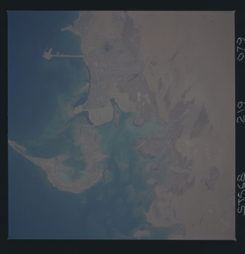
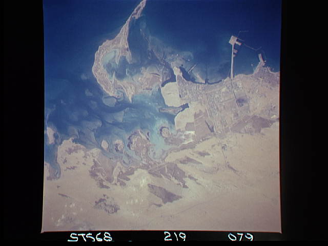
Image Caption: Abu Ali Is and Al Barri oilfield in the Persian Gulf.
Coastal and shallow-water habitats evident in the small bay to the
north of the island was surveyed during the STS-45 mission to assess
the impact of the 1991 Kuwait oil slick. Much of the southward-moving
oil came ashore in this small bay as Abu Ali Is. served as a natural
barrier, preventing the slick from progressing further south along the
Saudi coast. The Persian Gulf survey team reported encountering large
areas of beach on Abu Ali Is. covered by a thick asphalt material that
was likely the result of oil spills prior to the 1991 spill. North of
Abu Ali, surveys revealed a nearly continuous surface layer of oiled
sediments extending 250 meters offshore at high tide.
