STS068-212-34

| NASA Photo ID | STS068-212-34 |
| Focal Length | 250mm |
| Date taken | 1994.10.02 |
| Time taken | 18:30:00 GMT |
Resolutions offered for this image:
3857 x 3904 pixels 632 x 639 pixels 5700 x 5900 pixels 500 x 518 pixels 640 x 480 pixels
3857 x 3904 pixels 632 x 639 pixels 5700 x 5900 pixels 500 x 518 pixels 640 x 480 pixels

Cloud masks available for this image:
Spacecraft nadir point: 45.7° N, 83.0° W
Photo center point: 46.0° N, 84.0° W
Photo center point by machine learning:
Photo center point: 46.0° N, 84.0° W
Photo center point by machine learning:
Nadir to Photo Center: West
Spacecraft Altitude: 118 nautical miles (219km)
Country or Geographic Name: | USA-MICHIGAN |
Features: | MINES, ST. MARYS RIVER |
| Features Found Using Machine Learning: | |
Cloud Cover Percentage: | 5 (1-10)% |
Sun Elevation Angle: | 39° |
Sun Azimuth: | 202° |
Camera: | Hasselblad |
Focal Length: | 250mm |
Camera Tilt: | 28 degrees |
Format: | 5046: Kodak, natural color positive, Lumiere 100/5046, ASA 100, standard base |
Film Exposure: | Normal |
| Additional Information | |
| Width | Height | Annotated | Cropped | Purpose | Links |
|---|---|---|---|---|---|
| 3857 pixels | 3904 pixels | No | No | Earth From Space collection | Download Image |
| 632 pixels | 639 pixels | No | No | Earth From Space collection | Download Image |
| 5700 pixels | 5900 pixels | No | No | Download Image | |
| 500 pixels | 518 pixels | No | No | Download Image | |
| 640 pixels | 480 pixels | No | No | Download Image |
Download Packaged File
Download a Google Earth KML for this Image
View photo footprint information
Download a GeoTIFF for this photo
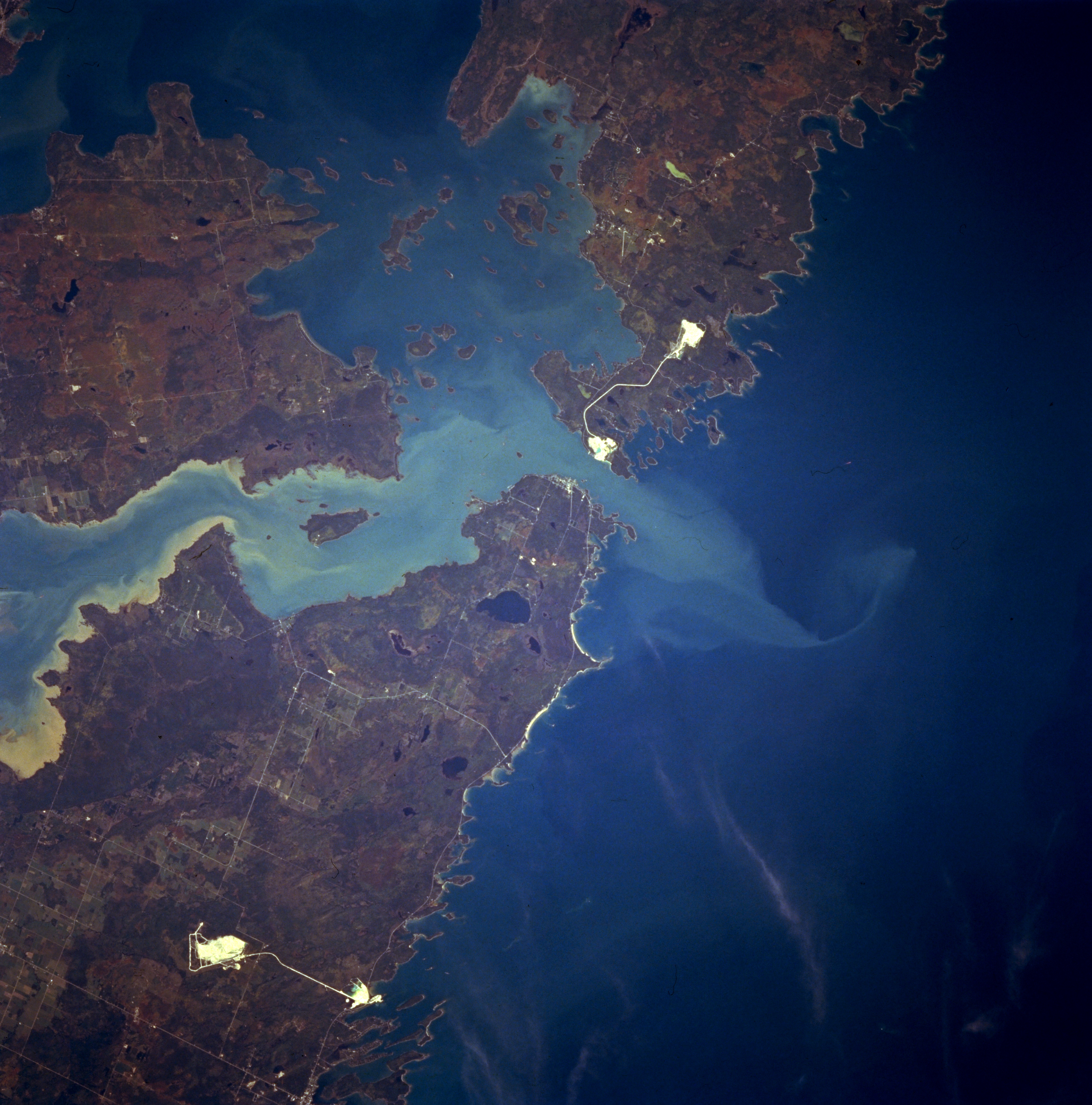
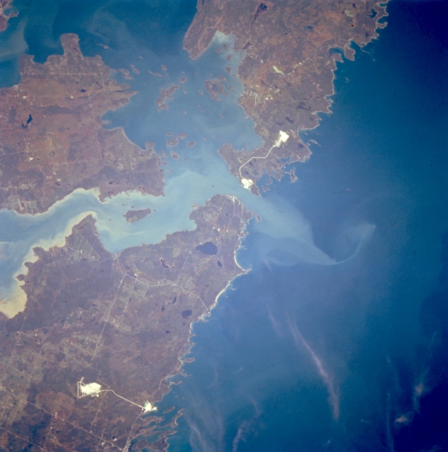
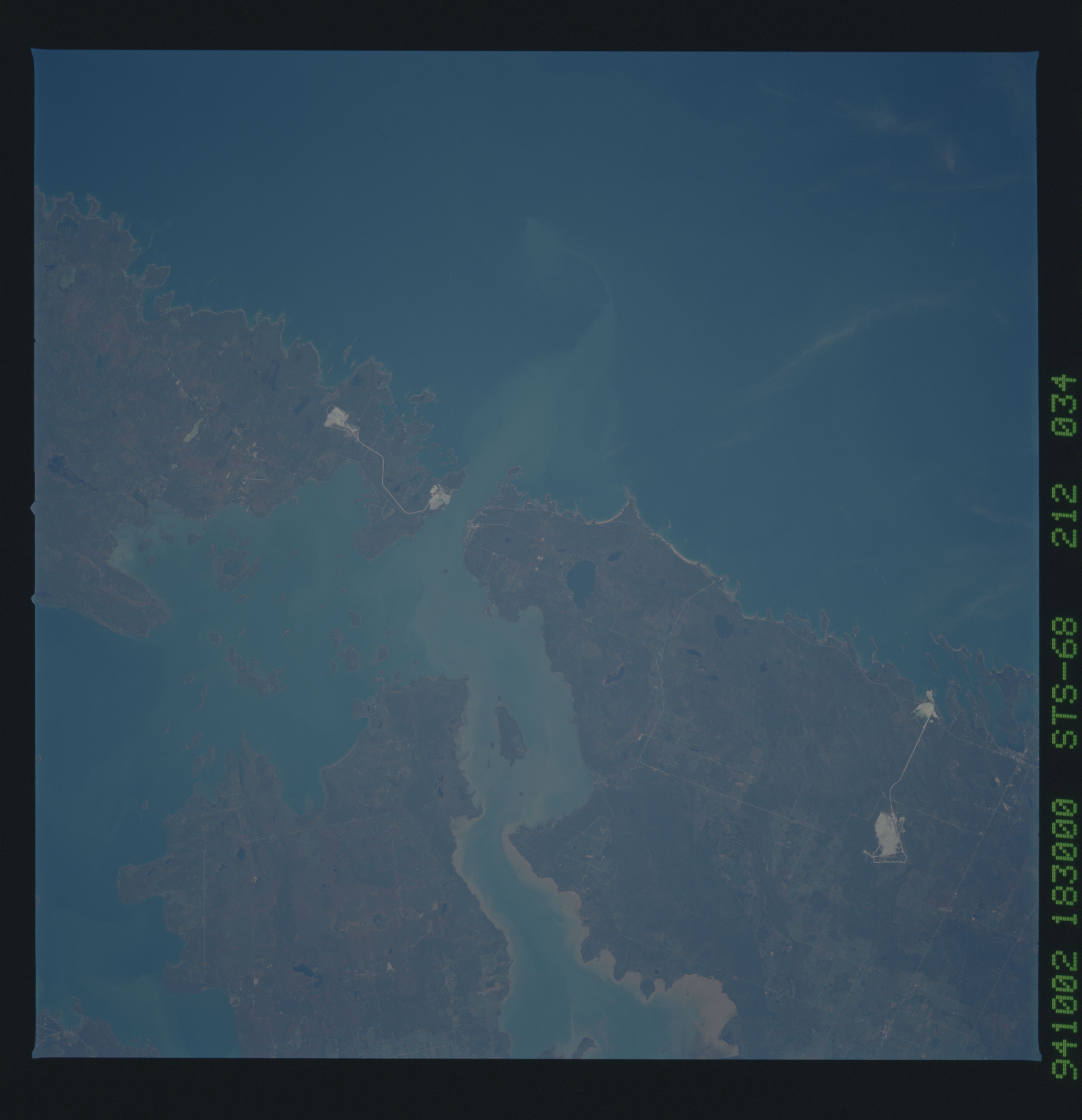
Image Caption: STS068-212-034 De Tour Passage, Michigan, U.S.A. October 1994
Sediment-laden Saint Marys River and the De Tour Passage into northern Lake Huron, important links in the Saint Lawrence Seaway, are featured in this northeast-looking, low-oblique photograph. Two large islands are discernible--Drummond Island (right top) and Saint Joseph Island in Canada (left center). Two highly reflective objects are probably locations of mining operations. Small Caribou Lake is apparent west of the De Tour Passage.
Sediment-laden Saint Marys River and the De Tour Passage into northern Lake Huron, important links in the Saint Lawrence Seaway, are featured in this northeast-looking, low-oblique photograph. Two large islands are discernible--Drummond Island (right top) and Saint Joseph Island in Canada (left center). Two highly reflective objects are probably locations of mining operations. Small Caribou Lake is apparent west of the De Tour Passage.
