STS068-202-32
| NASA Photo ID | STS068-202-32 |
| Focal Length | 250mm |
| Date taken | 1994.10.04 |
| Time taken | 06:17:00 GMT |
Resolutions offered for this image:
4043 x 4085 pixels 633 x 640 pixels 5700 x 5900 pixels 500 x 518 pixels 640 x 480 pixels 525 x 520 pixels
4043 x 4085 pixels 633 x 640 pixels 5700 x 5900 pixels 500 x 518 pixels 640 x 480 pixels 525 x 520 pixels

Cloud masks available for this image:
Spacecraft nadir point: 3.9° S, 135.4° E
Photo center point: 3.0° S, 135.5° E
Photo center point by machine learning:
Photo center point: 3.0° S, 135.5° E
Photo center point by machine learning:
Nadir to Photo Center: North
Spacecraft Altitude: 118 nautical miles (219km)
Country or Geographic Name: | INDONESIA-WNG |
Features: | NEAR NABIRE |
| Features Found Using Machine Learning: | |
Cloud Cover Percentage: | 25 (11-25)% |
Sun Elevation Angle: | 38° |
Sun Azimuth: | 268° |
Camera: | Hasselblad |
Focal Length: | 250mm |
Camera Tilt: | 25 degrees |
Format: | 2443: Kodak Aerochrome 2443, color IR, thin base, EA-5 process thru June 1999, E-6 process afterward |
Film Exposure: | Normal |
| Additional Information | |
| Width | Height | Annotated | Cropped | Purpose | Links |
|---|---|---|---|---|---|
| 4043 pixels | 4085 pixels | No | No | Earth From Space collection | Download Image |
| 633 pixels | 640 pixels | No | No | Earth From Space collection | Download Image |
| 5700 pixels | 5900 pixels | No | No | Download Image | |
| 500 pixels | 518 pixels | No | No | Download Image | |
| 640 pixels | 480 pixels | No | No | Download Image | |
| 525 pixels | 520 pixels | Download Image |
Download Packaged File
Download a Google Earth KML for this Image
View photo footprint information
Download a GeoTIFF for this photo
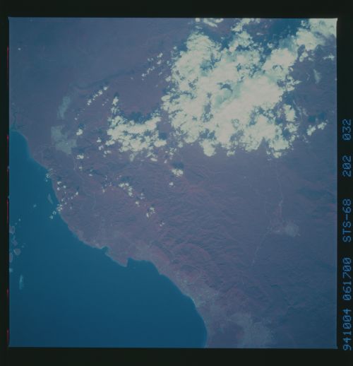
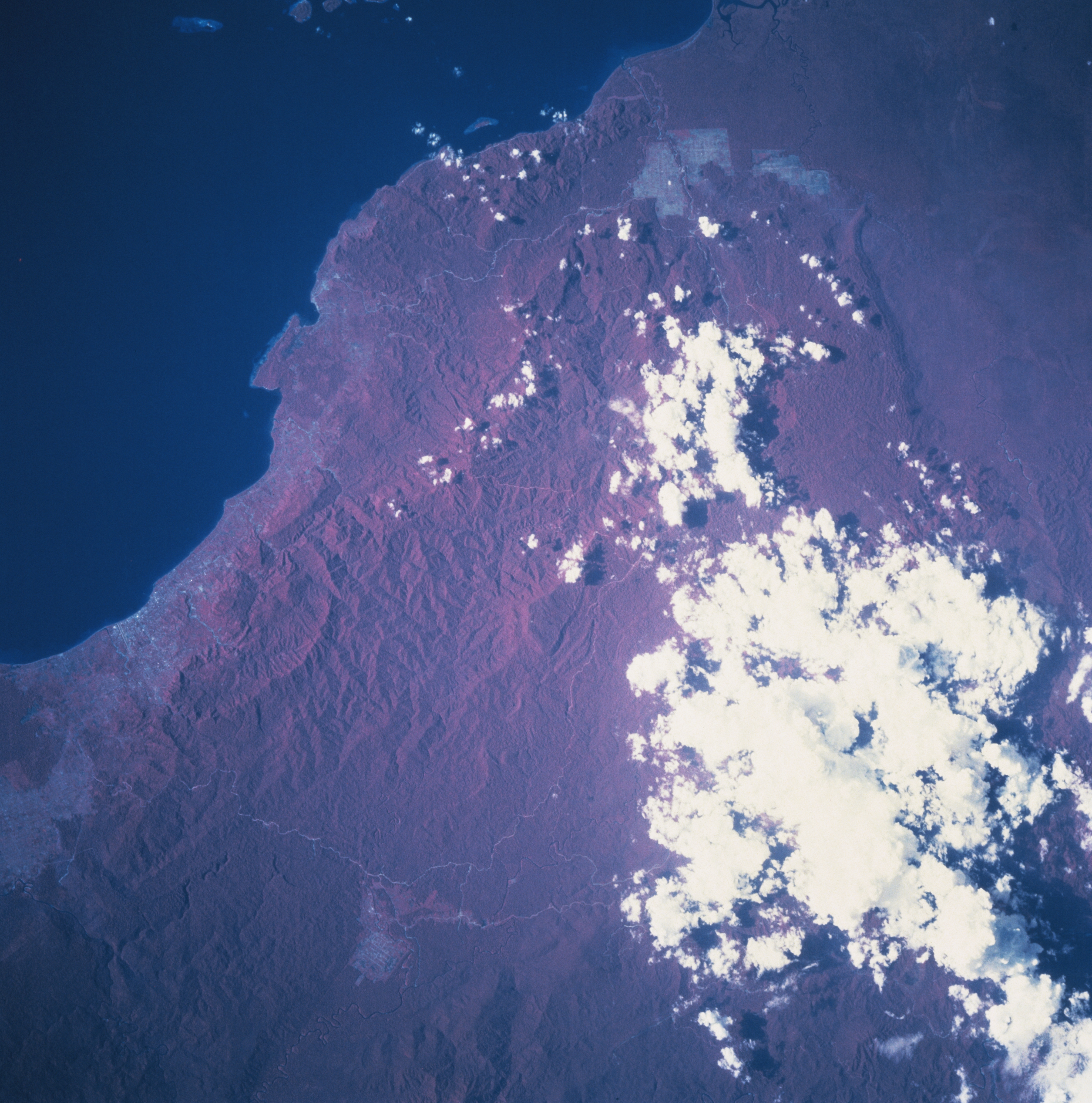
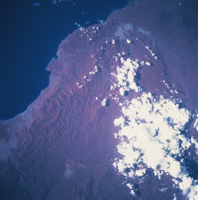
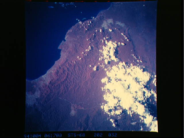
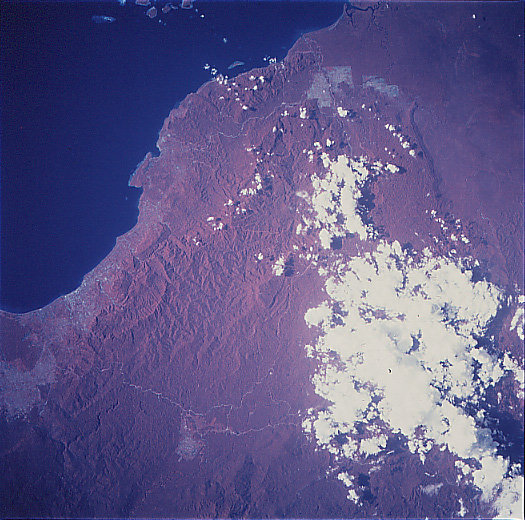
Image Caption: STS068-202-032 Irian Jaya, Indonesia October 1994
The coastline around the southern end of the Gulf of Cenderawasih (very dark area) that includes Nabire (the lighter colored area along the coast near the left margin), a small port city, contrasts with dense vegetated tropical rainforest of Irian Jaya. The color infrared image (red colors are actually green vegetation) is very effective in showing the extensive ground cover of the rainforest canopy that overlays primarily a rugged, mountainous landscape, especially the interior. The angular, pinkish areas, mainly near the coast, show where the tropical rainforest has been cleared for development, either for agricultural purposes or the extractive industry. The lighter-colored lines are roads that have been cut through the mountainous, jungle-covered terrain. Clouds obscure part of the mountainous terrain immediately north of the Weyland Mountains. STS068-202-031 provides additional photographic coverage of the area southwest of this scene that includes the port city of Nabire.
The coastline around the southern end of the Gulf of Cenderawasih (very dark area) that includes Nabire (the lighter colored area along the coast near the left margin), a small port city, contrasts with dense vegetated tropical rainforest of Irian Jaya. The color infrared image (red colors are actually green vegetation) is very effective in showing the extensive ground cover of the rainforest canopy that overlays primarily a rugged, mountainous landscape, especially the interior. The angular, pinkish areas, mainly near the coast, show where the tropical rainforest has been cleared for development, either for agricultural purposes or the extractive industry. The lighter-colored lines are roads that have been cut through the mountainous, jungle-covered terrain. Clouds obscure part of the mountainous terrain immediately north of the Weyland Mountains. STS068-202-031 provides additional photographic coverage of the area southwest of this scene that includes the port city of Nabire.
