STS068-201-74

| NASA Photo ID | STS068-201-74 |
| Focal Length | 250mm |
| Date taken | 1994.10.03 |
| Time taken | 18:12:44 GMT |
Resolutions offered for this image:
3904 x 3904 pixels 639 x 639 pixels 5700 x 5900 pixels 500 x 518 pixels 640 x 480 pixels
3904 x 3904 pixels 639 x 639 pixels 5700 x 5900 pixels 500 x 518 pixels 640 x 480 pixels

Cloud masks available for this image:
Spacecraft nadir point: 41.2° N, 77.5° W
Photo center point: 41.0° N, 77.0° W
Photo center point by machine learning:
Photo center point: 41.0° N, 77.0° W
Photo center point by machine learning:
Nadir to Photo Center: East
Spacecraft Altitude: 117 nautical miles (217km)
Country or Geographic Name: | USA-PENNSYLVANIA |
Features: | SUSQHEHANNA RIVER |
| Features Found Using Machine Learning: | |
Cloud Cover Percentage: | 0 (no clouds present) |
Sun Elevation Angle: | 42° |
Sun Azimuth: | 205° |
Camera: | Hasselblad |
Focal Length: | 250mm |
Camera Tilt: | 15 degrees |
Format: | 2443: Kodak Aerochrome 2443, color IR, thin base, EA-5 process thru June 1999, E-6 process afterward |
Film Exposure: | Normal |
| Additional Information | |
| Width | Height | Annotated | Cropped | Purpose | Links |
|---|---|---|---|---|---|
| 3904 pixels | 3904 pixels | No | No | Earth From Space collection | Download Image |
| 639 pixels | 639 pixels | No | No | Earth From Space collection | Download Image |
| 5700 pixels | 5900 pixels | No | No | Download Image | |
| 500 pixels | 518 pixels | No | No | Download Image | |
| 640 pixels | 480 pixels | No | No | Download Image |
Download Packaged File
Download a Google Earth KML for this Image
View photo footprint information
Download a GeoTIFF for this photo
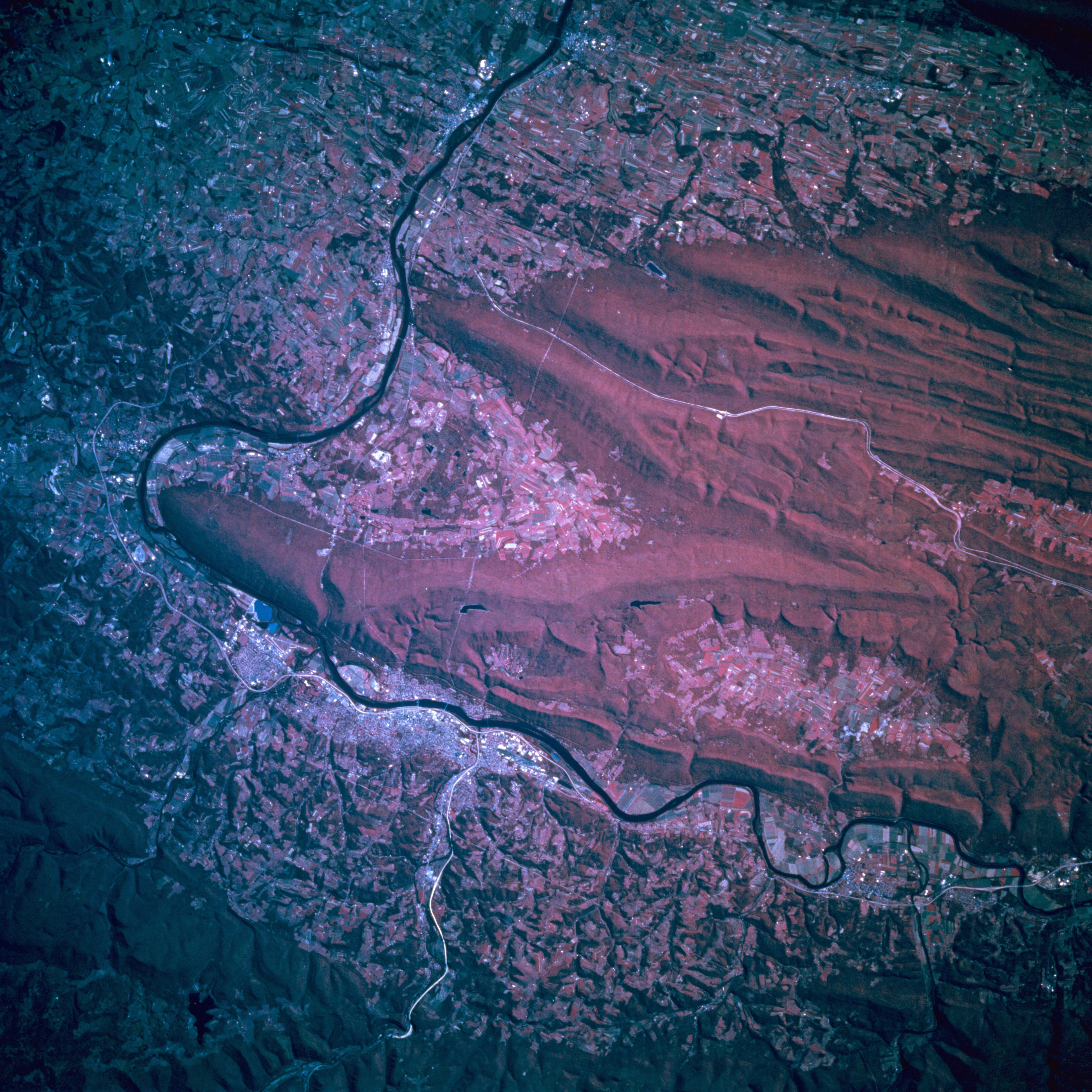
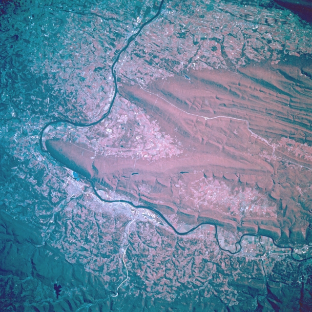
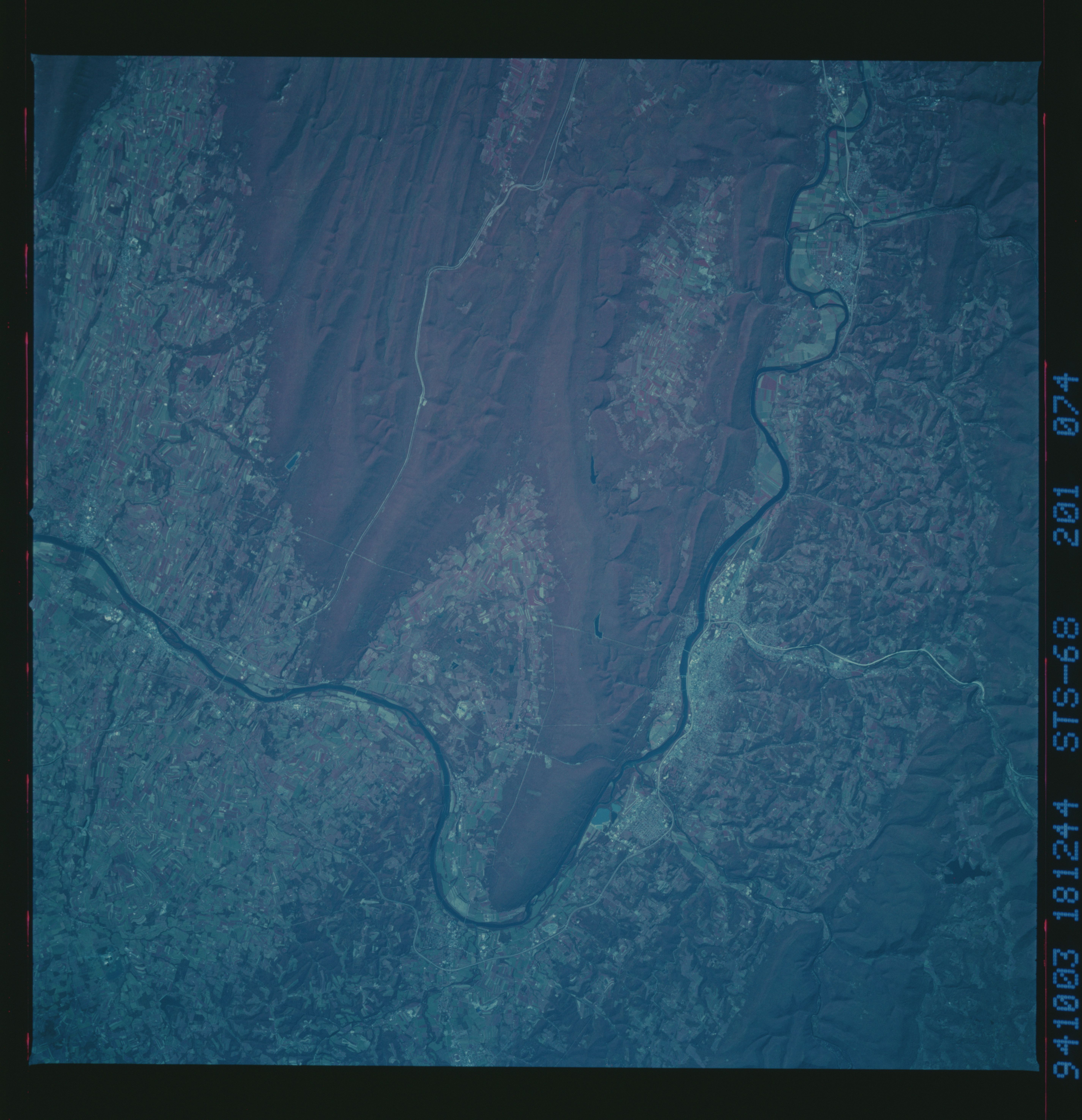
Image Caption: STS068-201-074 Williamsport Area, Pennsylvania October 1994
The Susquehanna River makes a 90-degree turn to the south just to the east of Williamsport, world famous for it's annual Little League Baseball World Series. Williamsport can be identified as the lighter colored area where US Highway 15 is visible as a thin, white line at the bottom of this color infrared image. Bald Eagle Mountain and North White Deer Ridge are the two main northeast-southwest trending mountain ridges south of Williamsport. A small section of Interstate Highway 80, an east-west corridor that crosses the entire state, can be identified as the long, thin white line that extends through one of the many valleys of the Appalachian Mountains (right of center). The darker, uniform terrain (lower left corner) is Tiadaghton State Forest. The densely wooded area south of Williamsport is considered to be part of the Bald Eagle State Forest (deep red). A large segment of the flatter landscape is used for agricultural purposes.
The Susquehanna River makes a 90-degree turn to the south just to the east of Williamsport, world famous for it's annual Little League Baseball World Series. Williamsport can be identified as the lighter colored area where US Highway 15 is visible as a thin, white line at the bottom of this color infrared image. Bald Eagle Mountain and North White Deer Ridge are the two main northeast-southwest trending mountain ridges south of Williamsport. A small section of Interstate Highway 80, an east-west corridor that crosses the entire state, can be identified as the long, thin white line that extends through one of the many valleys of the Appalachian Mountains (right of center). The darker, uniform terrain (lower left corner) is Tiadaghton State Forest. The densely wooded area south of Williamsport is considered to be part of the Bald Eagle State Forest (deep red). A large segment of the flatter landscape is used for agricultural purposes.
