STS068-174-171
| NASA Photo ID | STS068-174-171 |
| Focal Length | 250mm |
| Date taken | 1994.10.06 |
| Time taken | 18:45:13 GMT |

Cloud masks available for this image:
Spacecraft nadir point: 33.1° N, 93.7° W
Photo center point: 32.5° N, 95.5° W
Photo center point by machine learning:
Photo center point: 32.5° N, 95.5° W
Photo center point by machine learning:
Nadir to Photo Center: West
Spacecraft Altitude: 116 nautical miles (215km)
Camera: | Linhof |
Focal Length: | 250mm |
Camera Tilt: | 45 degrees |
Format: | 5048: Kodak, natural color positive, Lumiere 100x/5048, ASA 100x, standard base |
Film Exposure: | Normal |
| Additional Information | |
| Width | Height | Annotated | Cropped | Purpose | Links |
|---|---|---|---|---|---|
| 5216 pixels | 4032 pixels | No | No | Earth From Space collection | Download Image |
| 640 pixels | 494 pixels | No | No | Earth From Space collection | Download Image |
| 640 pixels | 480 pixels | No | No | ISD 1 | Download Image |
Download Packaged File
Download a Google Earth KML for this Image
View photo footprint information
Download a GeoTIFF for this photo
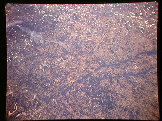
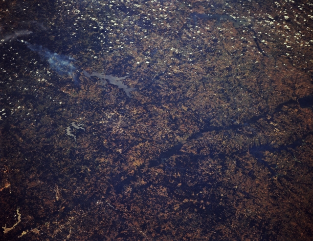
Image Caption: STS068-174-171 Sabine River, Northeast Texas, U.S.A. October 1994
Featured beneath cumulus clouds are Cedar Creek Lake (upper right edge), a tributary of the Trinity River basin, in this forested region of northeast Texas and the dark wooded river bottom of the Sabine River into which feeds Lake Fork Reservoir. Elongated Lake Palestine (center of photograph) and a wispy smoke plume to its south are visible. A pattern of intersecting highways helps to locate Tyler, northeast of Lake Palestine. Southeast of Tyler are two small, irregular reservoirs--more westerly Lake Tyler and smaller Lake Tyler East. Apparent are some of the highway network within Longview northeast of Tyler (lower left corner) and lighter lakes southeast of Longview.
Featured beneath cumulus clouds are Cedar Creek Lake (upper right edge), a tributary of the Trinity River basin, in this forested region of northeast Texas and the dark wooded river bottom of the Sabine River into which feeds Lake Fork Reservoir. Elongated Lake Palestine (center of photograph) and a wispy smoke plume to its south are visible. A pattern of intersecting highways helps to locate Tyler, northeast of Lake Palestine. Southeast of Tyler are two small, irregular reservoirs--more westerly Lake Tyler and smaller Lake Tyler East. Apparent are some of the highway network within Longview northeast of Tyler (lower left corner) and lighter lakes southeast of Longview.
