STS068-174-151
| NASA Photo ID | STS068-174-151 |
| Focal Length | 250mm |
| Date taken | 1994.10.06 |
| Time taken | 18:39:16 GMT |

Cloud masks available for this image:
Spacecraft nadir point: 49.4° N, 116.2° W
Photo center point: 47.0° N, 119.0° W
Photo center point by machine learning:
Photo center point: 47.0° N, 119.0° W
Photo center point by machine learning:
Nadir to Photo Center: Southwest
Spacecraft Altitude: 115 nautical miles (213km)
Country or Geographic Name: | USA-WASHINGTON |
Features: | COLUMBIA R, MOSES LAKE |
| Features Found Using Machine Learning: | |
Cloud Cover Percentage: | 0 (no clouds present) |
Sun Elevation Angle: | 34° |
Sun Azimuth: | 164° |
Camera: | Linhof |
Focal Length: | 250mm |
Camera Tilt: | Low Oblique |
Format: | 5048: Kodak, natural color positive, Lumiere 100x/5048, ASA 100x, standard base |
Film Exposure: | Normal |
| Additional Information | |
| Width | Height | Annotated | Cropped | Purpose | Links |
|---|---|---|---|---|---|
| 5184 pixels | 4096 pixels | No | No | Earth From Space collection | Download Image |
| 640 pixels | 505 pixels | No | No | Earth From Space collection | Download Image |
| 640 pixels | 480 pixels | No | No | ISD 1 | Download Image |
Download Packaged File
Download a Google Earth KML for this Image
View photo footprint information
Download a GeoTIFF for this photo
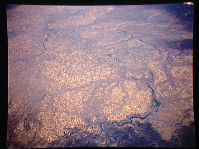
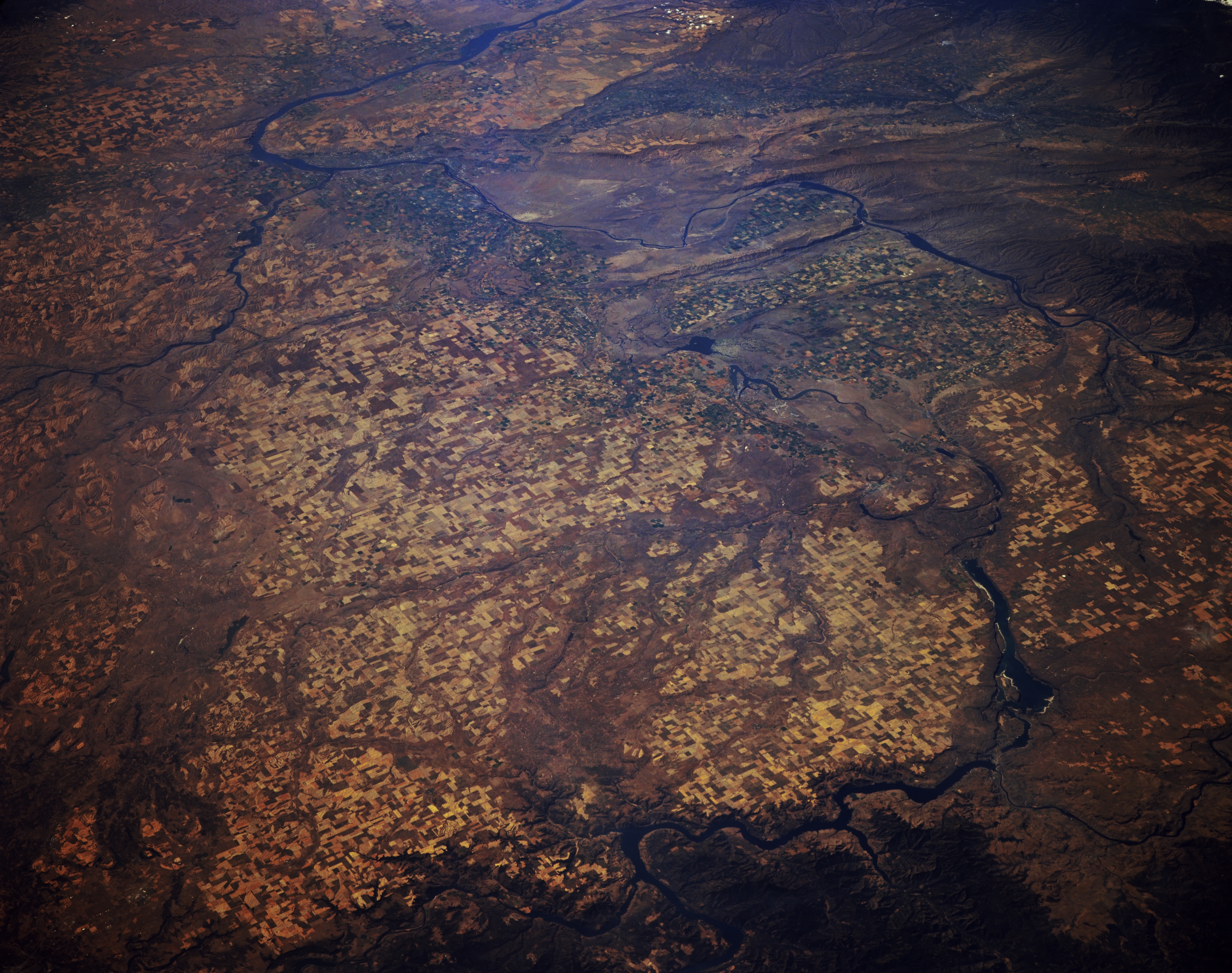
Image Caption: STS068-174-151 Columbia Plateau and Columbia River, Washington U.S.A. October 1994
The scablands (eroded basalt surfaces) and agricultural areas of the Columbia Plateau are visible in this southwest-looking, low-oblique photograph. Because of its rivers and lakes, the Columbia Plateau is an important source of hydroelectric power for Washington. The Spokane River can be seen joining the Columbia River at the bottom center of the photograph, and the confluence of the Snake River and Columbia River is evident just left of the photograph's center, near Kinnewick, Washington. Near the bottom right appears Grand Coulee Dam; directly to its south is Banks Lake, which sits in a canyon (coulee) that was the course of the Columbia River during the ice age.
The scablands (eroded basalt surfaces) and agricultural areas of the Columbia Plateau are visible in this southwest-looking, low-oblique photograph. Because of its rivers and lakes, the Columbia Plateau is an important source of hydroelectric power for Washington. The Spokane River can be seen joining the Columbia River at the bottom center of the photograph, and the confluence of the Snake River and Columbia River is evident just left of the photograph's center, near Kinnewick, Washington. Near the bottom right appears Grand Coulee Dam; directly to its south is Banks Lake, which sits in a canyon (coulee) that was the course of the Columbia River during the ice age.
