STS068-173-125
| NASA Photo ID | STS068-173-125 |
| Focal Length | 250mm |
| Date taken | 1994.10.07 |
| Time taken | 19:51:23 GMT |
Cloud masks available for this image:
Spacecraft nadir point: 38.3° N, 122.1° W
Photo center point: 39.5° N, 121.0° W
Photo center point by machine learning:
Photo center point: 39.5° N, 121.0° W
Photo center point by machine learning:
Nadir to Photo Center: Northeast
Spacecraft Altitude: 111 nautical miles (206km)
Country or Geographic Name: | USA-CALIFORNIA |
Features: | L. ALMANOR, OROVILLE RES. |
| Features Found Using Machine Learning: | |
Cloud Cover Percentage: | 0 (no clouds present) |
Sun Elevation Angle: | 46° |
Sun Azimuth: | 178° |
Camera: | Linhof |
Focal Length: | 250mm |
Camera Tilt: | 41 degrees |
Format: | 5048: Kodak, natural color positive, Lumiere 100x/5048, ASA 100x, standard base |
Film Exposure: | Normal |
| Additional Information | |
| Width | Height | Annotated | Cropped | Purpose | Links |
|---|---|---|---|---|---|
| 5088 pixels | 3936 pixels | No | No | Earth From Space collection | Download Image |
| 640 pixels | 495 pixels | No | No | Earth From Space collection | Download Image |
| 640 pixels | 480 pixels | No | No | ISD 1 | Download Image |
Download Packaged File
Download a Google Earth KML for this Image
View photo footprint information
Download a GeoTIFF for this photo
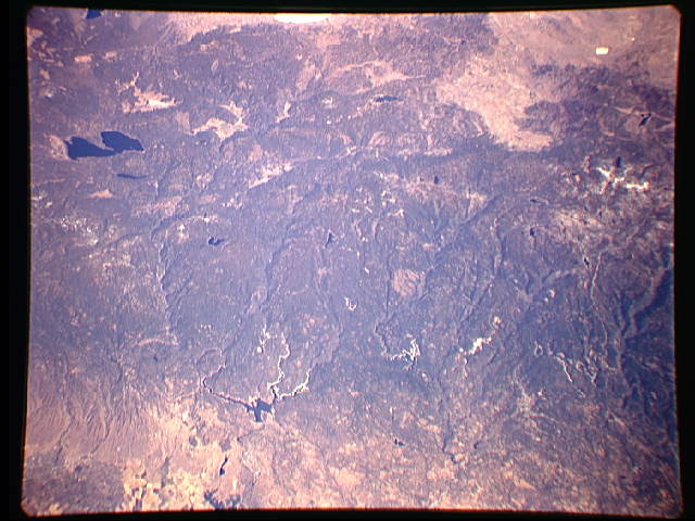
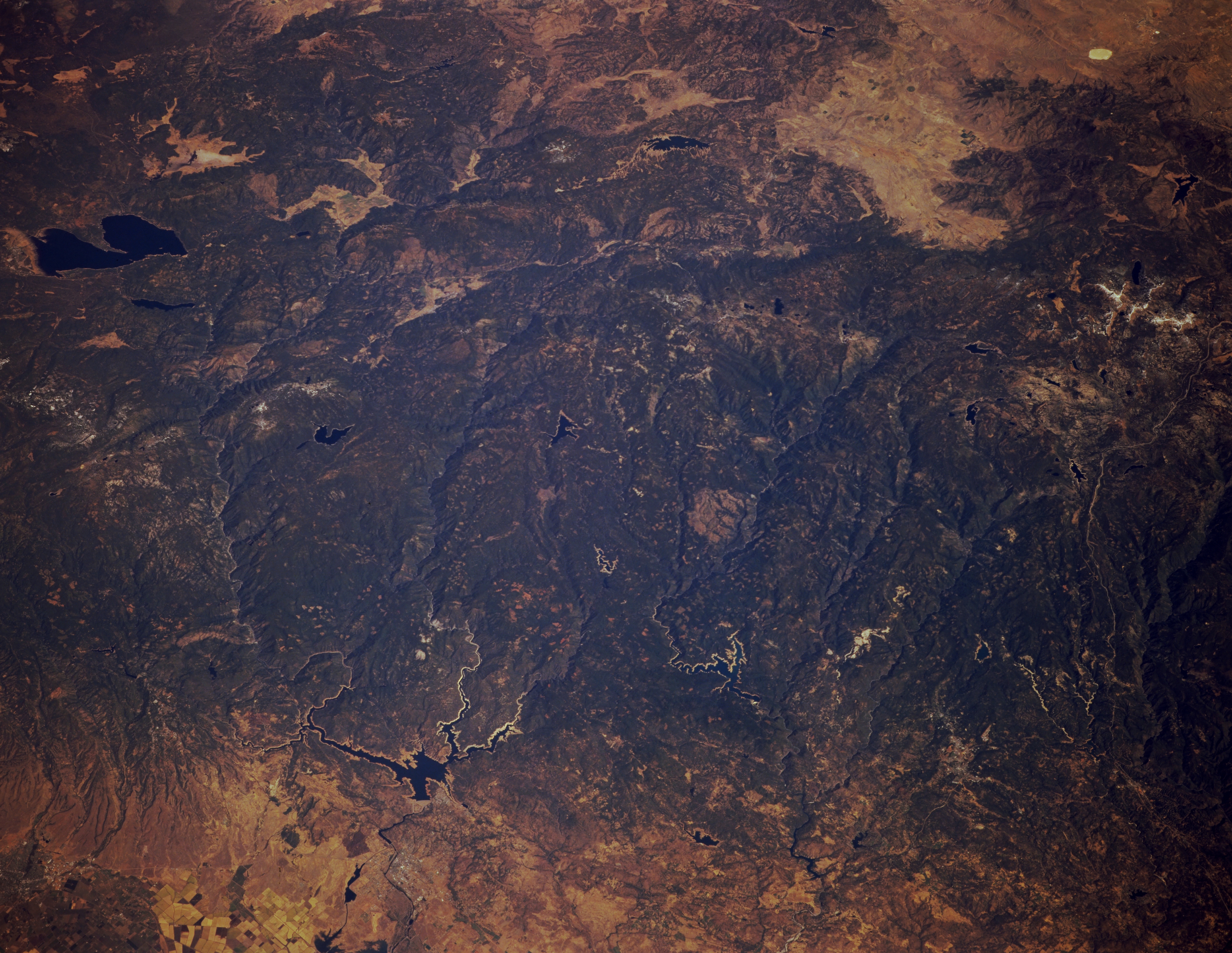
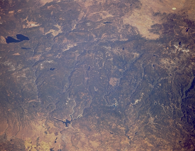
Image Caption: STS068-173-125 Lake Almanor and Lake Oroville, California, U.S.A. October 1994
The timber lands of Plumas National Forest in the northern Sierra Nevada Mountains are discernible in this low-oblique, northeast-looking photograph. Near the top left, Lake Almanor is visible. Between the bottom left and center of the photograph appears elongated Lake Oroville, fed by the Feather River's north, middle, and south forks, which flow generally westward from the high mountains. Part of the Sacramento Valley is visible near the bottom left of the photograph.
The timber lands of Plumas National Forest in the northern Sierra Nevada Mountains are discernible in this low-oblique, northeast-looking photograph. Near the top left, Lake Almanor is visible. Between the bottom left and center of the photograph appears elongated Lake Oroville, fed by the Feather River's north, middle, and south forks, which flow generally westward from the high mountains. Part of the Sacramento Valley is visible near the bottom left of the photograph.
