STS068-173-124
| NASA Photo ID | STS068-173-124 |
| Focal Length | 250mm |
| Date taken | 1994.10.07 |
| Time taken | 19:51:12 GMT |
Cloud masks available for this image:
Spacecraft nadir point: 38.8° N, 122.7° W
Photo center point: 40.5° N, 122.0° W
Photo center point by machine learning:
Photo center point: 40.5° N, 122.0° W
Photo center point by machine learning:
Nadir to Photo Center: North
Spacecraft Altitude: 111 nautical miles (206km)
Country or Geographic Name: | USA-CALIFORNIA |
Features: | LASSEN PEAK, L. ALMANOR |
| Features Found Using Machine Learning: | |
Cloud Cover Percentage: | 0 (no clouds present) |
Sun Elevation Angle: | 46° |
Sun Azimuth: | 177° |
Camera: | Linhof |
Focal Length: | 250mm |
Camera Tilt: | 45 degrees |
Format: | 5048: Kodak, natural color positive, Lumiere 100x/5048, ASA 100x, standard base |
Film Exposure: | Normal |
| Additional Information | |
| Width | Height | Annotated | Cropped | Purpose | Links |
|---|---|---|---|---|---|
| 5056 pixels | 3936 pixels | No | No | Earth From Space collection | Download Image |
| 640 pixels | 498 pixels | No | No | Earth From Space collection | Download Image |
| 640 pixels | 480 pixels | No | No | ISD 1 | Download Image |
Download Packaged File
Download a Google Earth KML for this Image
View photo footprint information
Download a GeoTIFF for this photo
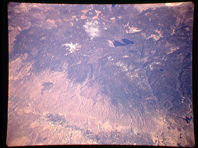
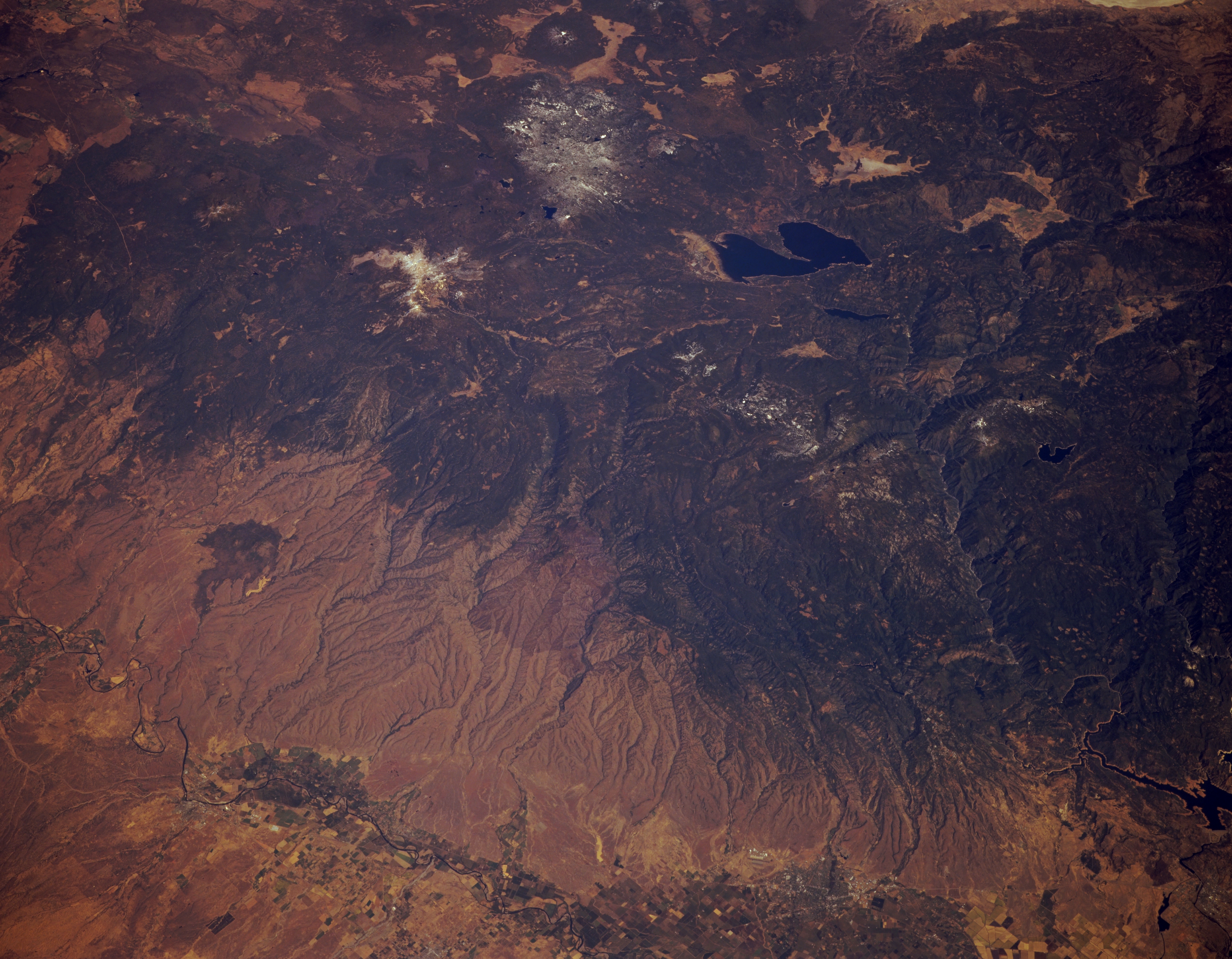
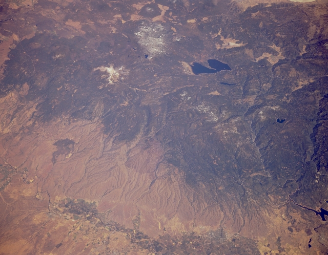
Image Caption: STS068-173-124 Lassen Peak Volcano and Lake Almanor, California, U.S.A. October 1994
This synoptic, low-oblique, northeast-looking photograph captures the timber-covered mountains of the extreme southern Cascades. Snowcapped Lassen Peak, a stratovolcano, is visible north-northwest of dark blue Lake Almanor. Grass- and scrub-covered alluvial fans, with red soil on some of the upper slopes, descend west of the Cascades to the Sacramento Valley. The Sacramento River traverses Red Bluff west of the lake.
This synoptic, low-oblique, northeast-looking photograph captures the timber-covered mountains of the extreme southern Cascades. Snowcapped Lassen Peak, a stratovolcano, is visible north-northwest of dark blue Lake Almanor. Grass- and scrub-covered alluvial fans, with red soil on some of the upper slopes, descend west of the Cascades to the Sacramento Valley. The Sacramento River traverses Red Bluff west of the lake.
