STS068-170-60
| NASA Photo ID | STS068-170-60 |
| Focal Length | 250mm |
| Date taken | 1994.10.04 |
| Time taken | 19:19:27 GMT |
Cloud masks available for this image:
Spacecraft nadir point: 48.4° N, 112.5° W
Photo center point: 47.5° N, 114.0° W
Photo center point by machine learning:
Photo center point: 47.5° N, 114.0° W
Photo center point by machine learning:
Nadir to Photo Center: Southwest
Spacecraft Altitude: 116 nautical miles (215km)
Country or Geographic Name: | USA-MONTANA |
Features: | FLATHEAD L., MISSION RA. |
| Features Found Using Machine Learning: | |
Cloud Cover Percentage: | 0 (no clouds present) |
Sun Elevation Angle: | 37° |
Sun Azimuth: | 180° |
Camera: | Linhof |
Focal Length: | 250mm |
Camera Tilt: | 42 degrees |
Format: | 5048: Kodak, natural color positive, Lumiere 100x/5048, ASA 100x, standard base |
Film Exposure: | Normal |
| Additional Information | |
| Width | Height | Annotated | Cropped | Purpose | Links |
|---|---|---|---|---|---|
| 5184 pixels | 4096 pixels | No | No | Earth From Space collection | Download Image |
| 640 pixels | 505 pixels | No | No | Earth From Space collection | Download Image |
| 640 pixels | 480 pixels | No | No | ISD 1 | Download Image |
Download Packaged File
Download a Google Earth KML for this Image
View photo footprint information
Download a GeoTIFF for this photo
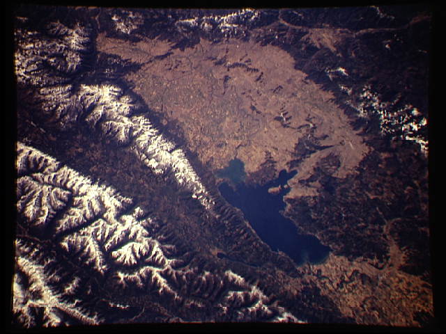
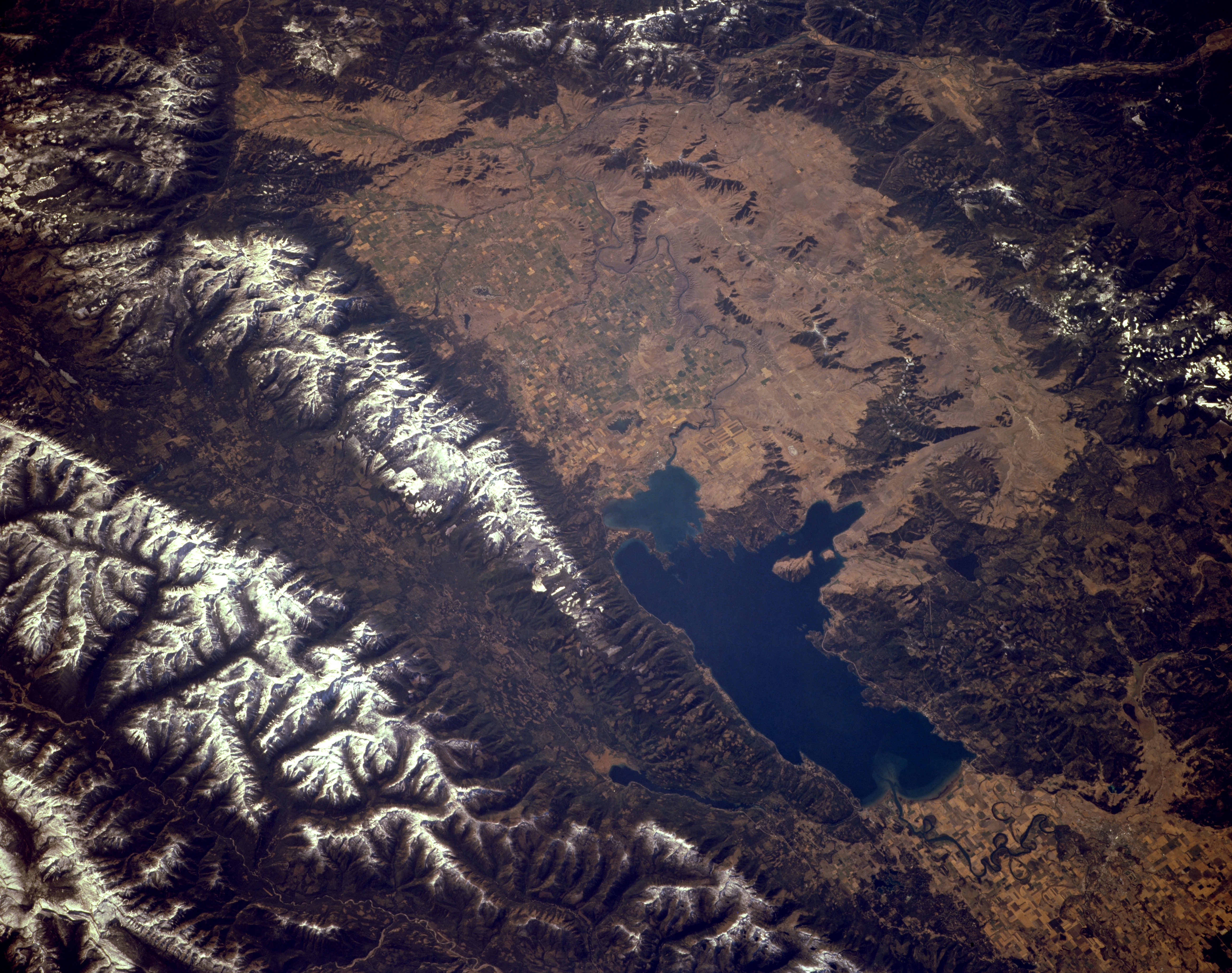
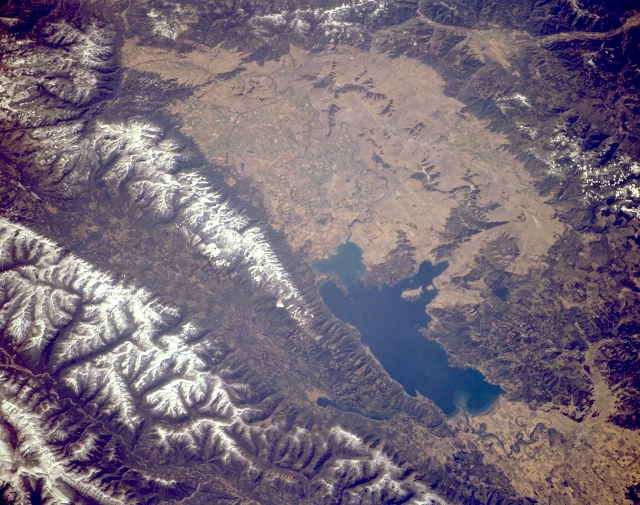
Image Caption: STS068-170-060 Flathead Lake, Mission Range, and Swan Range, Montana, U.S.A. October 1994
Formed by glacial damming of the Flathead River during the last ice age, Flathead Lake [30 miles (48 kilometers) long and 12 to 14 miles (19 to 23 kilometers) wide] and Flathead Valley are featured in this southwest-looking, low-oblique photograph. Barely discernible north of the lake is the small city of Kalispell. To the east of the lake lie two rugged, deeply glaciated, snow-covered mountain ranges separated by an elongated glaciated valley. Also, east of Flathead Lake are the Mission Range and to the north Swan Valley and the Swan Range. Visible are numerous agricultural field patterns south of the lake in Flathead Valley and portions of the Salish Mountains west of the lake.
Formed by glacial damming of the Flathead River during the last ice age, Flathead Lake [30 miles (48 kilometers) long and 12 to 14 miles (19 to 23 kilometers) wide] and Flathead Valley are featured in this southwest-looking, low-oblique photograph. Barely discernible north of the lake is the small city of Kalispell. To the east of the lake lie two rugged, deeply glaciated, snow-covered mountain ranges separated by an elongated glaciated valley. Also, east of Flathead Lake are the Mission Range and to the north Swan Valley and the Swan Range. Visible are numerous agricultural field patterns south of the lake in Flathead Valley and portions of the Salish Mountains west of the lake.
