STS068-168-78
| NASA Photo ID | STS068-168-78 |
| Focal Length | 250mm |
| Date taken | 1994.10.09 |
| Time taken | 04:41:09 GMT |
Cloud masks available for this image:
Spacecraft nadir point: 32.0° S, 152.0° E
Photo center point: 32.5° S, 151.5° E
Photo center point by machine learning:
Photo center point: 32.5° S, 151.5° E
Photo center point by machine learning:
Nadir to Photo Center: Southwest
Spacecraft Altitude: 111 nautical miles (206km)
Country or Geographic Name: | AUSTRALIA-NSW |
Features: | NEWCASTLE, GT. DIVIDING RA |
| Features Found Using Machine Learning: | |
Cloud Cover Percentage: | 10 (1-10)% |
Sun Elevation Angle: | 41° |
Sun Azimuth: | 291° |
Camera: | Linhof |
Focal Length: | 250mm |
Camera Tilt: | 21 degrees |
Format: | 5048: Kodak, natural color positive, Lumiere 100x/5048, ASA 100x, standard base |
Film Exposure: | Normal |
| Additional Information | |
| Width | Height | Annotated | Cropped | Purpose | Links |
|---|---|---|---|---|---|
| 5088 pixels | 4000 pixels | No | No | Earth From Space collection | Download Image |
| 640 pixels | 503 pixels | No | No | Earth From Space collection | Download Image |
| 640 pixels | 480 pixels | No | No | ISD 1 | Download Image |
Download Packaged File
Download a Google Earth KML for this Image
View photo footprint information
Download a GeoTIFF for this photo
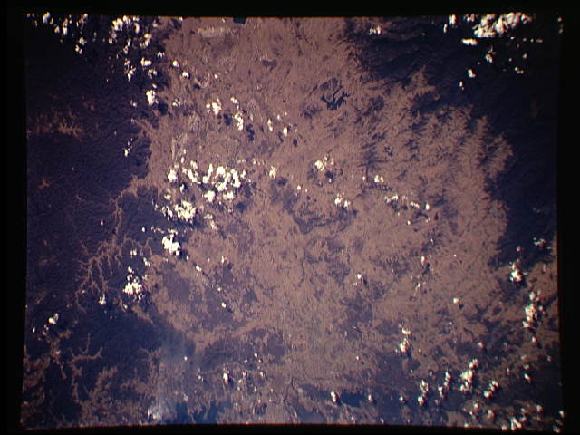
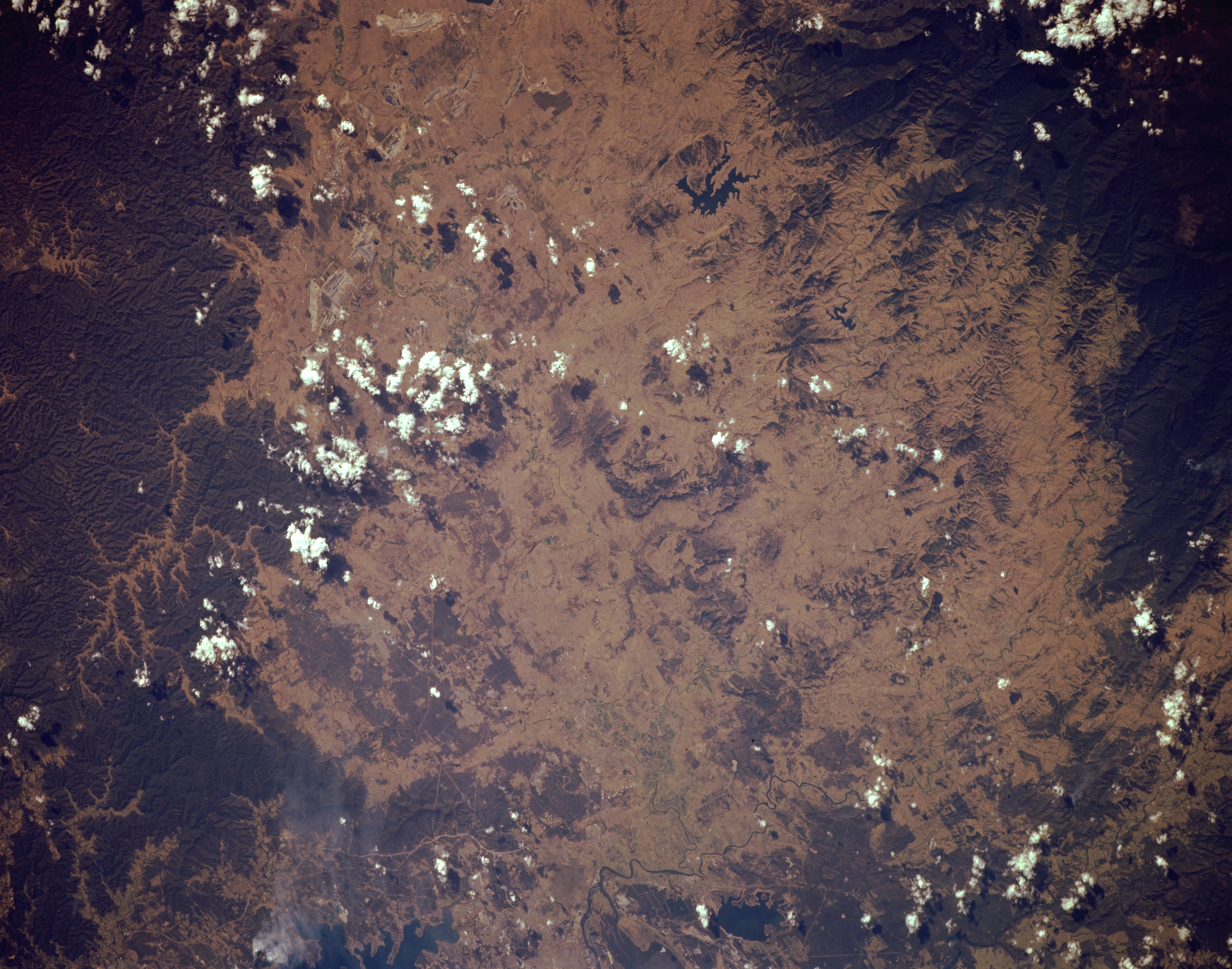
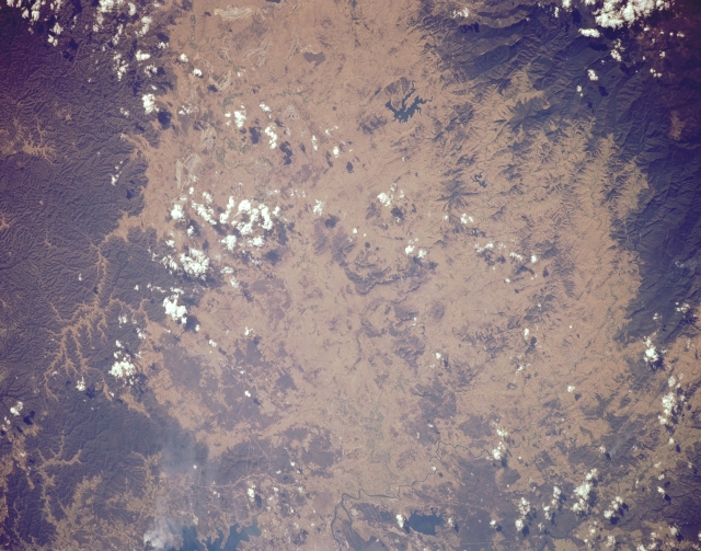
Image Caption: STS068-168-078 New Castle Area, New South Wales, Australia October 1994
Although the scale of this image precludes the identification of specific features, the large dark areas (upper right and bottom right) show forested slopes of mountains (part of the Great Dividing Range) that appear to be volcanic in origin. The pronounced radial drainage pattern that is observed in the lower right corner of the picture seems to support this observation. Although practically none of the actual river channel or floodplain is discernible, the Hunter River Valley runs laterally through the center of the image. The general location of Australia's sixth largest city, Newcastle, is barely visible as a grayish area (left middle edge). This area experienced a 5.6 (Richter Scale) earthquake in December 1989. One reservoir (irregular-shaped, dark feature), Lake Liddell, is visible in the lower right quadrant of the picture. Lake Grahmstown is also visible near the left bottom edge of the image.
Although the scale of this image precludes the identification of specific features, the large dark areas (upper right and bottom right) show forested slopes of mountains (part of the Great Dividing Range) that appear to be volcanic in origin. The pronounced radial drainage pattern that is observed in the lower right corner of the picture seems to support this observation. Although practically none of the actual river channel or floodplain is discernible, the Hunter River Valley runs laterally through the center of the image. The general location of Australia's sixth largest city, Newcastle, is barely visible as a grayish area (left middle edge). This area experienced a 5.6 (Richter Scale) earthquake in December 1989. One reservoir (irregular-shaped, dark feature), Lake Liddell, is visible in the lower right quadrant of the picture. Lake Grahmstown is also visible near the left bottom edge of the image.
