STS068-167-U
| NASA Photo ID | STS068-167-U |
| Focal Length | 250mm |
| Date taken | 1994.10.09 |
| Time taken | 17:38:12 GMT |
Cloud masks available for this image:
Spacecraft nadir point: 34.6° N, 95.7° W
Photo center point: 36.0° N, 94.0° W
Photo center point by machine learning:
Photo center point: 36.0° N, 94.0° W
Photo center point by machine learning:
Nadir to Photo Center: Northeast
Spacecraft Altitude: 111 nautical miles (206km)
Country or Geographic Name: | USA-ARKANSAS |
Features: | FAYETTEVILLE, RES., RIVER |
| Features Found Using Machine Learning: | |
Cloud Cover Percentage: | 0 (no clouds present) |
Sun Elevation Angle: | 48° |
Sun Azimuth: | 168° |
Camera: | Linhof |
Focal Length: | 250mm |
Camera Tilt: | 50 degrees |
Format: | 5048: Kodak, natural color positive, Lumiere 100x/5048, ASA 100x, standard base |
Film Exposure: | Normal |
| Additional Information | |
| Width | Height | Annotated | Cropped | Purpose | Links |
|---|---|---|---|---|---|
| 5184 pixels | 4096 pixels | No | No | Earth From Space collection | Download Image |
| 640 pixels | 505 pixels | No | No | Earth From Space collection | Download Image |
| 640 pixels | 480 pixels | No | No | ISD 1 | Download Image |
Download Packaged File
Download a Google Earth KML for this Image
View photo footprint information
Download a GeoTIFF for this photo
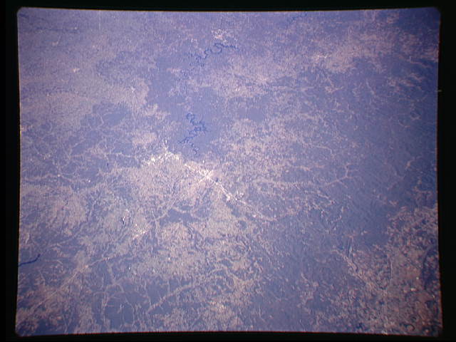
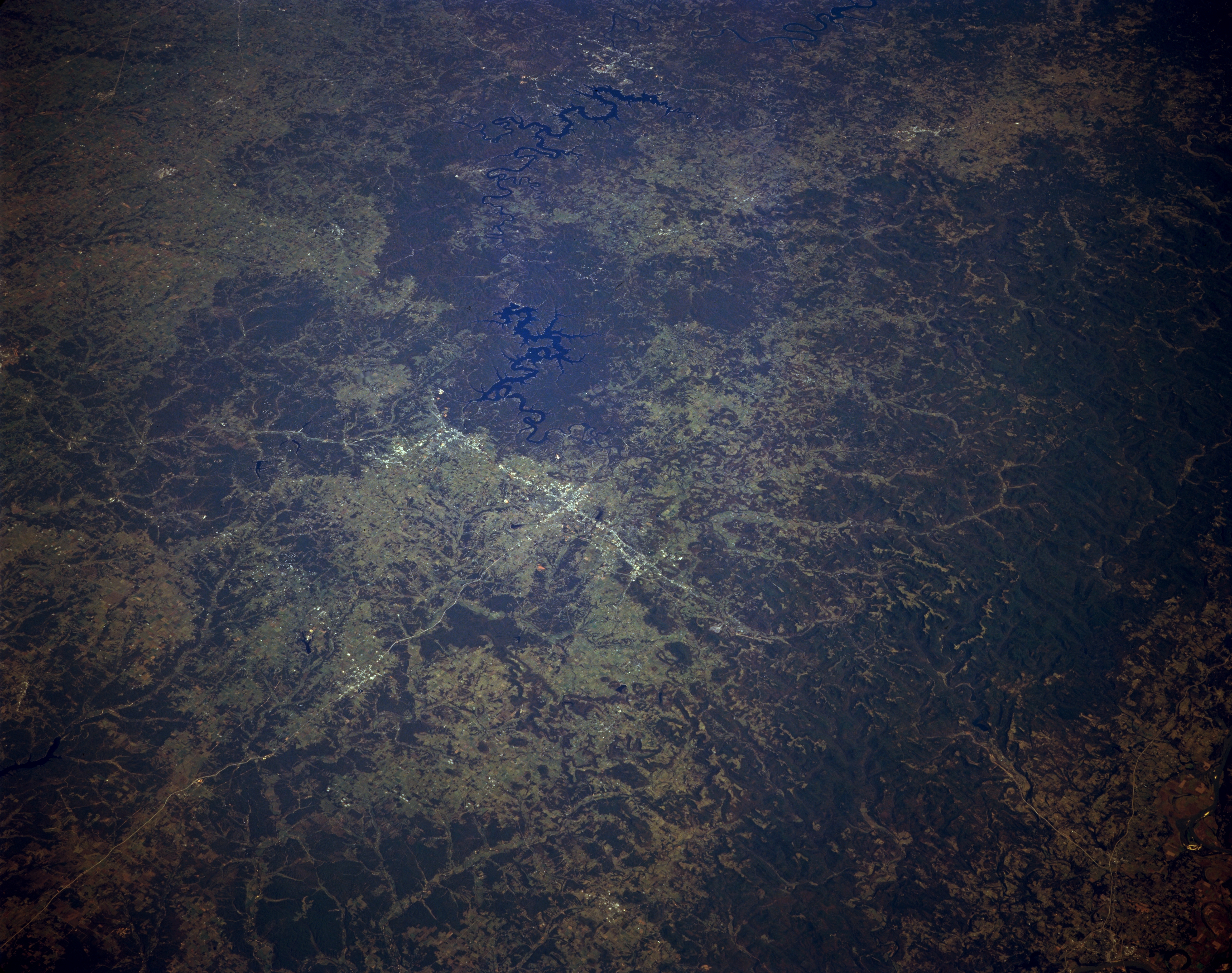
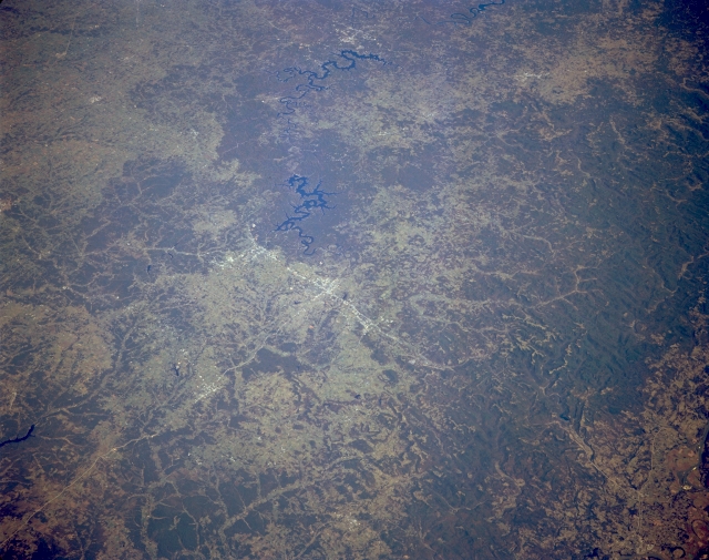
Image Caption: STS068-167-00U Northwest Arkansas, U.S.A. October 1994
Two serpentine lakes, Beaver Lake (closer to center) and Table Rock Lake (near top center) are obvious in the rugged, forested landscape of northwest Arkansas. This synoptic photograph includes Fayetteville, Springdale, and Rogers whose highly reflective urban areas can be identified along north-south-oriented U.S. Highway 71, southeast of which are the generally east-west-trending Boston Mountains. The extensive dark landscape depicts heavily forested terrain.
Two serpentine lakes, Beaver Lake (closer to center) and Table Rock Lake (near top center) are obvious in the rugged, forested landscape of northwest Arkansas. This synoptic photograph includes Fayetteville, Springdale, and Rogers whose highly reflective urban areas can be identified along north-south-oriented U.S. Highway 71, southeast of which are the generally east-west-trending Boston Mountains. The extensive dark landscape depicts heavily forested terrain.
