STS068-164-126
| NASA Photo ID | STS068-164-126 |
| Focal Length | 250mm |
| Date taken | 1994.10.02 |
| Time taken | 18:30:17 GMT |

Cloud masks available for this image:
Spacecraft nadir point: 44.9° N, 81.8° W
Photo center point: 44.0° N, 83.5° W
Photo center point by machine learning:
Photo center point: 44.0° N, 83.5° W
Photo center point by machine learning:
Nadir to Photo Center: Southwest
Spacecraft Altitude: 118 nautical miles (219km)
Country or Geographic Name: | USA-MICHIGAN |
Features: | SAGINAW B, AGRICULTURE, SNGLNT |
| Features Found Using Machine Learning: | |
Cloud Cover Percentage: | 5 (1-10)% |
Sun Elevation Angle: | 39° |
Sun Azimuth: | 204° |
Camera: | Linhof |
Focal Length: | 250mm |
Camera Tilt: | 44 degrees |
Format: | 5046: Kodak, natural color positive, Lumiere 100/5046, ASA 100, standard base |
Film Exposure: | Normal |
| Additional Information | |
| Width | Height | Annotated | Cropped | Purpose | Links |
|---|---|---|---|---|---|
| 5152 pixels | 4064 pixels | No | No | Earth From Space collection | Download Image |
| 640 pixels | 504 pixels | No | No | Earth From Space collection | Download Image |
| 640 pixels | 480 pixels | No | No | ISD 1 | Download Image |
Download Packaged File
Download a Google Earth KML for this Image
View photo footprint information
Download a GeoTIFF for this photo
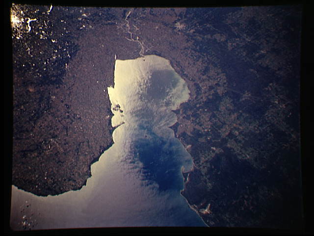
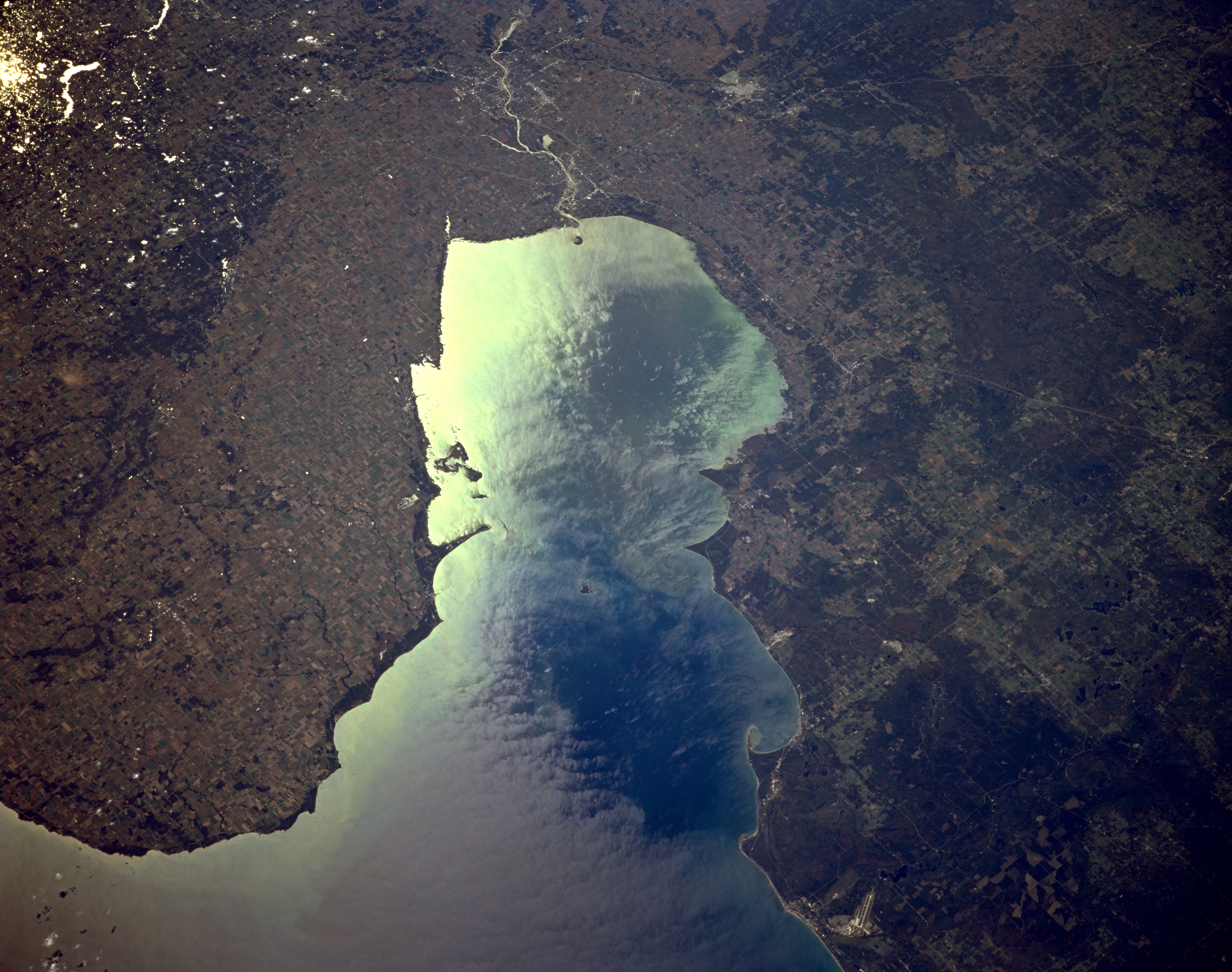
Image Caption: STS068-164-126 Saginaw Bay, Michigan, U.S.A. October 1994
Saginaw Bay, an inlet of Lake Huron, is featured in sunglint in this southwest-looking, low-oblique photograph. Fed mainly by the Saginaw River (near top center), the bay is a fishing and recreational area. Bay City, at the mouth of the Saginaw River, is a major Great Lakes port of entry and shipping center in southern Saginaw Bay. A small portion of Lake Huron is discernible (bottom left). Visible are the runways of Paul B. Wurtsmith Air Force Base (right of bottom center); Huron National Forest to the west; Midland, west of the Saginaw River (right of top center); and Holloway Reservoir (upper left in sunglint).
Saginaw Bay, an inlet of Lake Huron, is featured in sunglint in this southwest-looking, low-oblique photograph. Fed mainly by the Saginaw River (near top center), the bay is a fishing and recreational area. Bay City, at the mouth of the Saginaw River, is a major Great Lakes port of entry and shipping center in southern Saginaw Bay. A small portion of Lake Huron is discernible (bottom left). Visible are the runways of Paul B. Wurtsmith Air Force Base (right of bottom center); Huron National Forest to the west; Midland, west of the Saginaw River (right of top center); and Holloway Reservoir (upper left in sunglint).
