STS068-161-97
| NASA Photo ID | STS068-161-97 |
| Focal Length | 250mm |
| Date taken | 1994.10.08 |
| Time taken | 06:30:41 GMT |

Cloud masks available for this image:
Spacecraft nadir point: 25.8° S, 124.4° E
Photo center point: 26.5° S, 123.0° E
Photo center point by machine learning:
Photo center point: 26.5° S, 123.0° E
Photo center point by machine learning:
Nadir to Photo Center: Southwest
Spacecraft Altitude: 111 nautical miles (206km)
Country or Geographic Name: | AUSTRALIA-WA |
Features: | GIBSON DES., CARNEGIE L. |
| Features Found Using Machine Learning: | |
Cloud Cover Percentage: | 0 (no clouds present) |
Sun Elevation Angle: | 43° |
Sun Azimuth: | 287° |
Camera: | Linhof |
Focal Length: | 250mm |
Camera Tilt: | 40 degrees |
Format: | 5046: Kodak, natural color positive, Lumiere 100/5046, ASA 100, standard base |
Film Exposure: | Normal |
| Additional Information | |
| Width | Height | Annotated | Cropped | Purpose | Links |
|---|---|---|---|---|---|
| 5024 pixels | 3968 pixels | No | No | Earth From Space collection | Download Image |
| 640 pixels | 505 pixels | No | No | Earth From Space collection | Download Image |
| 640 pixels | 480 pixels | No | No | ISD 1 | Download Image |
Download Packaged File
Download a Google Earth KML for this Image
View photo footprint information
Download a GeoTIFF for this photo
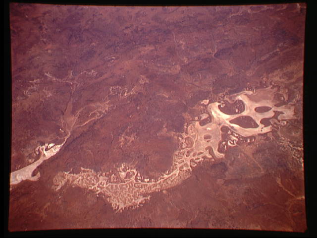
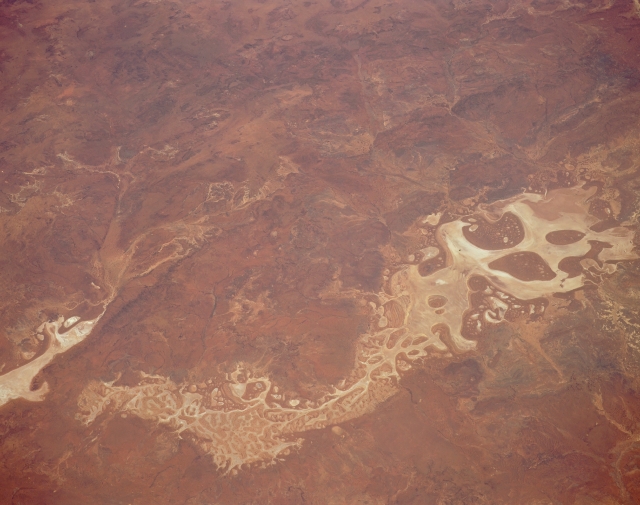
Image Caption: STS068-161-097 Lake Carnegie, Western Australia, Australia October 1994
The light colored, brownish looking area shows the general outline of Lake Carnegie, a dry lake located in the central part of Western Australia. This arid region is located southwest of the Gibson Desert and northwest of the Great Victoria Desert. The larger, dark brown features (right middle) are slightly elevated, more vegetated islands on the flat surface of the dry lakebed (or playa). A low range of hills, (darker, linear feature in the lower left quadrant), called the Von Treuer Tablelands, can be traced diagonally across part of the image. The eastern end of the Princess Range of mountains (darker, linear feature) is visible in the upper right quadrant of the image.
The light colored, brownish looking area shows the general outline of Lake Carnegie, a dry lake located in the central part of Western Australia. This arid region is located southwest of the Gibson Desert and northwest of the Great Victoria Desert. The larger, dark brown features (right middle) are slightly elevated, more vegetated islands on the flat surface of the dry lakebed (or playa). A low range of hills, (darker, linear feature in the lower left quadrant), called the Von Treuer Tablelands, can be traced diagonally across part of the image. The eastern end of the Princess Range of mountains (darker, linear feature) is visible in the upper right quadrant of the image.
