STS068-157-135
| NASA Photo ID | STS068-157-135 |
| Focal Length | 250mm |
| Date taken | 1994.10.10 |
| Time taken | 05:23:35 GMT |
Cloud masks available for this image:
Spacecraft nadir point: 44.1° N, 72.8° E
Photo center point: 42.5° N, 72.5° E
Photo center point by machine learning:
Photo center point: 42.5° N, 72.5° E
Photo center point by machine learning:
Nadir to Photo Center: South
Spacecraft Altitude: 110 nautical miles (204km)
Country or Geographic Name: | KAZAKHSTAN |
Features: | AREA EAST OF DZHAMBUL |
| Features Found Using Machine Learning: | |
Cloud Cover Percentage: | 0 (no clouds present) |
Sun Elevation Angle: | 35° |
Sun Azimuth: | 151° |
Camera: | Linhof |
Focal Length: | 250mm |
Camera Tilt: | 42 degrees |
Format: | 5046: Kodak, natural color positive, Lumiere 100/5046, ASA 100, standard base |
Film Exposure: | Normal |
| Additional Information | |
| Width | Height | Annotated | Cropped | Purpose | Links |
|---|---|---|---|---|---|
| 4096 pixels | 5248 pixels | No | No | Earth From Space collection | Download Image |
| 499 pixels | 640 pixels | No | No | Earth From Space collection | Download Image |
| 640 pixels | 480 pixels | No | No | ISD 1 | Download Image |
Download Packaged File
Download a Google Earth KML for this Image
View photo footprint information
Download a GeoTIFF for this photo
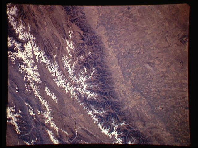
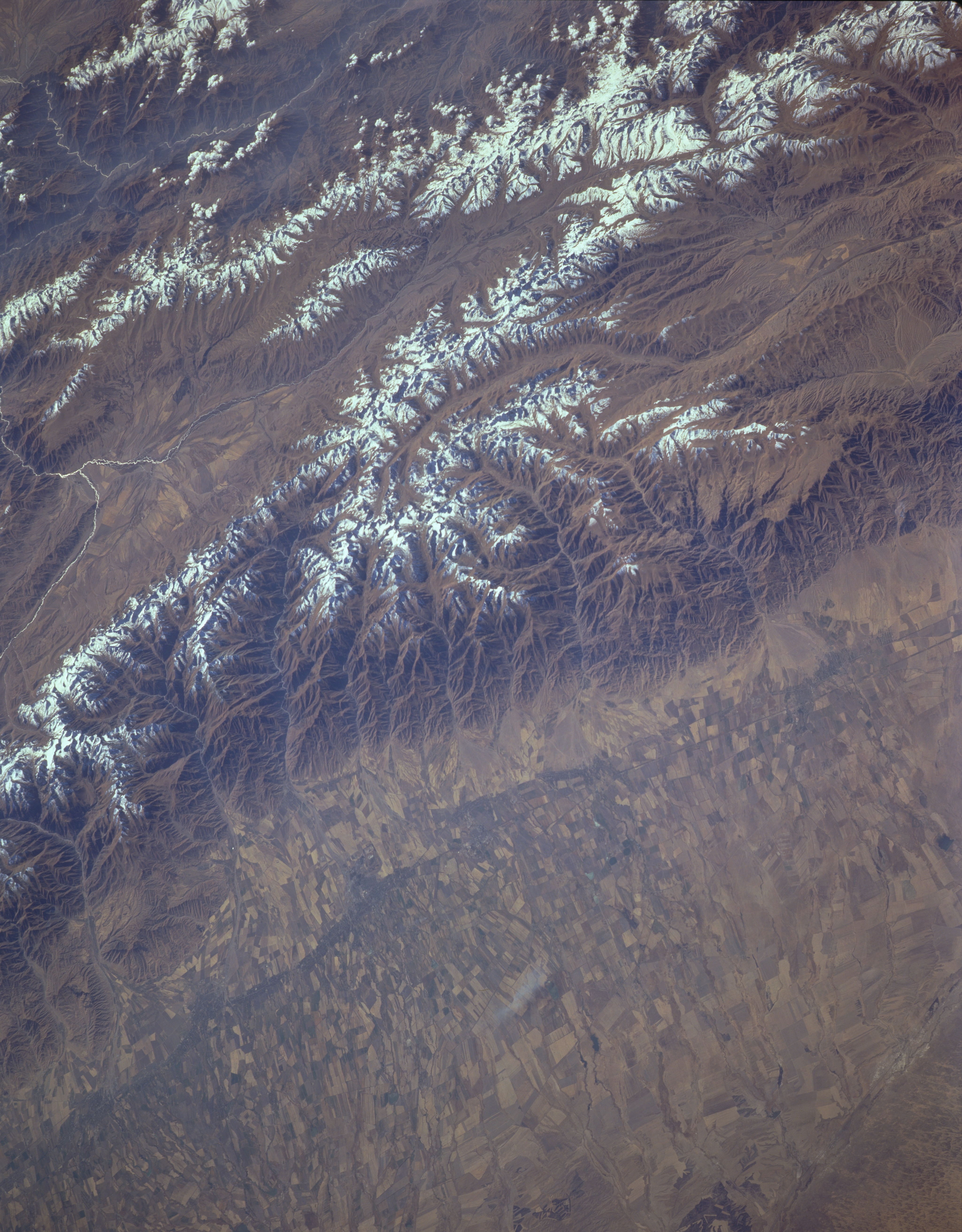
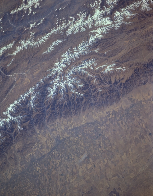
Image Caption: STS068-157-135 Western Kyrgyz Mountains, Kazakhstan October 1994
Extending from the top center of the image (east) to the bottom left of the image (west), the snow-covered western Kyrgyz Mountains are visible. The mountain range extends from near Issyk-Kul (lake) in the east to the west near the city of Dzhambul. The western Kyrgyz Mountains are rugged with numerous valleys and some peaks exceeding 12000 feet (3660 meters). Along the left portion of the image, and to the north of the Kyrgyz Range, agricultural field patterns are discernible in the Kuragatt River Valley. Wheat is one of the main crops grown in the valley. At the extreme bottom left of the image, a small portion of the Muyun Sand Desert is visible.
Extending from the top center of the image (east) to the bottom left of the image (west), the snow-covered western Kyrgyz Mountains are visible. The mountain range extends from near Issyk-Kul (lake) in the east to the west near the city of Dzhambul. The western Kyrgyz Mountains are rugged with numerous valleys and some peaks exceeding 12000 feet (3660 meters). Along the left portion of the image, and to the north of the Kyrgyz Range, agricultural field patterns are discernible in the Kuragatt River Valley. Wheat is one of the main crops grown in the valley. At the extreme bottom left of the image, a small portion of the Muyun Sand Desert is visible.
