STS068-154-87
| NASA Photo ID | STS068-154-87 |
| Focal Length | 250mm |
| Date taken | 1994.10.03 |
| Time taken | 04:48:17 GMT |

Cloud masks available for this image:
Spacecraft nadir point: 53.2° N, 101.7° E
Photo center point: 51.5° N, 100.0° E
Photo center point by machine learning:
Photo center point: 51.5° N, 100.0° E
Photo center point by machine learning:
Nadir to Photo Center: Southwest
Spacecraft Altitude: 117 nautical miles (217km)
Country or Geographic Name: | MONGOLIA |
Features: | L. HOVSGOL, MOUNTAINS |
| Features Found Using Machine Learning: | |
Cloud Cover Percentage: | 0 (no clouds present) |
Sun Elevation Angle: | 33° |
Sun Azimuth: | 176° |
Camera: | Linhof |
Focal Length: | 250mm |
Camera Tilt: | 51 degrees |
Format: | 5046: Kodak, natural color positive, Lumiere 100/5046, ASA 100, standard base |
Film Exposure: | Normal |
| Additional Information | |
| Width | Height | Annotated | Cropped | Purpose | Links |
|---|---|---|---|---|---|
| 5217 pixels | 4096 pixels | No | No | Earth From Space collection | Download Image |
| 639 pixels | 502 pixels | No | No | Earth From Space collection | Download Image |
| 640 pixels | 480 pixels | No | No | ISD 1 | Download Image |
Download Packaged File
Download a Google Earth KML for this Image
View photo footprint information
Download a GeoTIFF for this photo
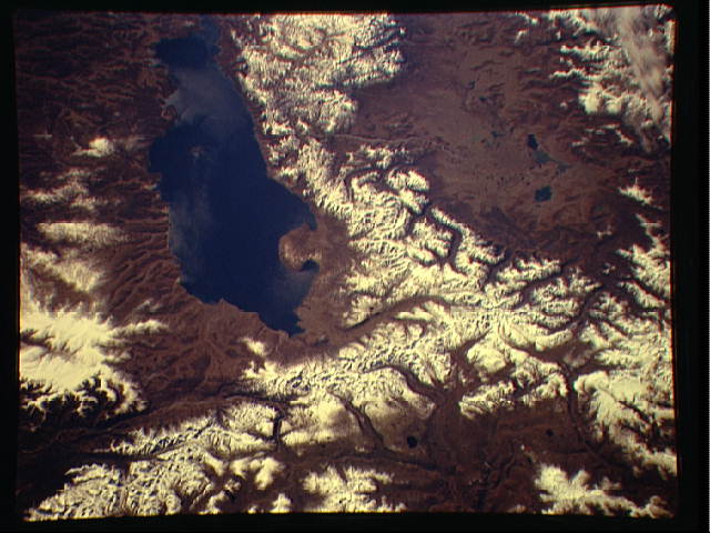
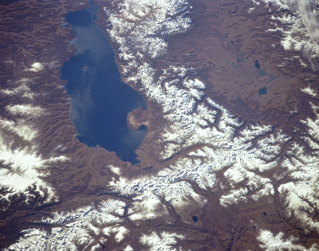
Image Caption: STS068-154-087 Lake Khubsugul, Mongolia October 1994
One of the largest fresh water lakes in Asia, Lake Khubsugul (Hovsgol) can be seen in this south-looking view. Lake Khubsugul is 83 miles (133 km) long and 21 miles (34 km) wide. The Selenga-Moron River drains Lake Khubsugul to the south. The Selenga River, which is one of the main rivers of Mongolia, eventually empties into Lake Baykal to the north. Lake Khubsugul, which is frozen almost six months of the year, supports a major fishing industry. The lake is located in the Eastern Sayan Mountains and the region around the lake suffers from frequent earthquakes. Efforts by the Mongolian Ministry of Environmental Protection has made great progress in keeping the waters of Lake Khubsugul mostly pollution free. The Valley of the Dood Lake is visible to the right (west) of Lake Khubsugul.
One of the largest fresh water lakes in Asia, Lake Khubsugul (Hovsgol) can be seen in this south-looking view. Lake Khubsugul is 83 miles (133 km) long and 21 miles (34 km) wide. The Selenga-Moron River drains Lake Khubsugul to the south. The Selenga River, which is one of the main rivers of Mongolia, eventually empties into Lake Baykal to the north. Lake Khubsugul, which is frozen almost six months of the year, supports a major fishing industry. The lake is located in the Eastern Sayan Mountains and the region around the lake suffers from frequent earthquakes. Efforts by the Mongolian Ministry of Environmental Protection has made great progress in keeping the waters of Lake Khubsugul mostly pollution free. The Valley of the Dood Lake is visible to the right (west) of Lake Khubsugul.
