STS067-727-4
| NASA Photo ID | STS067-727-4 |
| Focal Length | 100mm |
| Date taken | 1995.03.06 |
| Time taken | 02:55:57 GMT |
Cloud masks available for this image:
Spacecraft nadir point: 27.5° S, 142.0° E
Photo center point: 26.5° S, 141.5° E
Photo center point by machine learning:
Photo center point: 26.5° S, 141.5° E
Photo center point by machine learning:
Nadir to Photo Center: North
Spacecraft Altitude: 187 nautical miles (346km)
Country or Geographic Name: | AUSTRALIA-Q |
Features: | THOMSON R, L. YAMMA YAMMA |
| Features Found Using Machine Learning: | |
Cloud Cover Percentage: | 0 (no clouds present) |
Sun Elevation Angle: | 68° |
Sun Azimuth: | 352° |
Camera: | Hasselblad |
Focal Length: | 100mm |
Camera Tilt: | 20 degrees |
Format: | 5046: Kodak, natural color positive, Lumiere 100/5046, ASA 100, standard base |
Film Exposure: | Normal |
| Additional Information | |
| Width | Height | Annotated | Cropped | Purpose | Links |
|---|---|---|---|---|---|
| 5700 pixels | 5900 pixels | No | No | Download Image | |
| 500 pixels | 518 pixels | No | No | Download Image | |
| 640 pixels | 480 pixels | No | No | Download Image |
Download Packaged File
Download a Google Earth KML for this Image
View photo footprint information
Download a GeoTIFF for this photo
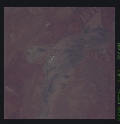
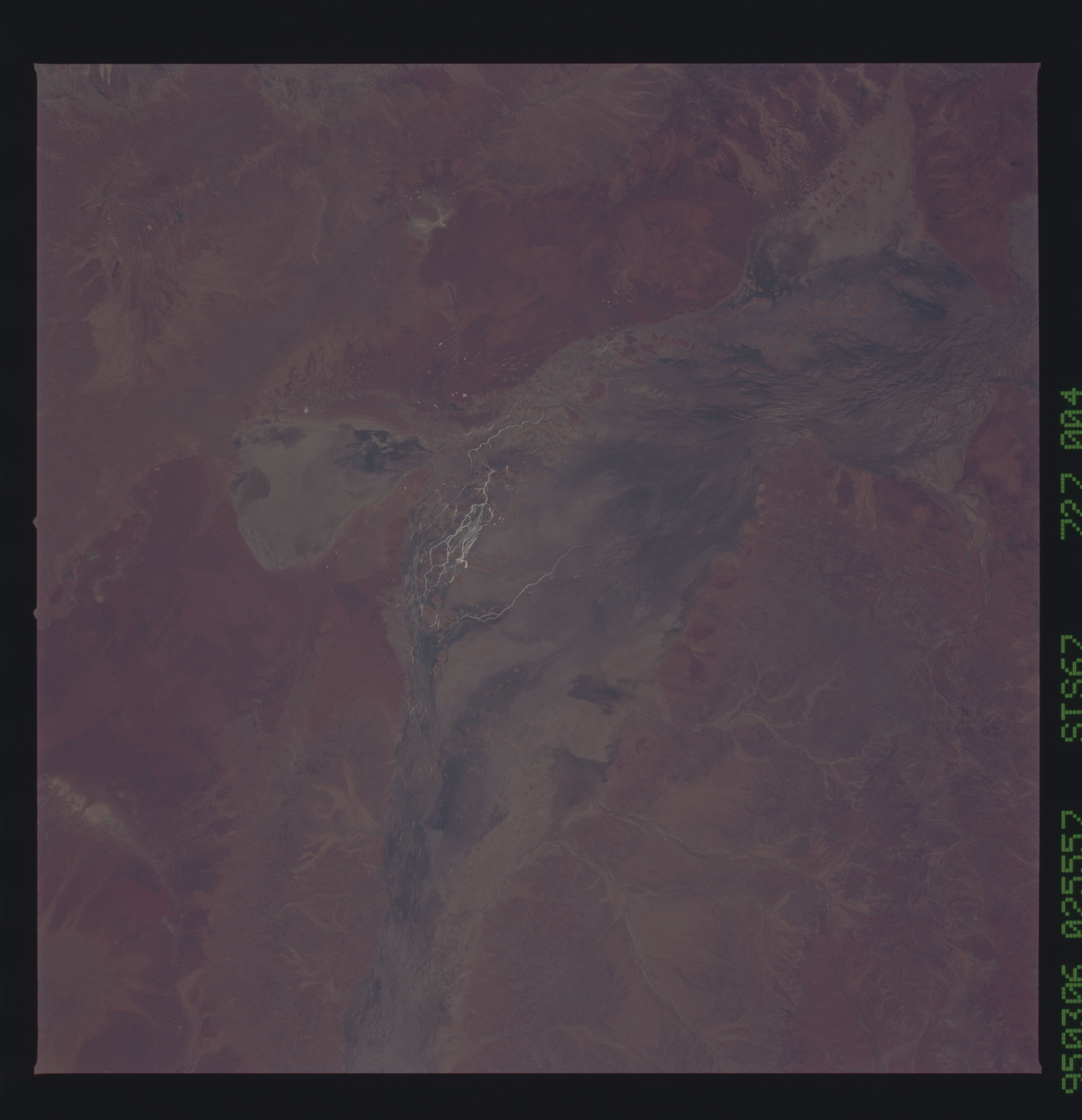
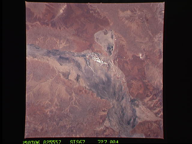
Image Caption: Cooper Creek is one of the largest drainages in the Channel Country of
the arid interior of Australia (Queensland). Rivers in this region are
usually dry but during floods (a few times per century) they occupy
very wide floodplains, shown here as the darker areas with hairlike
rills. After the great rains which recently fell in many parts of
Australia, the individual rills contain water and show up in sunglint
in this view. Flow is to the south (top) towards L. Eyre.
Lake Yamma Yamma is the medallion-shaped "flood-out" lake right
center. Water can be seen entering the Lake. Once the flood is past,
much of the water will flow back out of the Lake into Cooper Creek.
Cooper Creek is one of the largest drainage's in the Channel Country of the arid interior of Australia (Queensland). Rivers in this region are usually dry but during floods (a few times per century) they occupy very wide flood plains, shown here as the darker areas with hairlike rills. After the great rains which recently fell in many parts of Australia, individual rills contain water and show up in sunglint in this view. Flow is to the south (top) towards Lake Eyre. Lake Yamma Yamma is the medallion-shaped "flood-out" lake right center. Water can be seen entering the lake.
