STS067-721A-52
| NASA Photo ID | STS067-721A-52 |
| Focal Length | 100mm |
| Date taken | 1995.03.14 |
| Time taken | 07:48:58 GMT |

Cloud masks available for this image:
Spacecraft nadir point: 12.7° N, 97.7° E
Photo center point: 12.0° N, 93.5° E
Photo center point by machine learning:
Photo center point: 12.0° N, 93.5° E
Photo center point by machine learning:
Nadir to Photo Center: West
Spacecraft Altitude: 183 nautical miles (339km)
Country or Geographic Name: | ANDAMAN ISLANDS |
Features: | BARREN ISLAND VOLCANO |
| Features Found Using Machine Learning: | |
Cloud Cover Percentage: | 0 (no clouds present) |
Sun Elevation Angle: | 54° |
Sun Azimuth: | 247° |
Camera: | Hasselblad |
Focal Length: | 100mm |
Camera Tilt: | 54 degrees |
Format: | 5046: Kodak, natural color positive, Lumiere 100/5046, ASA 100, standard base |
Film Exposure: | Normal |
| Additional Information | |
| Width | Height | Annotated | Cropped | Purpose | Links |
|---|---|---|---|---|---|
| 5700 pixels | 5900 pixels | No | No | Download Image | |
| 500 pixels | 518 pixels | No | No | Download Image | |
| 640 pixels | 480 pixels | No | No | Download Image |
Download Packaged File
Download a Google Earth KML for this Image
View photo footprint information
Download a GeoTIFF for this photo
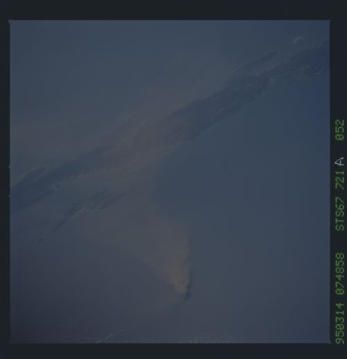
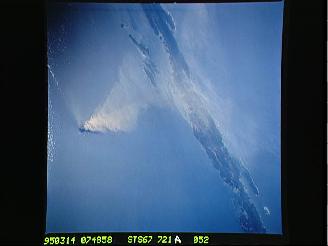
Image Caption: Barren Island, a small volcanic island which is part of the Andaman
Island group in the Andaman Sea west of Malayasia, began a new
eruptive phase late in 1994. Barren Island last erupted in 1991. The
current eruption was surveyed by a team of Indian scientists in
January, 1995; at that time they thought the eruption was in an
initial stage and gaining momentum. The STS-67 crew noticed the
volcanic plume early in their flight, and had several opportunities to
document the on-going eruption. This view, taken March 14, shows a
healthy volcanic plume rising several thousand feet into the
atmosphere. The main plume drifts westward over Andaman Island,
although a smaller plume close to the ground is being dispersed to the
south.
Barren Island, a small volcanic island which is part of the Andaman Island group in the Andaman Sea west of Malaysia, began a new eruptive phase late in 1994. The STS-67 crew noticed the volcanic plume early in their flight, and had several opportunities to document the on-going eruption. This view, taken March 14, 1995, shows a healthy volcanic plume rising several thousand feet into the atmosphere. The main plume drifts westward over Andaman Island, although a smaller plume close to the ground is being dispersed to the south.
