STS066-98-78
| NASA Photo ID | STS066-98-78 |
| Focal Length | 250mm |
| Date taken | 1994.11.10 |
| Time taken | 10:29:46 GMT |
Cloud masks available for this image:
Spacecraft nadir point: 39.2° N, 8.3° W
Photo center point: 36.0° N, 6.0° W
Photo center point by machine learning:
Photo center point: 36.0° N, 6.0° W
Photo center point by machine learning:
Nadir to Photo Center: Southeast
Spacecraft Altitude: 159 nautical miles (294km)
Country or Geographic Name: | ATLANTIC OCEAN |
Features: | STR. GIBRALTAR, SUNGLINT |
| Features Found Using Machine Learning: | |
Cloud Cover Percentage: | 80 (76-100)% |
Sun Elevation Angle: | 28° |
Sun Azimuth: | 151° |
Camera: | Hasselblad |
Focal Length: | 250mm |
Camera Tilt: | Low Oblique |
Format: | 5046: Kodak, natural color positive, Lumiere 100/5046, ASA 100, standard base |
Film Exposure: | Normal |
| Additional Information | |
| Width | Height | Annotated | Cropped | Purpose | Links |
|---|---|---|---|---|---|
| 5700 pixels | 5900 pixels | No | No | Download Image | |
| 500 pixels | 518 pixels | No | No | Download Image | |
| 640 pixels | 480 pixels | No | No | Download Image |
Download Packaged File
Download a Google Earth KML for this Image
View photo footprint information
Download a GeoTIFF for this photo
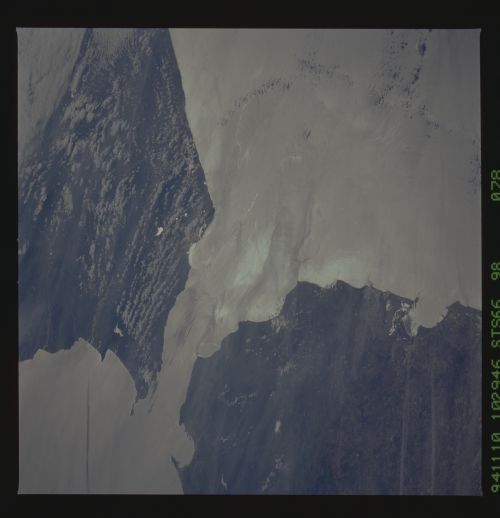
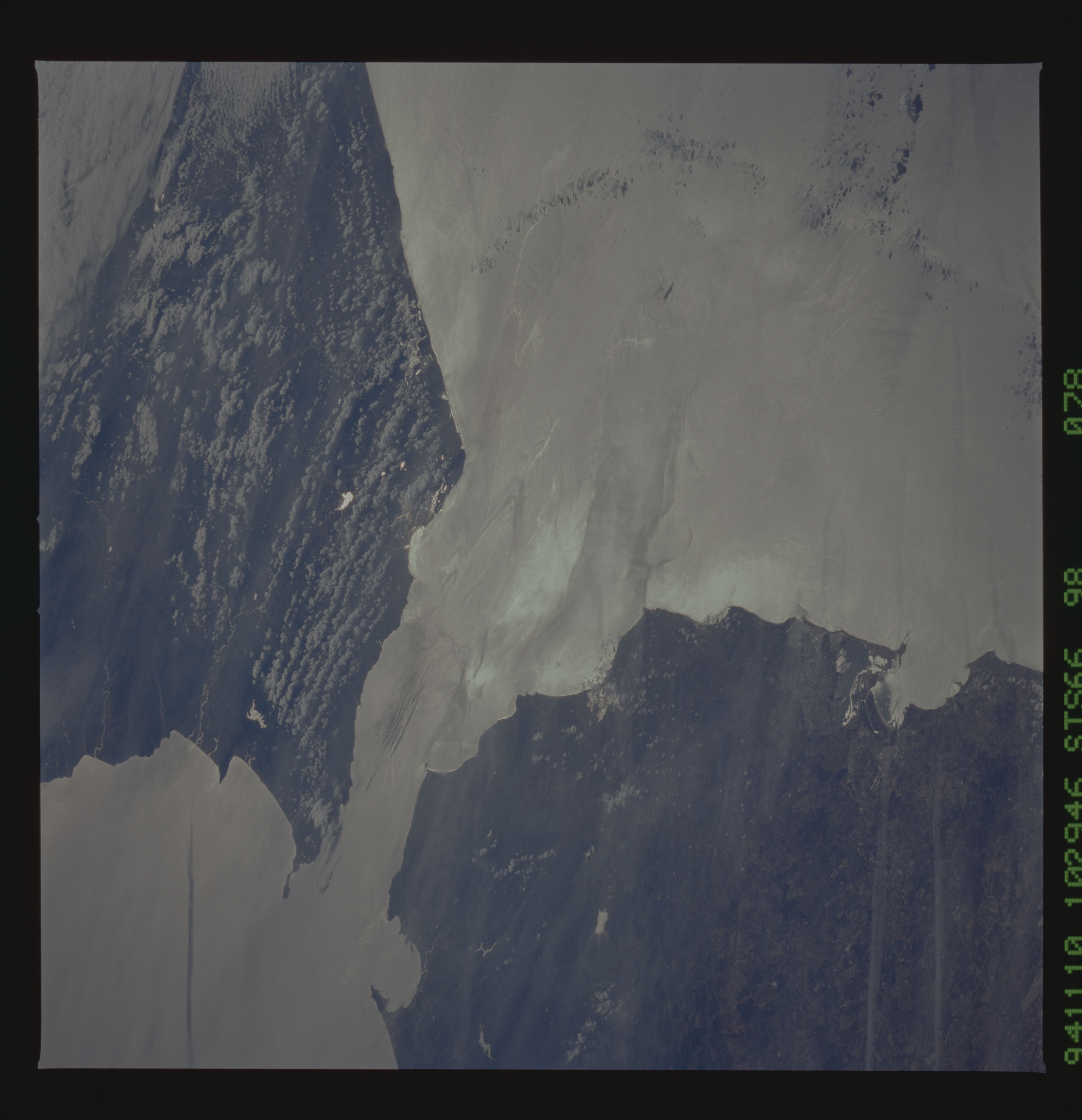
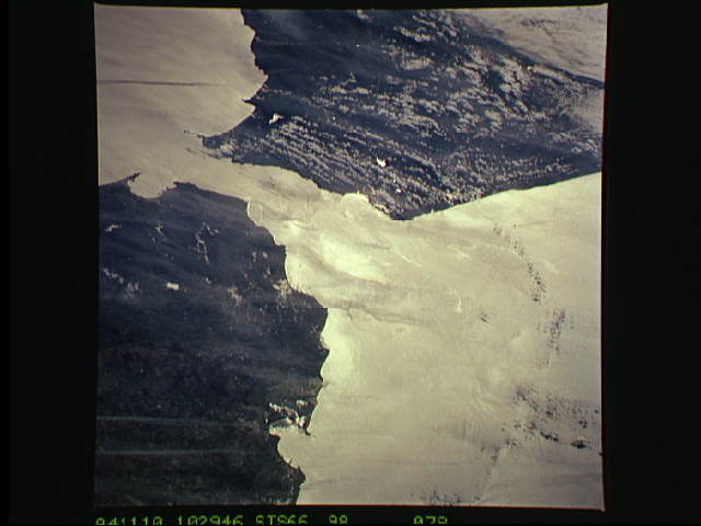
Image Caption: Swift currents flow through the Strait of Gibraltar, producing complicated patterns in the surface waters. Some of those patterns are highlighted in the sunglint in this photograph. The Mediterranean Sea is on the upper right, the Atlantic Ocean is in the lower left. Few features can be seen on the Mediterranean side, but current shears (straight lines coming off Spain), several sets of internal waves (impinging on the Spanish continental shelf) and ship wakes can be seen on the Atlantic side, west of Cadiz. Both Tangier and Cadiz show up in the sunglint as well.
Swift currents flow through the Strait of Gibraltar, producing complicated patterns in the surface waters. Some of those patterns are highlighted in the sunglint in this photograph. The Mediterranian Sea is on the upper right, the Atlantic Ocean in in the lower left. Few features can be seen on the Mediterranian side, but current shears (straight lines coming off Spain), several sets of internal waves (impinging on the Spanish continental shelf) and ship wakes can be seen on the Atlantic side, west of Cadiz. Both Tangier and Cadiz show up in the sunglint as well.
Swift currents flow through the Strait of Gibraltar, producing complicated patterns in the surface waters. Some of those patterns are highlighted in the sunglint in this photograph. The Mediterranian Sea is on the upper right, the Atlantic Ocean in in the lower left. Few features can be seen on the Mediterranian side, but current shears (straight lines coming off Spain), several sets of internal waves (impinging on the Spanish continental shelf) and ship wakes can be seen on the Atlantic side, west of Cadiz. Both Tangier and Cadiz show up in the sunglint as well.
