STS066-94-20

| NASA Photo ID | STS066-94-20 |
| Focal Length | 250mm |
| Date taken | 1994.11.08 |
| Time taken | 08:39:13 GMT |
Cloud masks available for this image:
Spacecraft nadir point: 19.3° N, 12.3° E
Photo center point: 13.5° N, 14.5° E
Photo center point by machine learning:
Photo center point: 13.5° N, 14.5° E
Photo center point by machine learning:
Nadir to Photo Center: South
Spacecraft Altitude: 160 nautical miles (296km)
Country or Geographic Name: | CHAD |
Features: | LAKE CHAD, SMOKE PLUMES |
| Features Found Using Machine Learning: | |
Cloud Cover Percentage: | 20 (11-25)% |
Sun Elevation Angle: | 41° |
Sun Azimuth: | 135° |
Camera: | Hasselblad |
Focal Length: | 250mm |
Camera Tilt: | Low Oblique |
Format: | 5046: Kodak, natural color positive, Lumiere 100/5046, ASA 100, standard base |
Film Exposure: | Normal |
| Additional Information | |
| Width | Height | Annotated | Cropped | Purpose | Links |
|---|---|---|---|---|---|
| 5700 pixels | 5900 pixels | No | No | Download Image | |
| 500 pixels | 518 pixels | No | No | Download Image | |
| 640 pixels | 480 pixels | No | No | Download Image |
Download Packaged File
Download a Google Earth KML for this Image
View photo footprint information
Download a GeoTIFF for this photo
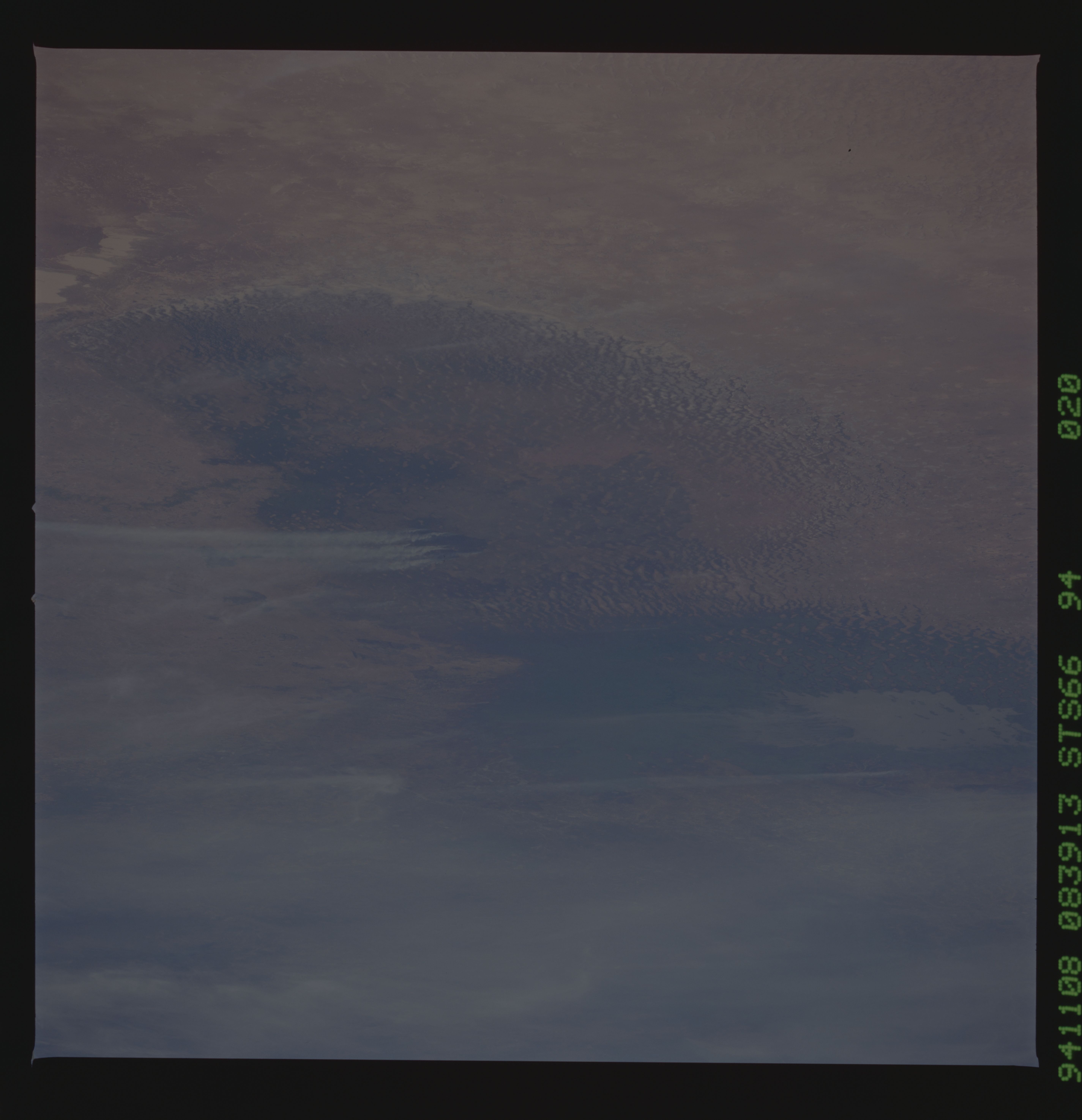
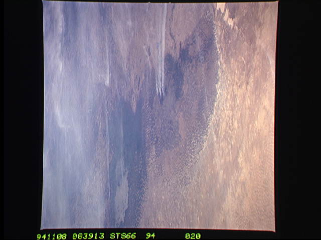
Image Caption: This oblique view of Lake Chad was taken by the STS-66 crew in November, 1994. This lake lies mainly in the Republic of Chad, and partly in Nigeria, Cameroon and Niger. The size of Lake Chad varies seasonally and is actually divided into north and south basins; neither of which is generally more than 25 feet (7.6 meters) deep. In this photograph, all the water appears to be located in the southern basin with the northern and eastern edges of both basins covered with sand dunes which have invaded the area where water once stood. The prevailing wind direction can be seen from the agriculture burning in both basins to be from the east.
This oblique view of Lake Chad was taken by the STS-66 crew in November 1994. This lake lies mainly in the Republic of Chad and partly in Nigeria, Cameroon and Niger. The size of Lake Chad varies seasonally and is actually divided into north and south basins; neither of which is generally more than 25 feet (7.6 meters) deep. In this photograph, all the water appears to be located in the southern basin with the northern and eastern edges of both basins covered with sand dunes which have invaded the area where the water once stood. The prevailing wind direction can be seen from the agriculture burning in both basins to be from the east.
This oblique view of Lake Chad was taken by the STS-66 crew in November 1994. This lake lies mainly in the Republic of Chad and partly in Nigeria, Cameroon and Niger. The size of Lake Chad varies seasonally and is actually divided into north and south basins; neither of which is generally more than 25 feet (7.6 meters) deep. In this photograph, all the water appears to be located in the southern basin with the northern and eastern edges of both basins covered with sand dunes which have invaded the area where the water once stood. The prevailing wind direction can be seen from the agriculture burning in both basins to be from the east.
