STS066-89-27
| NASA Photo ID | STS066-89-27 |
| Focal Length | 100mm |
| Date taken | 1994.11.06 |
| Time taken | 00:39:07 GMT |
Cloud masks available for this image:
Spacecraft nadir point: 22.1° S, 117.1° E
Photo center point: 21.5° S, 115.5° E
Photo center point by machine learning:
Photo center point: 21.5° S, 115.5° E
Photo center point by machine learning:
Nadir to Photo Center: West
Spacecraft Altitude: 161 nautical miles (298km)
Camera: | Hasselblad |
Focal Length: | 100mm |
Camera Tilt: | 33 degrees |
Format: | 5046: Kodak, natural color positive, Lumiere 100/5046, ASA 100, standard base |
Film Exposure: | Normal |
| Additional Information | |
| Width | Height | Annotated | Cropped | Purpose | Links |
|---|---|---|---|---|---|
| 5700 pixels | 5900 pixels | No | No | Download Image | |
| 500 pixels | 518 pixels | No | No | Download Image | |
| 640 pixels | 480 pixels | No | No | Download Image |
Download Packaged File
Download a Google Earth KML for this Image
View photo footprint information
Download a GeoTIFF for this photo
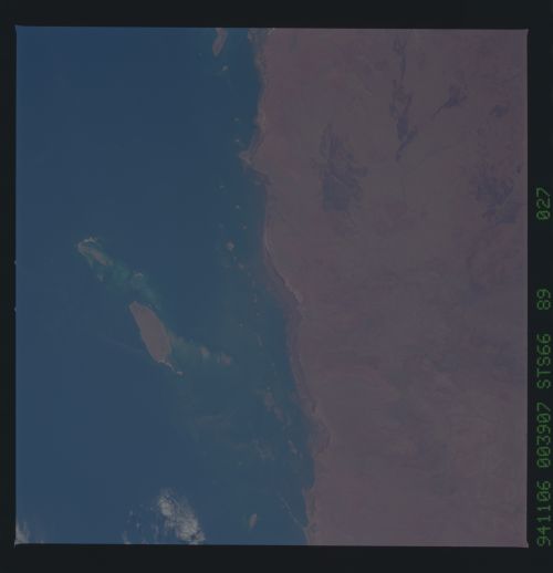
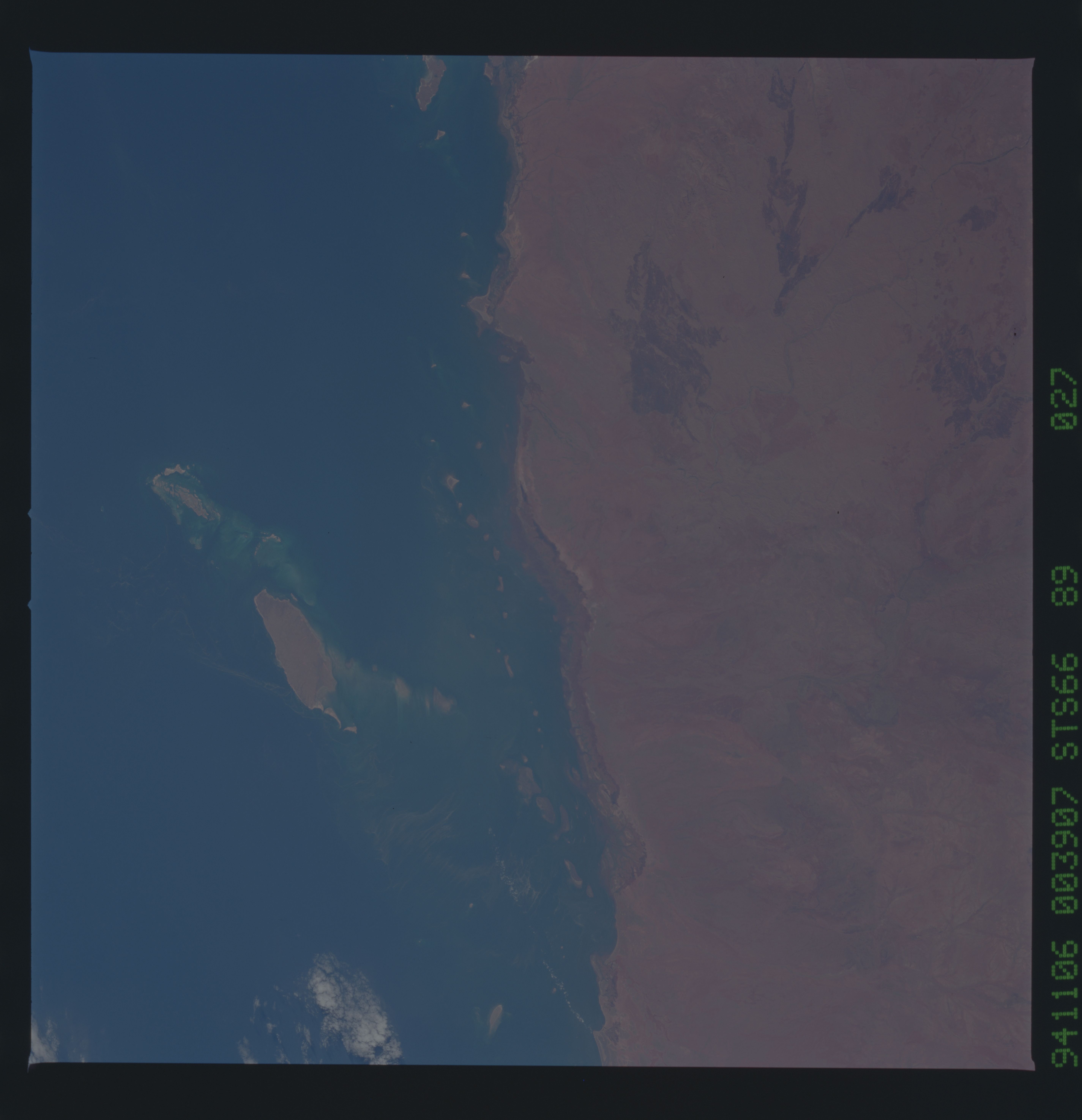
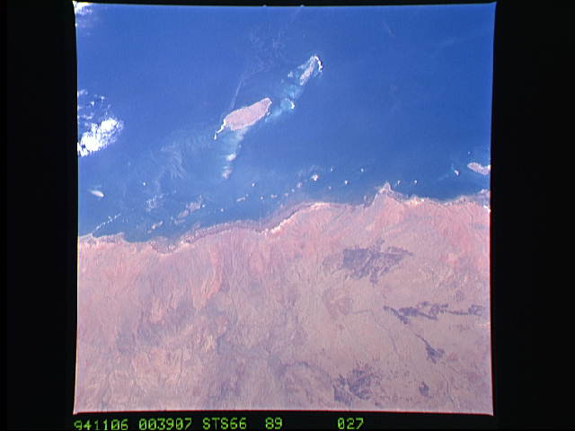
Image Caption: Nadir 22.3S 117.0E, Plankton bloom around Barrow Island off the west central coast of Australia. Trichodesmium plankton blooms are not as apparent as the bright blue of the coccolithophor blooms but have been documented just as often. This plankton bloom was around Barrow Island off the west central coast of Australia. Extensive filaments of this type of plankton bloom have been photographed off the Western, Northern and Eastern coasts of Australia.
This phenomena has not been easily detectable with other sensors such as the color zone coastal scanner (CZCS) or Advanced Very High Resolution Radiometer (AVHRR). First using Shuttle photography to detect Trichodesmium erythraeum phytoplankton blooms, Ajit Subramaniam, Marine Sciences Research Center, State University of New York Stony Brook, was then able to extract data from specific area from the CZCS data to build an algorithm to detect these plankton blooms in other regions of the world from the CZCS data. Since plankton use carbon, this type of information adds to the understanding of the process and quantity of carbon which the oceans can absorb.
This phenomena has not been easily detectable with other sensors such as the color zone coastal scanner (CZCS) or Advanced Very High Resolution Radiometer (AVHRR). First using Shuttle photography to detect Trichodesmium erythraeum phytoplankton blooms, Ajit Subramaniam, Marine Sciences Research Center, State University of New York Stony Brook, was then able to extract data from specific area from the CZCS data to build an algorithm to detect these plankton blooms in other regions of the world from the CZCS data. Since plankton use carbon, this type of information adds to the understanding of the process and quantity of carbon which the oceans can absorb.
