STS066-82-11
| NASA Photo ID | STS066-82-11 |
| Focal Length | 250mm |
| Date taken | 1994.11.08 |
| Time taken | 08:48:25 GMT |
Resolutions offered for this image:
4085 x 4067 pixels 640 x 637 pixels 5700 x 5900 pixels 500 x 518 pixels 640 x 480 pixels
4085 x 4067 pixels 640 x 637 pixels 5700 x 5900 pixels 500 x 518 pixels 640 x 480 pixels
Cloud masks available for this image:
Spacecraft nadir point: 46.4° N, 39.6° E
Photo center point: 47.0° N, 39.0° E
Photo center point by machine learning:
Photo center point: 47.0° N, 39.0° E
Photo center point by machine learning:
Nadir to Photo Center: Northwest
Spacecraft Altitude: 161 nautical miles (298km)
Country or Geographic Name: | RUSSIAN FEDERATION |
Features: | MOUTH OF DON RIVER |
| Features Found Using Machine Learning: | |
Cloud Cover Percentage: | 0 (no clouds present) |
Sun Elevation Angle: | 27° |
Sun Azimuth: | 175° |
Camera: | Hasselblad |
Focal Length: | 250mm |
Camera Tilt: | 18 degrees |
Format: | 2443: Kodak Aerochrome 2443, color IR, thin base, EA-5 process thru June 1999, E-6 process afterward |
Film Exposure: | Normal |
| Additional Information | |
| Width | Height | Annotated | Cropped | Purpose | Links |
|---|---|---|---|---|---|
| 4085 pixels | 4067 pixels | No | No | Earth From Space collection | Download Image |
| 640 pixels | 637 pixels | No | No | Earth From Space collection | Download Image |
| 5700 pixels | 5900 pixels | No | No | Download Image | |
| 500 pixels | 518 pixels | No | No | Download Image | |
| 640 pixels | 480 pixels | No | No | Download Image |
Download Packaged File
Download a Google Earth KML for this Image
View photo footprint information
Download a GeoTIFF for this photo
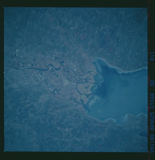
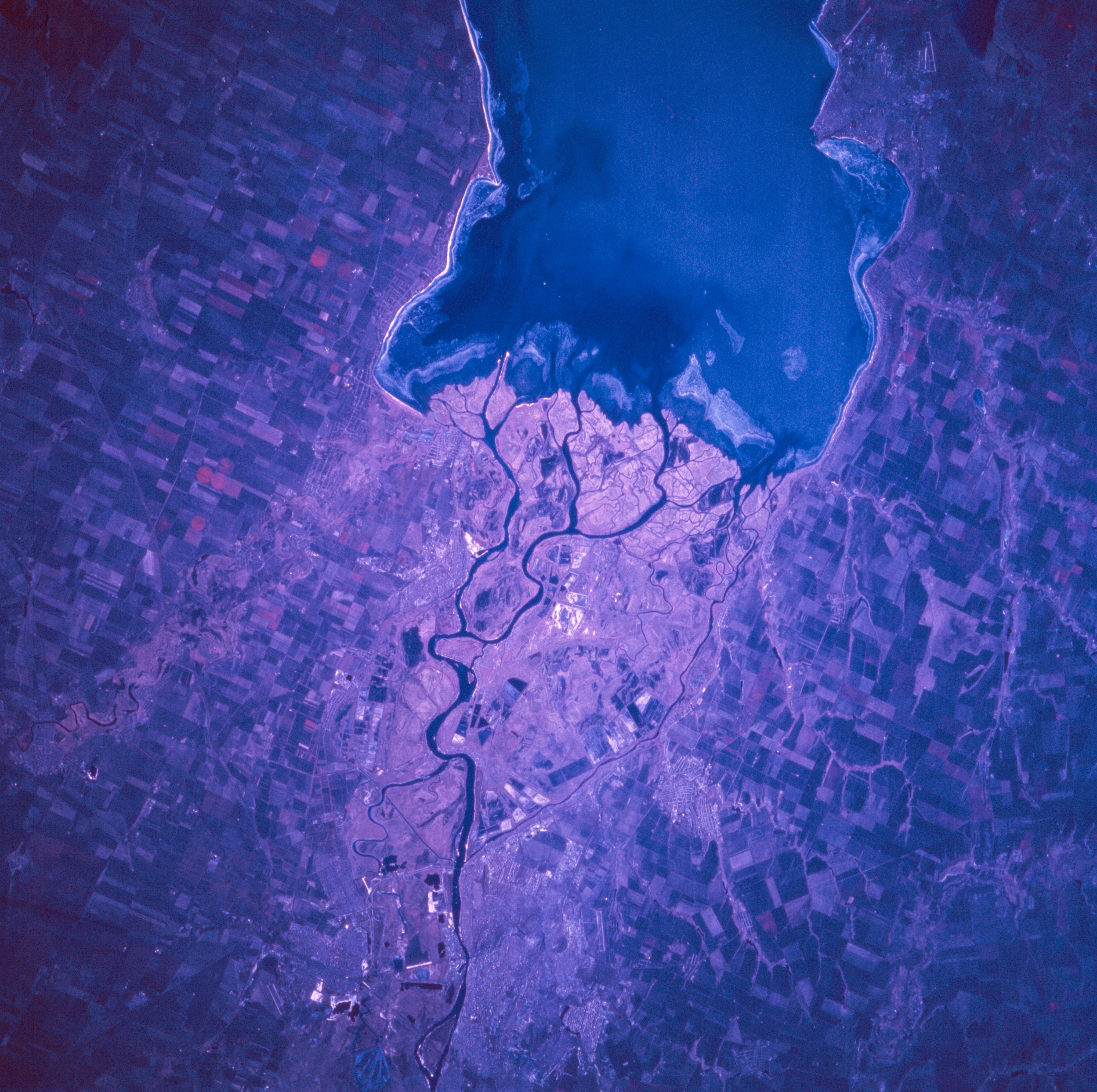
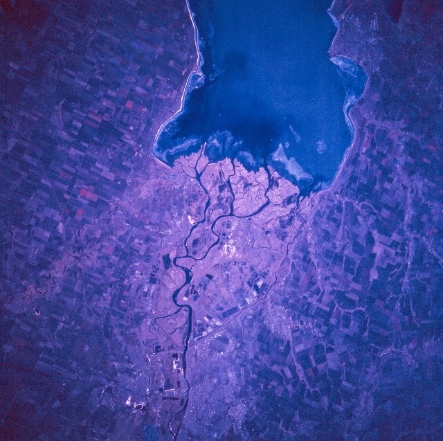
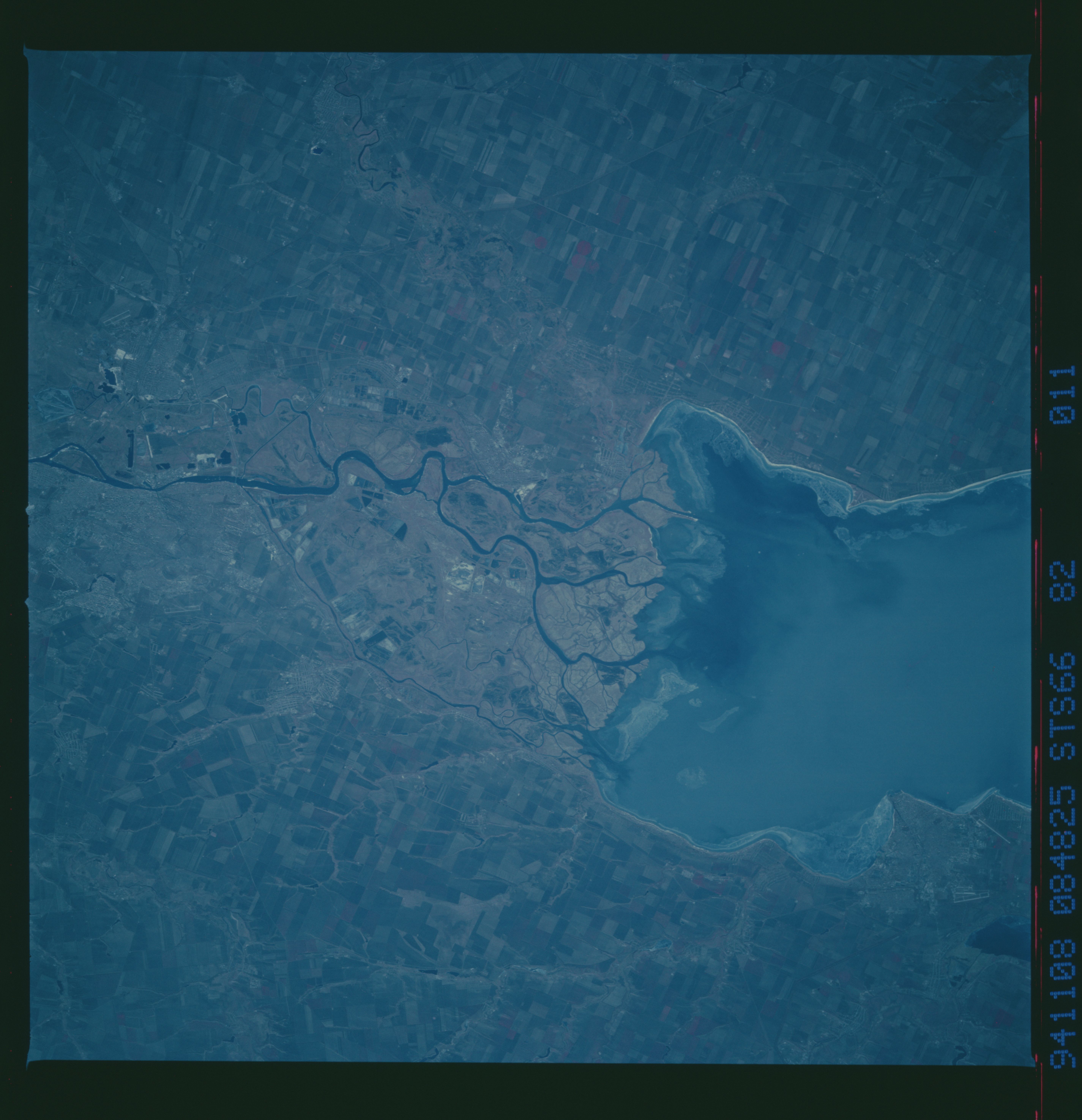
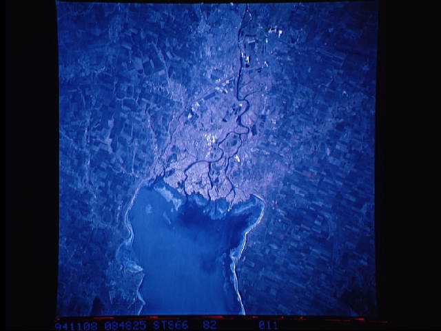
Image Caption: STS066-082-011 Rostov-On-Don, Russia November 1994
The large city of Rostov-On-Don (over 1 million people) is located in southwest Russia approximately 30 miles (50 km) from the mouth of the Don River delta. Rostov (bottom center) is the industrial, scientific, and cultural center of the North Caucasus Region. The large feature (top center) is the eastern end of Taganrogskiy Bay, which is an inlet to the Sea of Azov. Several distributary channels of the Don River (westward draining) fan out to create a low-lying, swampy delta (lighter-shaded area, center of image), immediately west of Rostov. Several airport runways (linear, light-colored features) are visible in the Rostov area: one runway can be identified south of Rostov (lower left) and two runways are visible near the town of Taganrog which is located west of Rostov and along the north side of the bay (upper right). Large cultivated field patterns (angular-looking features) north and south of the Don River indicates an agricultural landscape. The reddish color that is associated with healthy, green vegetation is subdued on this late autumn color infrared image.
The large city of Rostov-On-Don (over 1 million people) is located in southwest Russia approximately 30 miles (50 km) from the mouth of the Don River delta. Rostov (bottom center) is the industrial, scientific, and cultural center of the North Caucasus Region. The large feature (top center) is the eastern end of Taganrogskiy Bay, which is an inlet to the Sea of Azov. Several distributary channels of the Don River (westward draining) fan out to create a low-lying, swampy delta (lighter-shaded area, center of image), immediately west of Rostov. Several airport runways (linear, light-colored features) are visible in the Rostov area: one runway can be identified south of Rostov (lower left) and two runways are visible near the town of Taganrog which is located west of Rostov and along the north side of the bay (upper right). Large cultivated field patterns (angular-looking features) north and south of the Don River indicates an agricultural landscape. The reddish color that is associated with healthy, green vegetation is subdued on this late autumn color infrared image.
