STS066-152-172
| NASA Photo ID | STS066-152-172 |
| Focal Length | 90mm |
| Date taken | 1994.11.06 |
| Time taken | 23:16:18 GMT |
Cloud masks available for this image:
Spacecraft nadir point: 23.5° S, 131.5° E
Photo center point: 23.5° S, 132.0° E
Photo center point by machine learning:
Photo center point: 23.5° S, 132.0° E
Photo center point by machine learning:
Nadir to Photo Center: East
Spacecraft Altitude: 160 nautical miles (296km)
Country or Geographic Name: | AUSTRALIA-NT |
Features: | MACDONNELL RANGES |
| Features Found Using Machine Learning: | |
Cloud Cover Percentage: | 0 (no clouds present) |
Sun Elevation Angle: | 38° |
Sun Azimuth: | 93° |
Camera: | Linhof |
Focal Length: | 90mm |
Camera Tilt: | 11 degrees |
Format: | 5046: Kodak, natural color positive, Lumiere 100/5046, ASA 100, standard base |
Film Exposure: | Normal |
| Additional Information | |
| Width | Height | Annotated | Cropped | Purpose | Links |
|---|---|---|---|---|---|
| 5056 pixels | 3968 pixels | No | No | Earth From Space collection | Download Image |
| 640 pixels | 502 pixels | No | No | Earth From Space collection | Download Image |
| 640 pixels | 480 pixels | No | No | ISD 1 | Download Image |
Download Packaged File
Download a Google Earth KML for this Image
View photo footprint information
Download a GeoTIFF for this photo
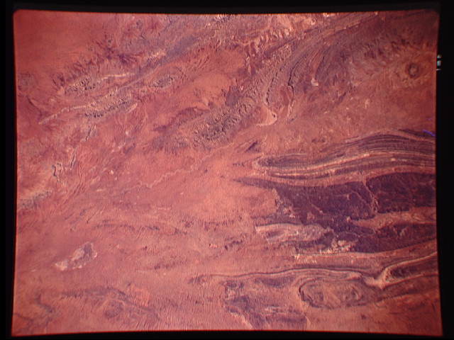
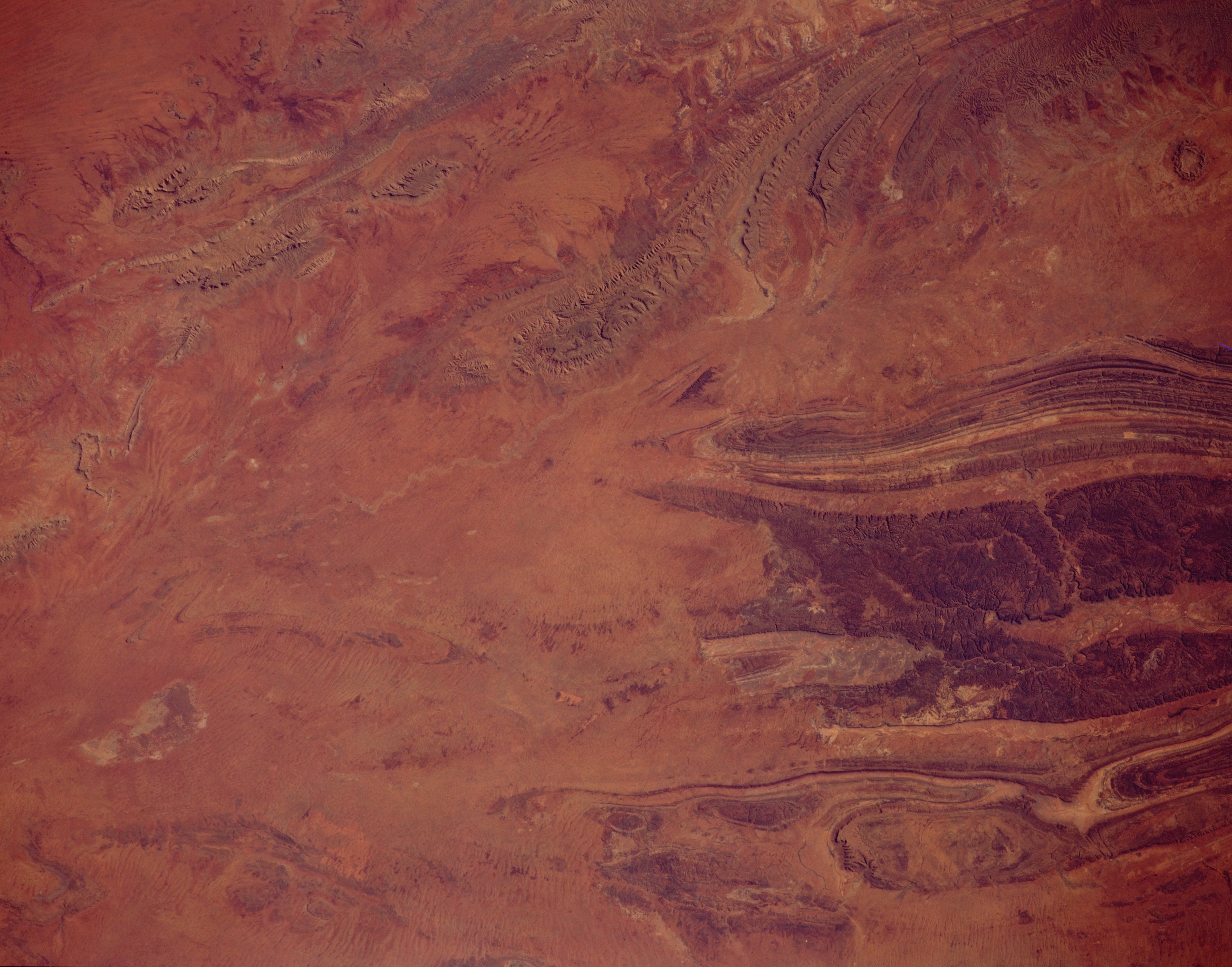
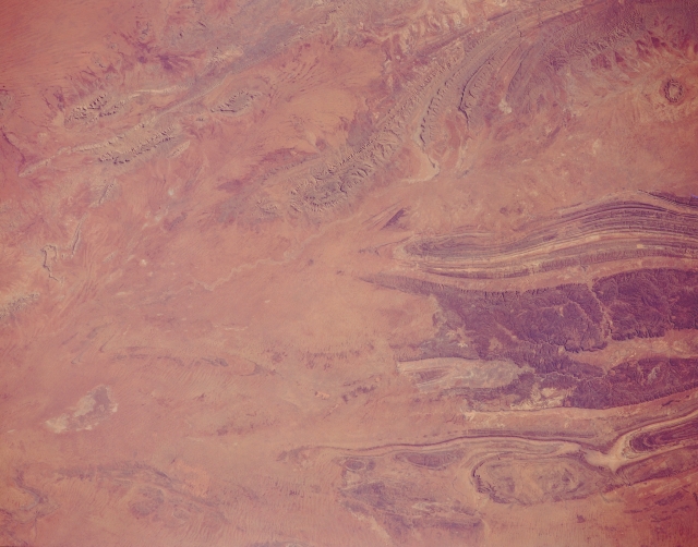
Image Caption: STS066-152-172 Macdonnell Ranges, Northern Territory, Australia November 1994
The Macdonnell Ranges are the gently arching mountains in the upper right of this view. The oval structure immediately south of those ranges is Gosses Bluff, an impact crater. The crater measures 14 miles (22 kilometers) in diameter and is approximately 142 million years old. South of this impact crater are three parallel mountain ranges (from north to south): Gardiner Range, Middle Range (broad dark band, right center), and the George Gill Range. A few isolated low mountains are also visible west-northwest of the Macdonnell Ranges (upper left). Practically all of these mountains are made up of folded sedimentary rocks. Slightly elevated sand plains covered by sparse vegetation and intermontane valleys make up the rest of the landscape in southcentral Northern Territory.
The Macdonnell Ranges are the gently arching mountains in the upper right of this view. The oval structure immediately south of those ranges is Gosses Bluff, an impact crater. The crater measures 14 miles (22 kilometers) in diameter and is approximately 142 million years old. South of this impact crater are three parallel mountain ranges (from north to south): Gardiner Range, Middle Range (broad dark band, right center), and the George Gill Range. A few isolated low mountains are also visible west-northwest of the Macdonnell Ranges (upper left). Practically all of these mountains are made up of folded sedimentary rocks. Slightly elevated sand plains covered by sparse vegetation and intermontane valleys make up the rest of the landscape in southcentral Northern Territory.
