STS066-150-90
| NASA Photo ID | STS066-150-90 |
| Focal Length | 250mm |
| Date taken | 1994.11.05 |
| Time taken | 02:16:47 GMT |
Resolutions offered for this image:
640 x 480 pixels
640 x 480 pixels
Cloud masks available for this image:
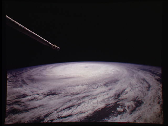
Spacecraft nadir point: 28.6° N, 133.8° E
Photo center point:
Photo center point by machine learning:
Photo center point:
Photo center point by machine learning:
Nadir to Photo Center:
Spacecraft Altitude: 163 nautical miles (302km)
Country or Geographic Name: | PACIFIC OCEAN |
Features: | TYPHOON |
| Features Found Using Machine Learning: | |
Cloud Cover Percentage: | 90 (76-100)% |
Sun Elevation Angle: | 45° |
Sun Azimuth: | 169° |
Camera: | Linhof |
Focal Length: | 250mm |
Camera Tilt: | High Oblique |
Format: | 5046: Kodak, natural color positive, Lumiere 100/5046, ASA 100, standard base |
Film Exposure: | Normal |
| Additional Information | |
| Width | Height | Annotated | Cropped | Purpose | Links |
|---|---|---|---|---|---|
| 640 pixels | 480 pixels | No | No | ISD 1 | Download Image |
Download Packaged File
Download a Google Earth KML for this Image
View photo footprint information
Download a GeoTIFF for this photo
Image Caption: This is a picture of Hurricane Florence at its peak, over the open waters of the North Atlantic. This hurricane never made landfall over the United States, however after the storm became extra-tropical, it's moisture combined with a storm system over parts of Europe and caused large amounts of flooding across Spain and France.
