STS066-126-95
| NASA Photo ID | STS066-126-95 |
| Focal Length | 250mm |
| Date taken | 1994.11.__ |
| Time taken | GMT |
Resolutions offered for this image:
3904 x 3875 pixels 639 x 635 pixels 5700 x 5900 pixels 500 x 518 pixels 640 x 480 pixels
3904 x 3875 pixels 639 x 635 pixels 5700 x 5900 pixels 500 x 518 pixels 640 x 480 pixels
Cloud masks available for this image:
Spacecraft nadir point:
Photo center point: 30.5° N, 88.0° W
Photo center point by machine learning:
Photo center point: 30.5° N, 88.0° W
Photo center point by machine learning:
Nadir to Photo Center:
Spacecraft Altitude: nautical miles (0km)
Country or Geographic Name: | USA-ALABAMA |
Features: | MOBILE, MOBILE BAY, SED. |
| Features Found Using Machine Learning: | |
Cloud Cover Percentage: | 0 (no clouds present) |
Sun Elevation Angle: | ° |
Sun Azimuth: | ° |
Camera: | Hasselblad |
Focal Length: | 250mm |
Camera Tilt: | Low Oblique |
Format: | 5046: Kodak, natural color positive, Lumiere 100/5046, ASA 100, standard base |
Film Exposure: | Normal |
| Additional Information | |
| Width | Height | Annotated | Cropped | Purpose | Links |
|---|---|---|---|---|---|
| 3904 pixels | 3875 pixels | No | No | Earth From Space collection | Download Image |
| 639 pixels | 635 pixels | No | No | Earth From Space collection | Download Image |
| 5700 pixels | 5900 pixels | No | No | Download Image | |
| 500 pixels | 518 pixels | No | No | Download Image | |
| 640 pixels | 480 pixels | No | No | Download Image |
Download Packaged File
Download a Google Earth KML for this Image
View photo footprint information
Download a GeoTIFF for this photo
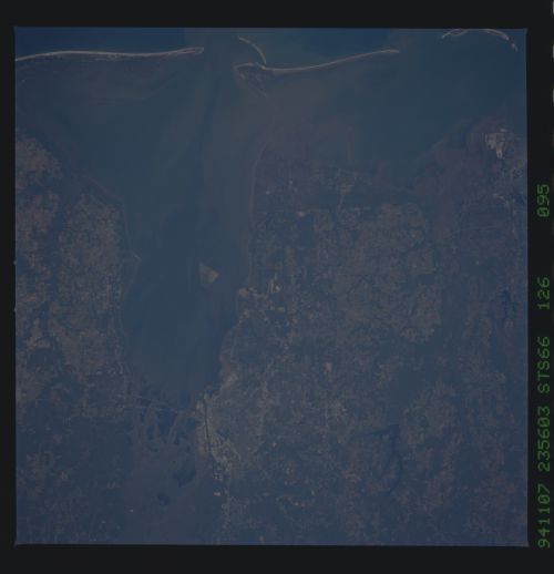
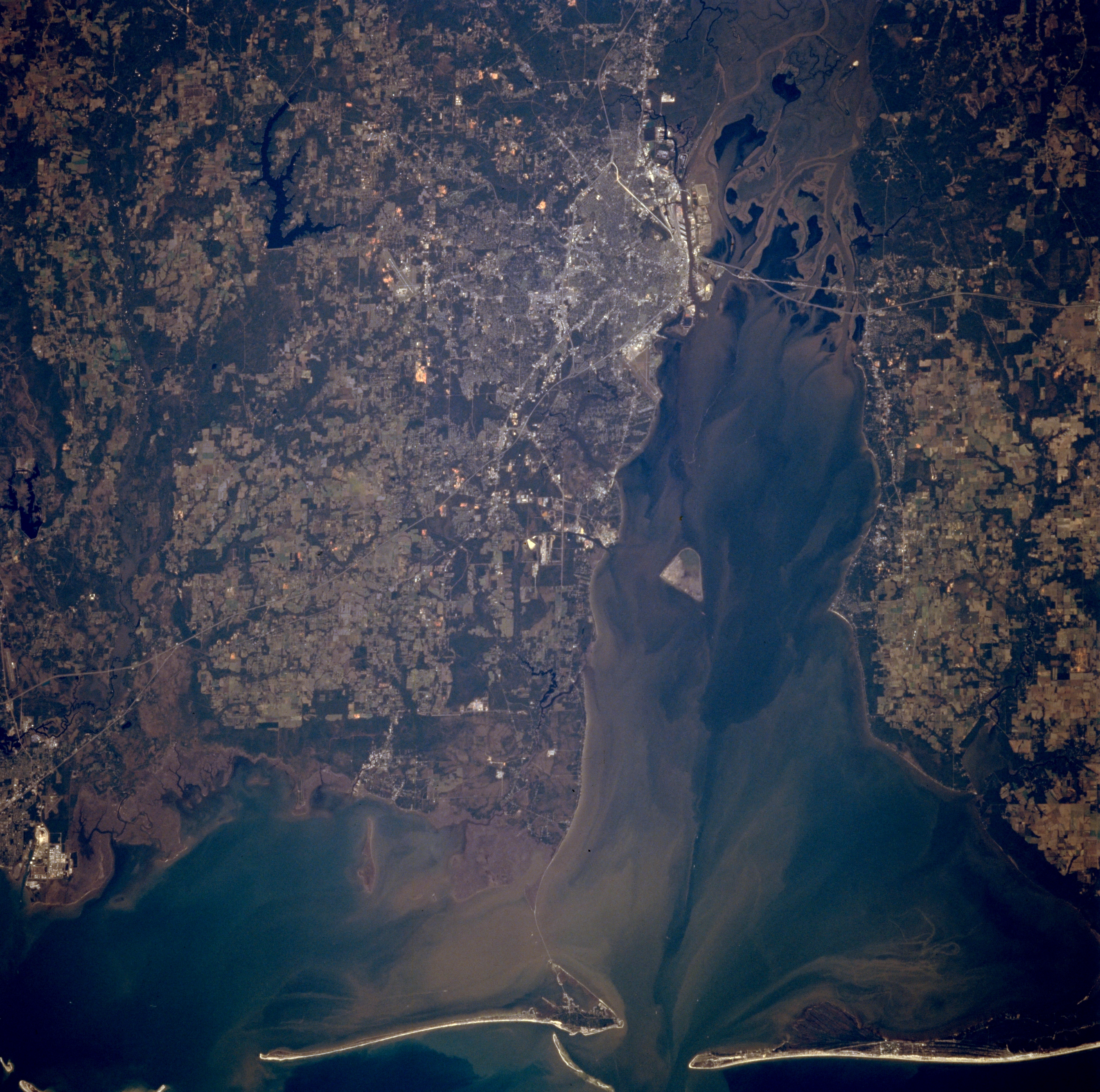
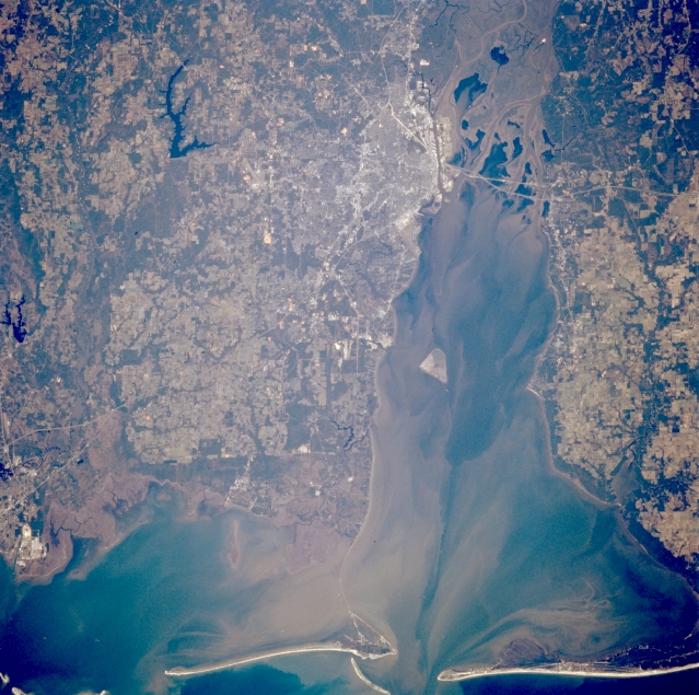
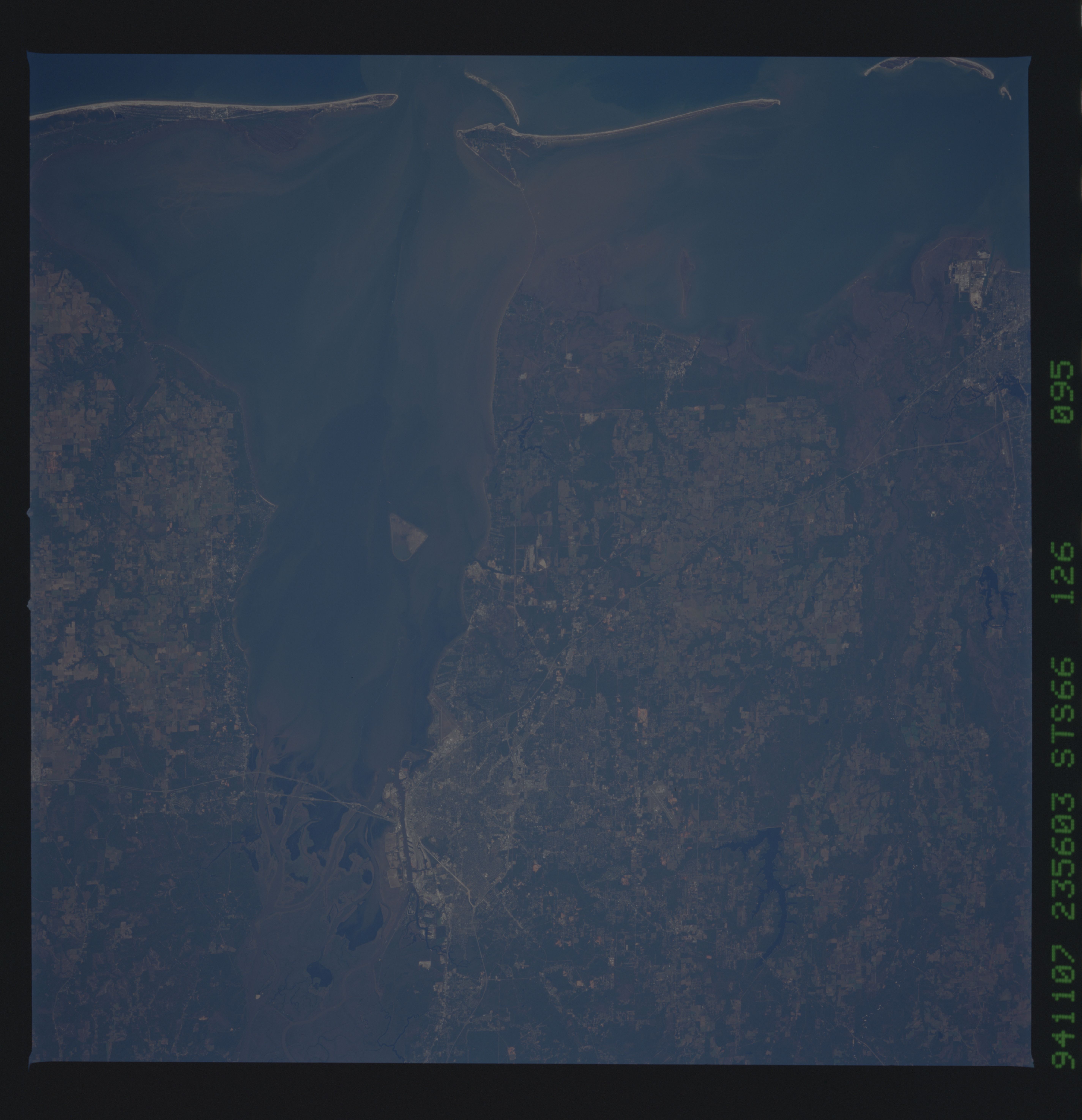
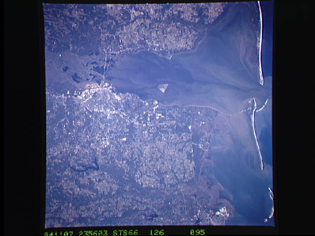
Image Caption: STS066-126-095 Mobile Bay, Alabama, U.S.A. November 1994
Featured in this photograph are the Gulf of Mexico; the port of Mobile at the northwest corner of sediment-laden Mobile Bay; and highly reflective, elongated, sandy beaches of the barrier islands that help to create the east-west-oriented Intracoastal Waterway. The Mobile River, the southern extension of the Tombigbee Waterway System that connects Mobile with Knoxville, Tennessee, has created a sizable delta at the northern end of Mobile Bay. Visible are dark Big Creek Lake west of Mobile; segments of Interstate Highway 10 across the southern end of the delta at the north end of Mobile Bay; and highly reflective, industrialized Moss Point, Mississippi (lower left edge). Apparent are dark vegetated and wooded bottomlands and lighter cultivated fields and pasturelands.
Featured in this photograph are the Gulf of Mexico; the port of Mobile at the northwest corner of sediment-laden Mobile Bay; and highly reflective, elongated, sandy beaches of the barrier islands that help to create the east-west-oriented Intracoastal Waterway. The Mobile River, the southern extension of the Tombigbee Waterway System that connects Mobile with Knoxville, Tennessee, has created a sizable delta at the northern end of Mobile Bay. Visible are dark Big Creek Lake west of Mobile; segments of Interstate Highway 10 across the southern end of the delta at the north end of Mobile Bay; and highly reflective, industrialized Moss Point, Mississippi (lower left edge). Apparent are dark vegetated and wooded bottomlands and lighter cultivated fields and pasturelands.
