STS066-124-67
| NASA Photo ID | STS066-124-67 |
| Focal Length | 100mm |
| Date taken | 1994.11.__ |
| Time taken | GMT |
Resolutions offered for this image:
3857 x 3904 pixels 632 x 639 pixels 5700 x 5900 pixels 500 x 518 pixels 640 x 480 pixels
3857 x 3904 pixels 632 x 639 pixels 5700 x 5900 pixels 500 x 518 pixels 640 x 480 pixels


Cloud masks available for this image:
Spacecraft nadir point:
Photo center point: 42.5° N, 83.5° W
Photo center point by machine learning:
Photo center point: 42.5° N, 83.5° W
Photo center point by machine learning:
Nadir to Photo Center:
Spacecraft Altitude: nautical miles (0km)
Country or Geographic Name: | USA-MICHIGAN |
Features: | DETROIT, L. ST. CLAIR |
| Features Found Using Machine Learning: | |
Cloud Cover Percentage: | 5 (1-10)% |
Sun Elevation Angle: | ° |
Sun Azimuth: | ° |
Camera: | Hasselblad |
Focal Length: | 100mm |
Camera Tilt: | Low Oblique |
Format: | 5046: Kodak, natural color positive, Lumiere 100/5046, ASA 100, standard base |
Film Exposure: | Normal |
| Additional Information | |
| Width | Height | Annotated | Cropped | Purpose | Links |
|---|---|---|---|---|---|
| 3857 pixels | 3904 pixels | No | No | Earth From Space collection | Download Image |
| 632 pixels | 639 pixels | No | No | Earth From Space collection | Download Image |
| 5700 pixels | 5900 pixels | No | No | Download Image | |
| 500 pixels | 518 pixels | No | No | Download Image | |
| 640 pixels | 480 pixels | No | No | Download Image |
Download Packaged File
Download a Google Earth KML for this Image
View photo footprint information
Download a GeoTIFF for this photo
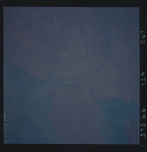
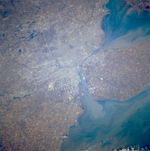
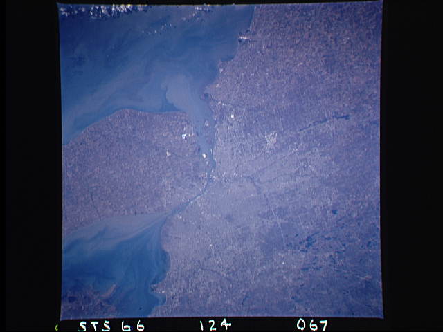
Image Caption: STS066-124-067 Detroit, Michigan, U.S.A. November 1994
Detroit, the "automobile capital of the world," lies west of Lake Saint Clair and the Detroit River in this north-looking, low-oblique photograph. The largest city in Michigan, Detroit is a port of entry; a major Great Lakes shipping and rail center; and a major industrial, commercial, financial, and cultural center for the region. Detroit leads the nation in the production of gray iron foundry products, metal stampings, and machine tools. Extensive salt mines underlie the southwestern section of the city. Visible are the runways of Detroit Metropolitan Wayne County Airport (left of center) west of the Detroit River; numerous small lakes northwest of the city; Lake Saint Clair (upper right); and Lake Erie (bottom right). Windsor, Ontario, Canada, is discernible (near center) east of the Detroit River.
Detroit, the "automobile capital of the world," lies west of Lake Saint Clair and the Detroit River in this north-looking, low-oblique photograph. The largest city in Michigan, Detroit is a port of entry; a major Great Lakes shipping and rail center; and a major industrial, commercial, financial, and cultural center for the region. Detroit leads the nation in the production of gray iron foundry products, metal stampings, and machine tools. Extensive salt mines underlie the southwestern section of the city. Visible are the runways of Detroit Metropolitan Wayne County Airport (left of center) west of the Detroit River; numerous small lakes northwest of the city; Lake Saint Clair (upper right); and Lake Erie (bottom right). Windsor, Ontario, Canada, is discernible (near center) east of the Detroit River.
