STS066-119-90
| NASA Photo ID | STS066-119-90 |
| Focal Length | 100mm |
| Date taken | 1994.11.05 |
| Time taken | 23:08:05 GMT |
Resolutions offered for this image:
3872 x 3904 pixels 634 x 639 pixels 5700 x 5900 pixels 500 x 518 pixels 640 x 480 pixels
3872 x 3904 pixels 634 x 639 pixels 5700 x 5900 pixels 500 x 518 pixels 640 x 480 pixels
Cloud masks available for this image:
Spacecraft nadir point: 23.7° S, 139.0° E
Photo center point: 24.5° S, 139.5° E
Photo center point by machine learning:
Photo center point: 24.5° S, 139.5° E
Photo center point by machine learning:
Nadir to Photo Center: Southeast
Spacecraft Altitude: 161 nautical miles (298km)
Country or Geographic Name: | AUSTRALIA-Q |
Features: | SIMPSON DES., EYRE CREEK |
| Features Found Using Machine Learning: | |
Cloud Cover Percentage: | 0 (no clouds present) |
Sun Elevation Angle: | 43° |
Sun Azimuth: | 90° |
Camera: | Hasselblad |
Focal Length: | 100mm |
Camera Tilt: | 19 degrees |
Format: | 5046: Kodak, natural color positive, Lumiere 100/5046, ASA 100, standard base |
Film Exposure: | Normal |
| Additional Information | |
| Width | Height | Annotated | Cropped | Purpose | Links |
|---|---|---|---|---|---|
| 3872 pixels | 3904 pixels | No | No | Earth From Space collection | Download Image |
| 634 pixels | 639 pixels | No | No | Earth From Space collection | Download Image |
| 5700 pixels | 5900 pixels | No | No | Download Image | |
| 500 pixels | 518 pixels | No | No | Download Image | |
| 640 pixels | 480 pixels | No | No | Download Image |
Download Packaged File
Download a Google Earth KML for this Image
View photo footprint information
Download a GeoTIFF for this photo
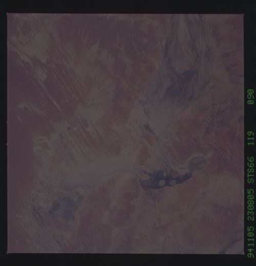
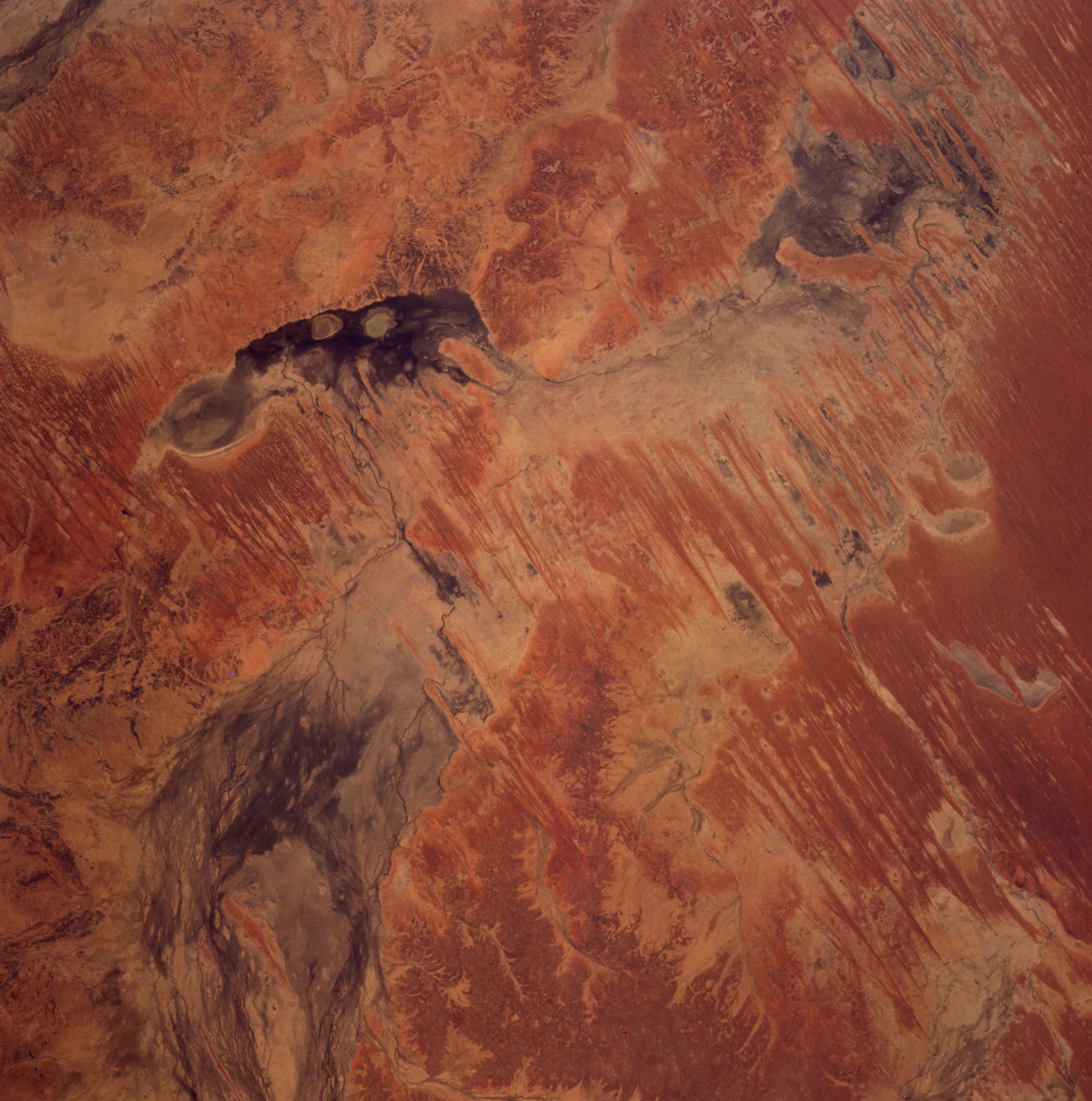
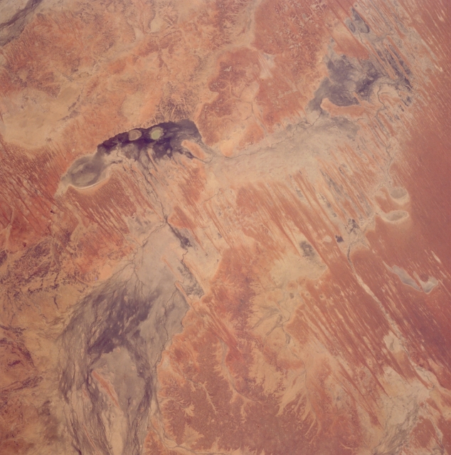
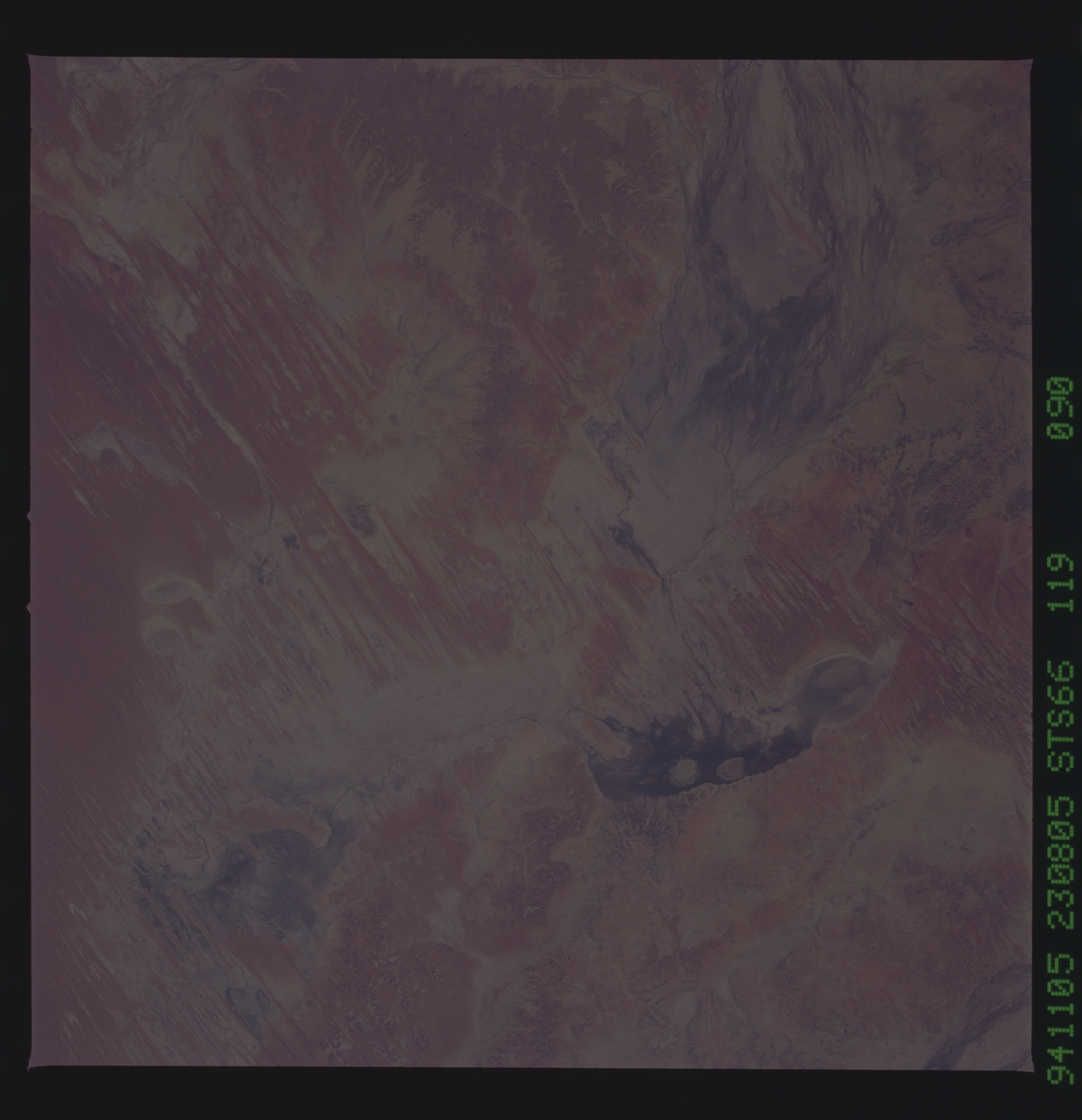
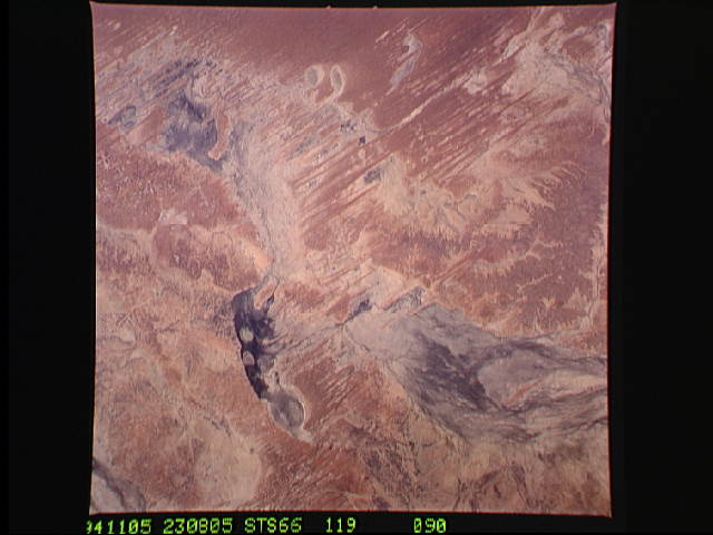
Image Caption: STS066-119-090 Eyre Creek, Queensland, Australia November 1994
A complex interior drainage pattern of Eyre Creek marks the arid transition zone between the Great Artesian Basin and the northeastern fringe of the Simpson Desert in southwest Queensland. The water flow in Eyre Creek is actually from north (bottom left) to south where it enters a depression. After passing through the ephemeral "lagoon" (darker feature) the creek makes a ninety-degree turn to the west, eventually ending up in another shallow depression (darker feature--upper right). The darker areas within the multi-braided ephemeral stream channels show where the lower lying areas are located within the slope of the landscape. These ephemeral "lagoons" are darker because of plant growth or fungus and in some cases moisture is present in the depressions. The alternating light and dark, paralleling lines are a series of sand dunes, generally oriented north-south.
A complex interior drainage pattern of Eyre Creek marks the arid transition zone between the Great Artesian Basin and the northeastern fringe of the Simpson Desert in southwest Queensland. The water flow in Eyre Creek is actually from north (bottom left) to south where it enters a depression. After passing through the ephemeral "lagoon" (darker feature) the creek makes a ninety-degree turn to the west, eventually ending up in another shallow depression (darker feature--upper right). The darker areas within the multi-braided ephemeral stream channels show where the lower lying areas are located within the slope of the landscape. These ephemeral "lagoons" are darker because of plant growth or fungus and in some cases moisture is present in the depressions. The alternating light and dark, paralleling lines are a series of sand dunes, generally oriented north-south.
