STS066-118-98

| NASA Photo ID | STS066-118-98 |
| Focal Length | 100mm |
| Date taken | 1994.11.08 |
| Time taken | 07:10:36 GMT |
Resolutions offered for this image:
3976 x 3977 pixels 639 x 639 pixels 5700 x 5900 pixels 500 x 518 pixels 640 x 480 pixels 527 x 519 pixels
3976 x 3977 pixels 639 x 639 pixels 5700 x 5900 pixels 500 x 518 pixels 640 x 480 pixels 527 x 519 pixels


Cloud masks available for this image:
Spacecraft nadir point: 26.1° N, 40.1° E
Photo center point: 24.5° N, 39.5° E
Photo center point by machine learning:
Photo center point: 24.5° N, 39.5° E
Photo center point by machine learning:
Nadir to Photo Center: South
Spacecraft Altitude: 160 nautical miles (296km)
Country or Geographic Name: | SAUDI ARABIA |
Features: | LAVA FLOWS, MEDINA |
| Features Found Using Machine Learning: | |
Cloud Cover Percentage: | 0 (no clouds present) |
Sun Elevation Angle: | 39° |
Sun Azimuth: | 144° |
Camera: | Hasselblad |
Focal Length: | 100mm |
Camera Tilt: | 33 degrees |
Format: | 5046: Kodak, natural color positive, Lumiere 100/5046, ASA 100, standard base |
Film Exposure: | Normal |
| Additional Information | |
| Width | Height | Annotated | Cropped | Purpose | Links |
|---|---|---|---|---|---|
| 3976 pixels | 3977 pixels | No | No | Earth From Space collection | Download Image |
| 639 pixels | 639 pixels | No | No | Earth From Space collection | Download Image |
| 5700 pixels | 5900 pixels | No | No | Download Image | |
| 500 pixels | 518 pixels | No | No | Download Image | |
| 640 pixels | 480 pixels | No | No | Download Image | |
| 527 pixels | 519 pixels | Download Image |
Download Packaged File
Download a Google Earth KML for this Image
View photo footprint information
Download a GeoTIFF for this photo
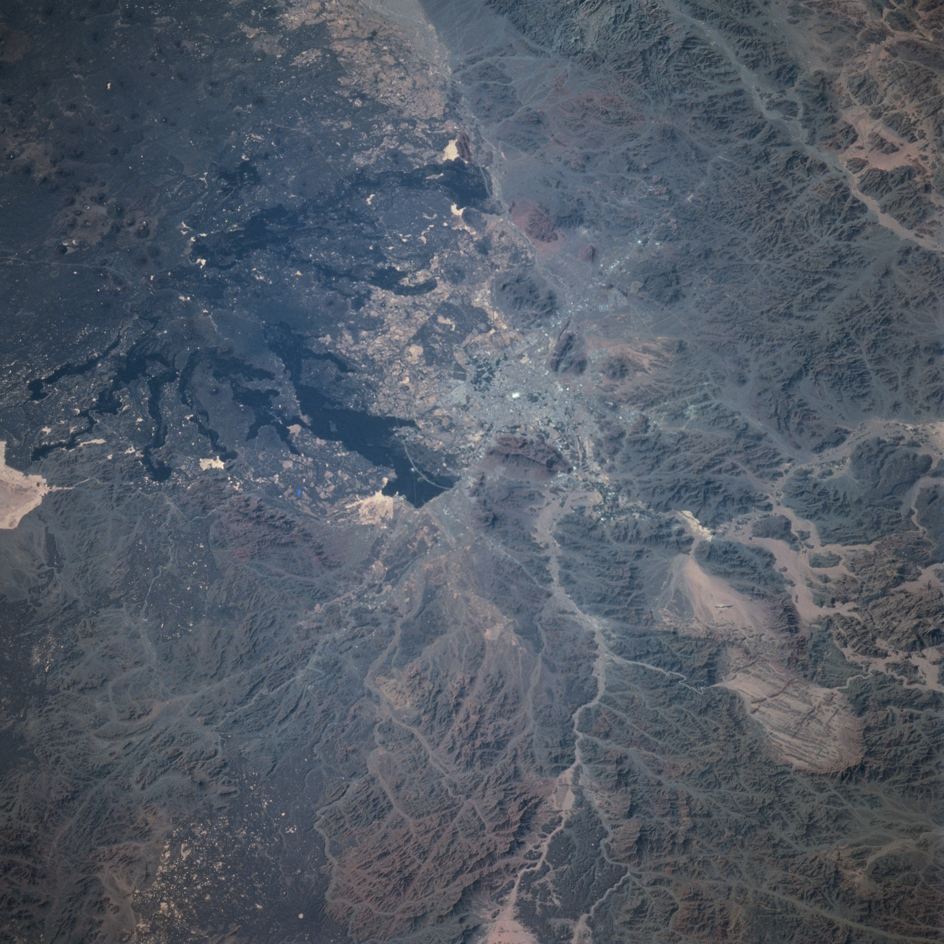
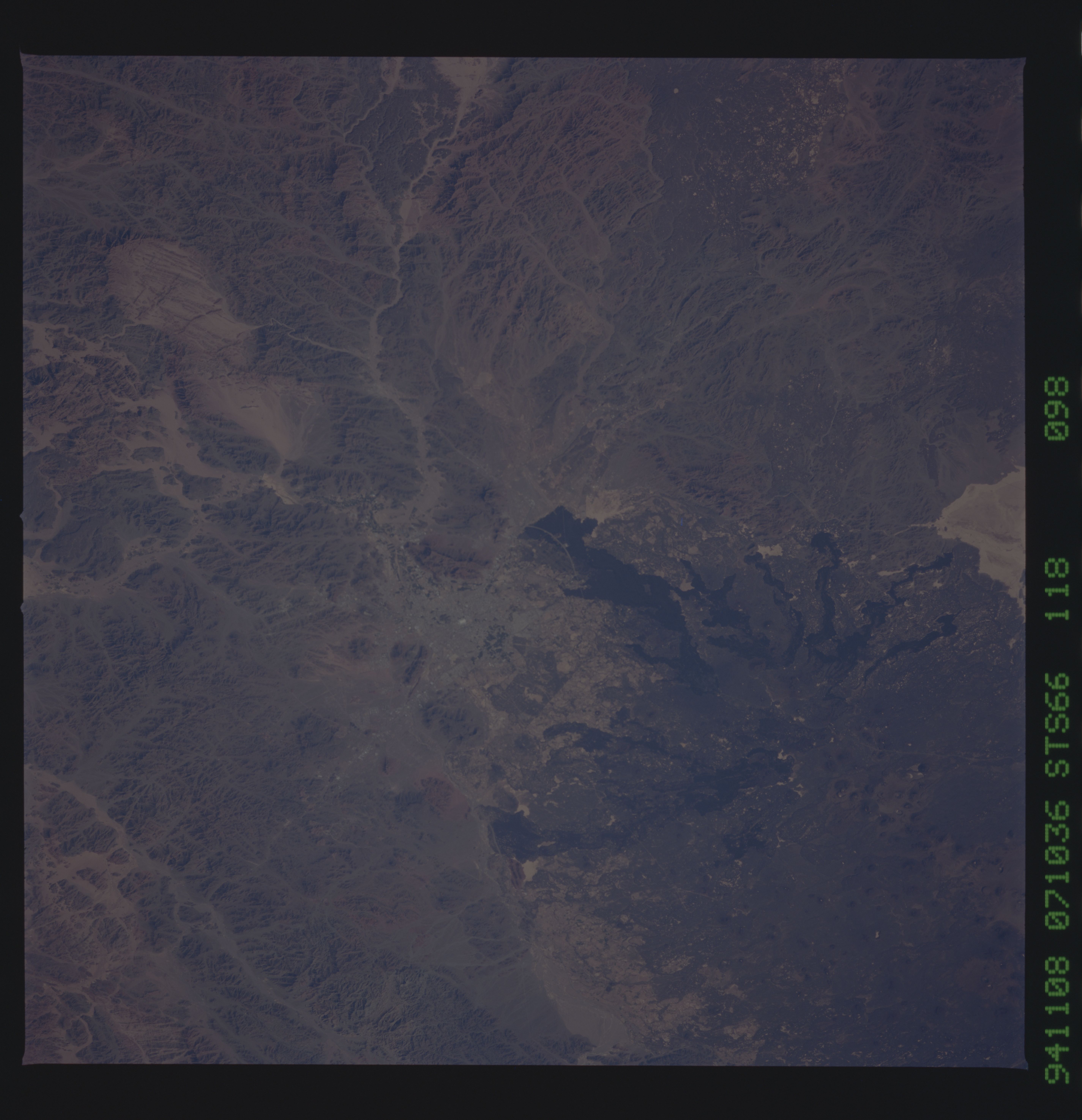
Image Caption: STS066-118-098 Medina, Saudi Arabia November 1994
Considered to be the second most important holy city of Islam, the city of Medina (center of image) is discernible in the south-looking view. Medina is located in a well-watered oasis 110 miles (180 km) inland (east) of the Red Sea. Much fruit and some grain are raised in and around the city. The Rahat Lava Field (elongated, black features) can be seen to the south and east (upper left portion of the image) of the city. The chief building is the large mosque (white dot near the center of the image), which contains the tombs of Mohammed, his daughter Fatima, and the Caliph Omar. When making the pilgrimage to the holy city of Mecca, usually a visit to Medina is part of the trip. The city is surrounded by the low rugged hills of the eastern Hijaz Massif, which parallels the Red Sea coast.
Considered to be the second most important holy city of Islam, the city of Medina (center of image) is discernible in the south-looking view. Medina is located in a well-watered oasis 110 miles (180 km) inland (east) of the Red Sea. Much fruit and some grain are raised in and around the city. The Rahat Lava Field (elongated, black features) can be seen to the south and east (upper left portion of the image) of the city. The chief building is the large mosque (white dot near the center of the image), which contains the tombs of Mohammed, his daughter Fatima, and the Caliph Omar. When making the pilgrimage to the holy city of Mecca, usually a visit to Medina is part of the trip. The city is surrounded by the low rugged hills of the eastern Hijaz Massif, which parallels the Red Sea coast.
