STS066-103-27

| NASA Photo ID | STS066-103-27 |
| Focal Length | 250mm |
| Date taken | 1994.11.06 |
| Time taken | 15:59:17 GMT |
Cloud masks available for this image:
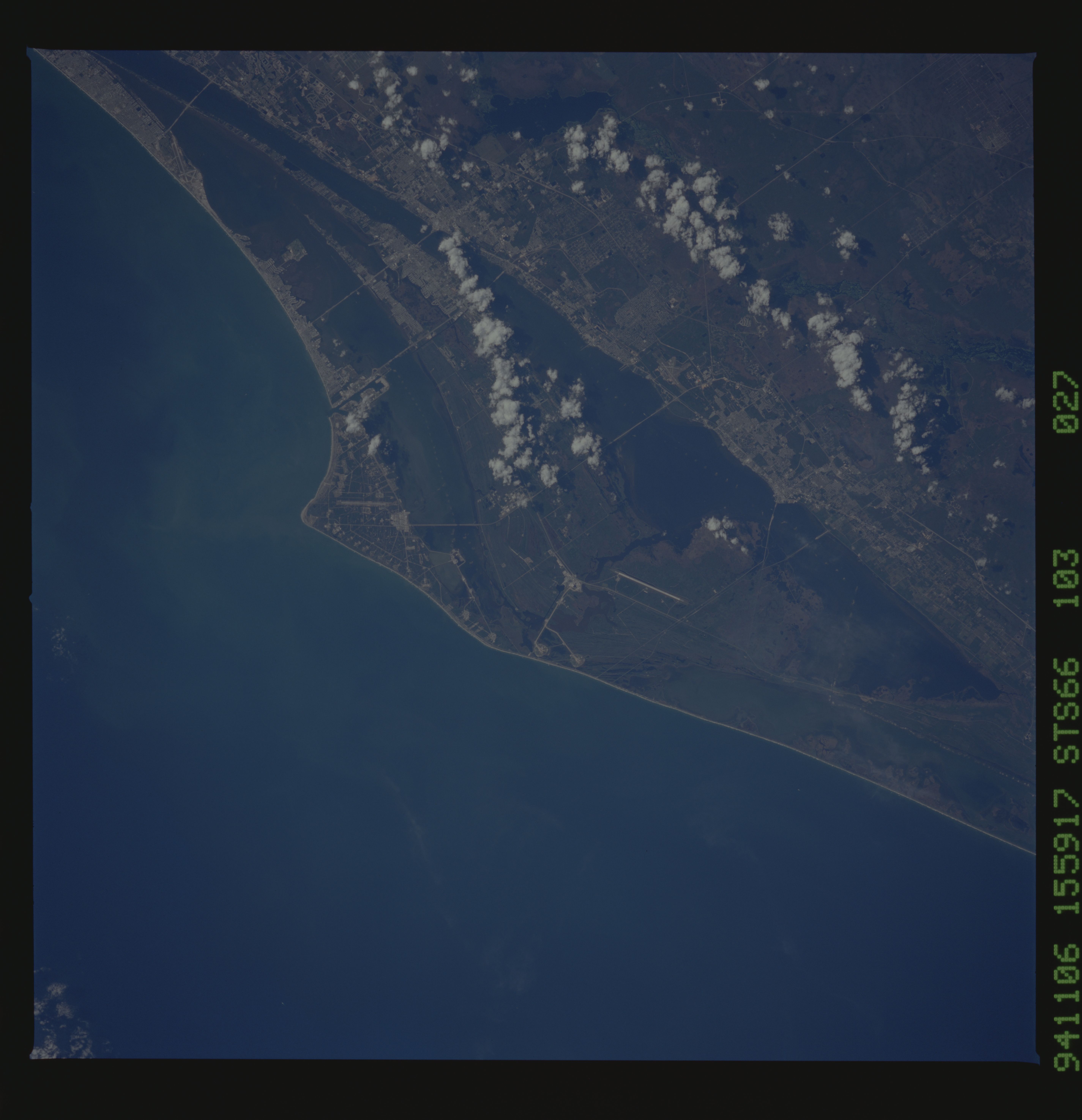
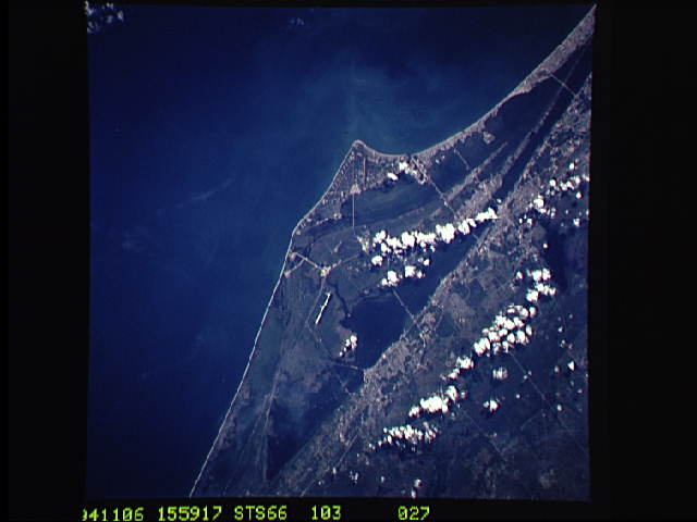
Spacecraft nadir point: 28.1° N, 81.1° W
Photo center point: 28.5° N, 80.5° W
Photo center point by machine learning:
Photo center point: 28.5° N, 80.5° W
Photo center point by machine learning:
Nadir to Photo Center: Northeast
Spacecraft Altitude: 162 nautical miles (300km)
Country or Geographic Name: | USA-FLORIDA |
Features: | CAPE CANAVERAL, COAST |
| Features Found Using Machine Learning: | |
Cloud Cover Percentage: | 5 (1-10)% |
Sun Elevation Angle: | 43° |
Sun Azimuth: | 157° |
Camera: | Hasselblad |
Focal Length: | 250mm |
Camera Tilt: | 15 degrees |
Format: | 5046: Kodak, natural color positive, Lumiere 100/5046, ASA 100, standard base |
Film Exposure: | Normal |
| Additional Information | |
| Width | Height | Annotated | Cropped | Purpose | Links |
|---|---|---|---|---|---|
| 5700 pixels | 5900 pixels | No | No | Download Image | |
| 500 pixels | 518 pixels | No | No | Download Image | |
| 640 pixels | 480 pixels | No | No | Download Image |
Download Packaged File
Download a Google Earth KML for this Image
View photo footprint information
Download a GeoTIFF for this photo
Image Caption: This nadir photograph of the Cape Canaveral area on Florida's eastern coast was taken by the STS-66 crew in November, 1994. The Space Shuttle Vehicle Assembly area and the runways used by the returning Shuttles can be seen near the center of this photograph as part of the John F. Kennedy Space Center (KSC). Launch Pads A and B as well as many other launch pads and a runway can be seen on Cape Canaveral. Cape Canaveral is located to the east of KSC. South of the launch area is Port Canaveral and Cocoa Beach on the Atlantic coast with the towns of Cocoa, Merrit Island and Titusville situated along the Intercoastal Waterway.
