STS065-112-43
| NASA Photo ID | STS065-112-43 |
| Focal Length | 250mm |
| Date taken | 1994.07.19 |
| Time taken | 03:10:25 GMT |
Resolutions offered for this image:
5294 x 5294 pixels 640 x 640 pixels 5700 x 5900 pixels 500 x 518 pixels 640 x 480 pixels
5294 x 5294 pixels 640 x 640 pixels 5700 x 5900 pixels 500 x 518 pixels 640 x 480 pixels

Cloud masks available for this image:
Spacecraft nadir point: 7.6° S, 139.5° E
Photo center point: 8.0° S, 139.5° E
Photo center point by machine learning:
Photo center point: 8.0° S, 139.5° E
Photo center point by machine learning:
Nadir to Photo Center: South
Spacecraft Altitude: 162 nautical miles (300km)
Country or Geographic Name: | INDONESIA-WNG |
Features: | COAST, BIAN RIVER, ROAD |
| Features Found Using Machine Learning: | |
Cloud Cover Percentage: | 10 (1-10)% |
Sun Elevation Angle: | 61° |
Sun Azimuth: | 349° |
Camera: | Hasselblad |
Focal Length: | 250mm |
Camera Tilt: | 8 degrees |
Format: | 2443: Kodak Aerochrome 2443, color IR, thin base, EA-5 process thru June 1999, E-6 process afterward |
Film Exposure: | Normal |
| Additional Information | |
| Width | Height | Annotated | Cropped | Purpose | Links |
|---|---|---|---|---|---|
| 5294 pixels | 5294 pixels | No | No | Earth From Space collection | Download Image |
| 640 pixels | 640 pixels | No | No | Earth From Space collection | Download Image |
| 5700 pixels | 5900 pixels | No | No | Download Image | |
| 500 pixels | 518 pixels | No | No | Download Image | |
| 640 pixels | 480 pixels | No | No | Download Image |
Download Packaged File
Download a Google Earth KML for this Image
View photo footprint information
Download a GeoTIFF for this photo
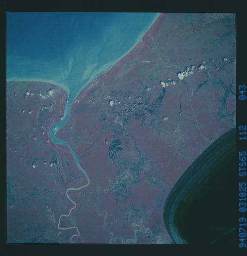
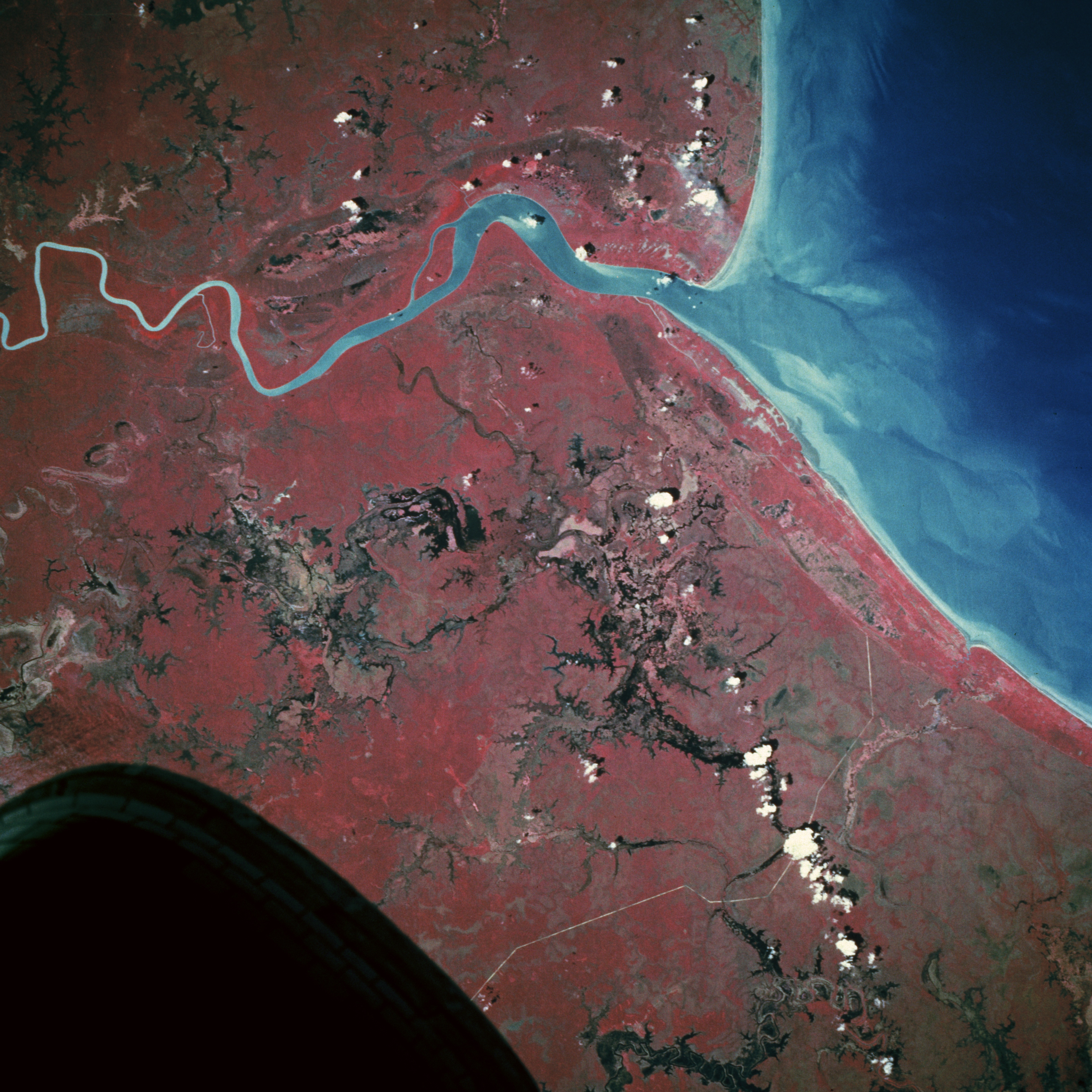
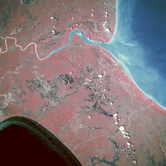
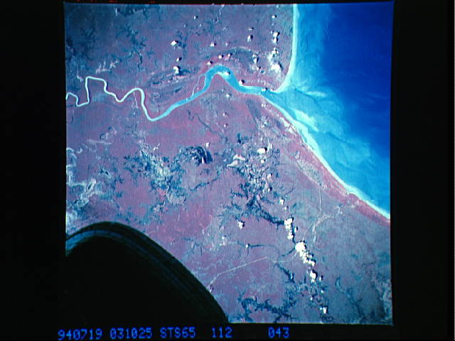
Image Caption: STS065-112-043 Southern Coast, Irian Jaya, Indonesia July 1994
The southeastern coast of Irian Jaya, Indonesia, remains a sparsely inhabited landscape consisting of dense, impenetrable forests; extensive wetlands; and swamps. This near-vertical photograph of the coastline and the mouth of the Bian River indicates a wetland environment only slightly impacted by humans. The reds, representing tropical vegetation, and the blacks, representing swamps and open water features, graphically capture the pristine conditions of this area. The major indication of human impact on this environment is the narrow, highly reflective, generally north-south line near the western edge of the photograph that could be a new road into the interior or a jungle pipeline right-of-way. A few features adjacent to the coastline appear to be roads or clearings where small settlements exist.
The southeastern coast of Irian Jaya, Indonesia, remains a sparsely inhabited landscape consisting of dense, impenetrable forests; extensive wetlands; and swamps. This near-vertical photograph of the coastline and the mouth of the Bian River indicates a wetland environment only slightly impacted by humans. The reds, representing tropical vegetation, and the blacks, representing swamps and open water features, graphically capture the pristine conditions of this area. The major indication of human impact on this environment is the narrow, highly reflective, generally north-south line near the western edge of the photograph that could be a new road into the interior or a jungle pipeline right-of-way. A few features adjacent to the coastline appear to be roads or clearings where small settlements exist.
