STS064-92-45
| NASA Photo ID | STS064-92-45 |
| Focal Length | 250mm |
| Date taken | 1994.09.15 |
| Time taken | 02:13:57 GMT |
Resolutions offered for this image:
5294 x 5294 pixels 640 x 640 pixels 5700 x 5900 pixels 500 x 518 pixels 640 x 480 pixels
5294 x 5294 pixels 640 x 640 pixels 5700 x 5900 pixels 500 x 518 pixels 640 x 480 pixels


Cloud masks available for this image:
Spacecraft nadir point: 26.4° S, 154.3° E
Photo center point: 27.5° S, 153.0° E
Photo center point by machine learning:
Photo center point: 27.5° S, 153.0° E
Photo center point by machine learning:
Nadir to Photo Center: Southwest
Spacecraft Altitude: 140 nautical miles (259km)
Camera: | Hasselblad |
Focal Length: | 250mm |
Camera Tilt: | 36 degrees |
Format: | 5046: Kodak, natural color positive, Lumiere 100/5046, ASA 100, standard base |
Film Exposure: | Normal |
| Additional Information | |
| Width | Height | Annotated | Cropped | Purpose | Links |
|---|---|---|---|---|---|
| 5294 pixels | 5294 pixels | No | No | Earth From Space collection | Download Image |
| 640 pixels | 640 pixels | No | No | Earth From Space collection | Download Image |
| 5700 pixels | 5900 pixels | No | No | Download Image | |
| 500 pixels | 518 pixels | No | No | Download Image | |
| 640 pixels | 480 pixels | No | No | Download Image |
Download Packaged File
Download a Google Earth KML for this Image
View photo footprint information
Download a GeoTIFF for this photo
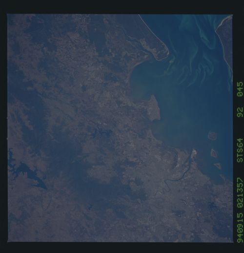
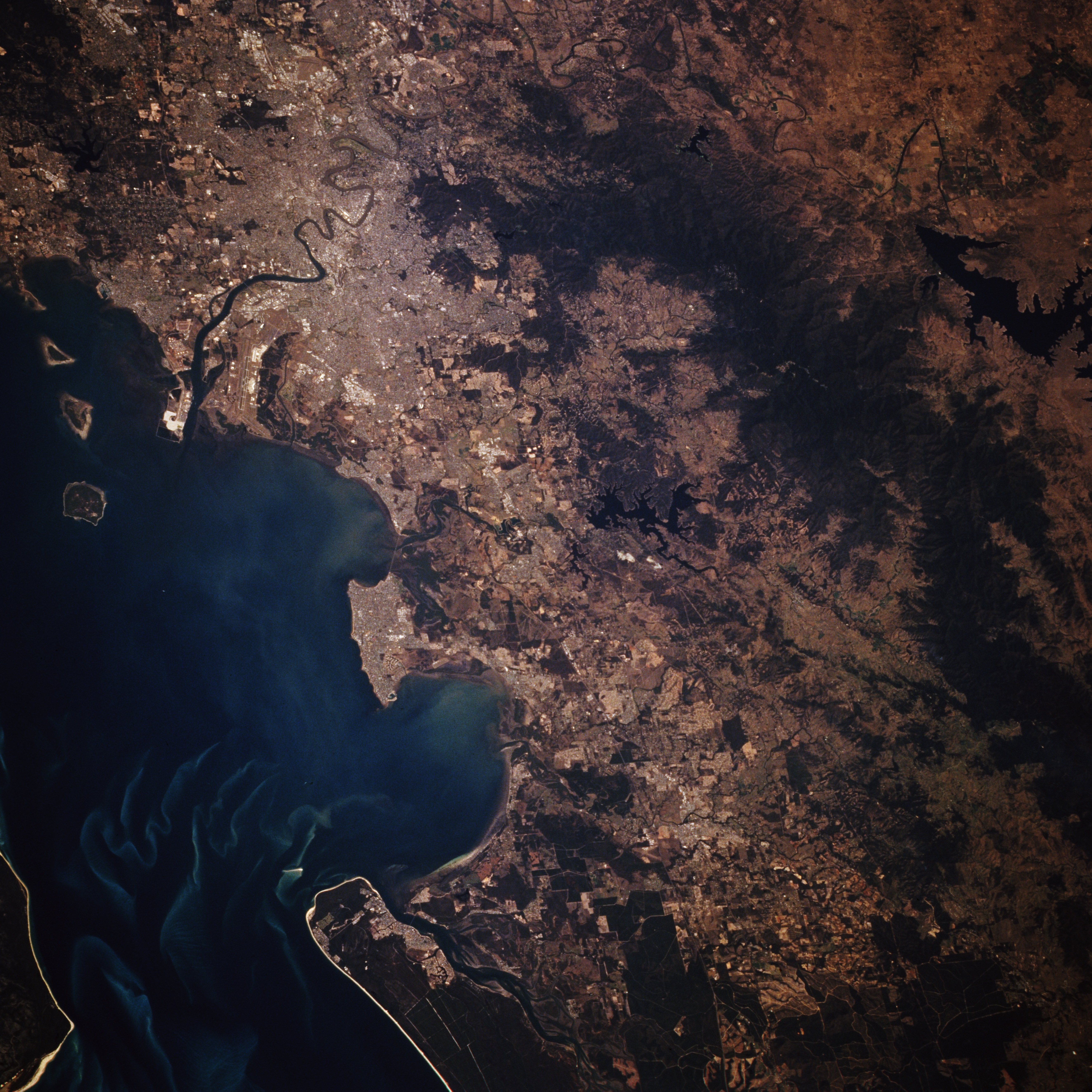
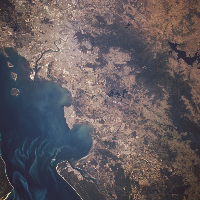
Image Caption: STS064-092-045 Brisbane and Moreton Bay, Queensland, Australia September 1994
Brisbane, founded in 1824 as one of Australia's penal colonies and now Australia's third largest urban center, is seen in the southeast corner of this low-oblique, south-looking photograph. Brisbane, the capital of Queensland, occupies the rolling terrain on either side of the Brisbane River, spreading eastward to Moreton Bay and westward into the foothills of the Great Dividing Range. Brisbane's major commercial industries include shipyards, oil and sugar refineries, food processing plants, textile mills, automobile plants, agriculture products, machinery manufacturing, and railroad workshops. The large runway of the Brisbane International Airport is west of the Brisbane River near the river's entrance into Moreton Bay. The bay, which serves as the entrance to the Port of Brisbane, is 65 miles (105 kilometers) long and 20 miles (32 kilometers) wide.
Brisbane, founded in 1824 as one of Australia's penal colonies and now Australia's third largest urban center, is seen in the southeast corner of this low-oblique, south-looking photograph. Brisbane, the capital of Queensland, occupies the rolling terrain on either side of the Brisbane River, spreading eastward to Moreton Bay and westward into the foothills of the Great Dividing Range. Brisbane's major commercial industries include shipyards, oil and sugar refineries, food processing plants, textile mills, automobile plants, agriculture products, machinery manufacturing, and railroad workshops. The large runway of the Brisbane International Airport is west of the Brisbane River near the river's entrance into Moreton Bay. The bay, which serves as the entrance to the Port of Brisbane, is 65 miles (105 kilometers) long and 20 miles (32 kilometers) wide.
