STS064-76-BB
| NASA Photo ID | STS064-76-BB |
| Focal Length | 250mm |
| Date taken | 1994.09.__ |
| Time taken | GMT |
Resolutions offered for this image:
5203 x 5203 pixels 639 x 639 pixels 5700 x 5900 pixels 500 x 518 pixels 640 x 480 pixels 3441 x 2829 pixels 909 x 1181 pixels 6820 x 6811 pixels 5069 x 5153 pixels 540 x 702 pixels
5203 x 5203 pixels 639 x 639 pixels 5700 x 5900 pixels 500 x 518 pixels 640 x 480 pixels 3441 x 2829 pixels 909 x 1181 pixels 6820 x 6811 pixels 5069 x 5153 pixels 540 x 702 pixels


Cloud masks available for this image:
Spacecraft nadir point:
Photo center point: 17.0° N, 62.0° W
Photo center point by machine learning:
Photo center point: 17.0° N, 62.0° W
Photo center point by machine learning:
Nadir to Photo Center:
Spacecraft Altitude: nautical miles (0km)
Country or Geographic Name: | LESSER ANTILLES |
Features: | ANTIGUA I., SUNGLINT |
| Features Found Using Machine Learning: | |
Cloud Cover Percentage: | 5 (1-10)% |
Sun Elevation Angle: | ° |
Sun Azimuth: | ° |
Camera: | Hasselblad |
Focal Length: | 250mm |
Camera Tilt: | Near Vertical |
Format: | 5046: Kodak, natural color positive, Lumiere 100/5046, ASA 100, standard base |
Film Exposure: | Normal |
| Additional Information | |
| Width | Height | Annotated | Cropped | Purpose | Links |
|---|---|---|---|---|---|
| 5203 pixels | 5203 pixels | No | No | Earth From Space collection | Download Image |
| 639 pixels | 639 pixels | No | No | Earth From Space collection | Download Image |
| 5700 pixels | 5900 pixels | No | No | Download Image | |
| 500 pixels | 518 pixels | No | No | Download Image | |
| 640 pixels | 480 pixels | No | No | Download Image | |
| 3441 pixels | 2829 pixels | ReefBase pilot | Download Image | ||
| 909 pixels | 1181 pixels | Yes | Yes | Publisher Request | Download Image |
| 6820 pixels | 6811 pixels | No | No | Download Image | |
| 5069 pixels | 5153 pixels | No | No | Download Image | |
| 540 pixels | 702 pixels | Yes | Yes | Publisher Request | Download Image |
Download Packaged File
Download a Google Earth KML for this Image
View photo footprint information
Download a GeoTIFF for this photo
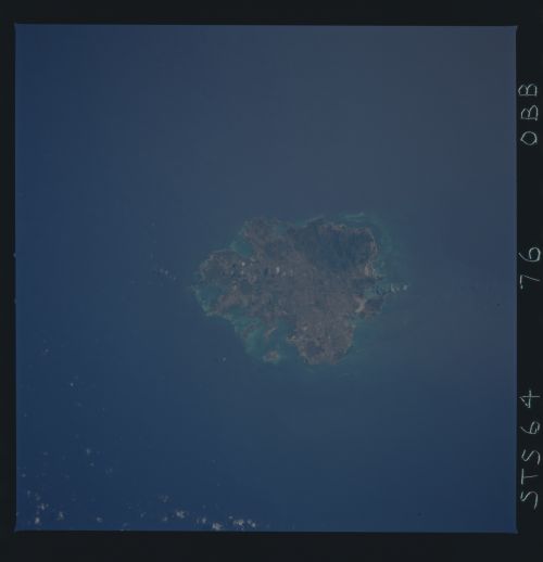
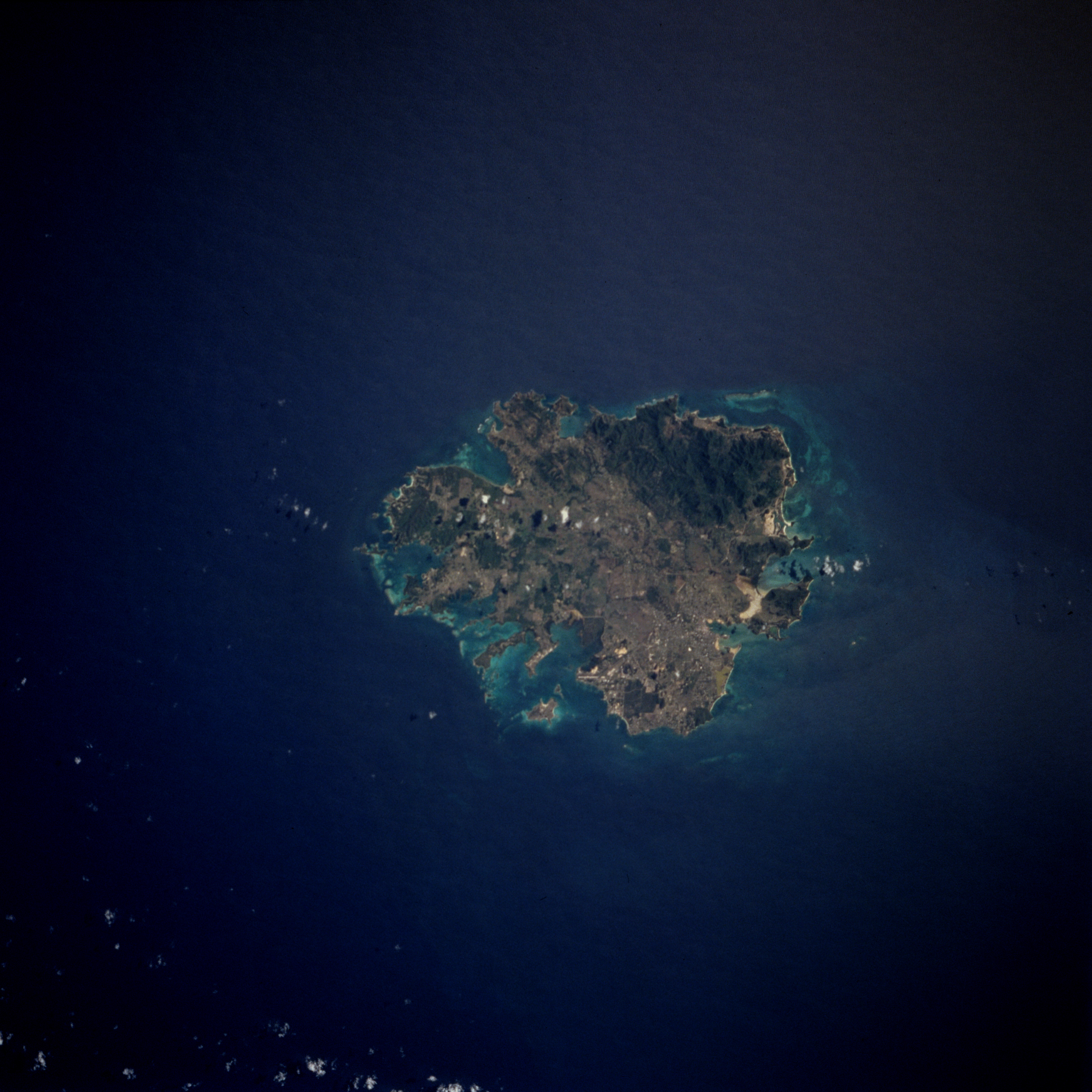
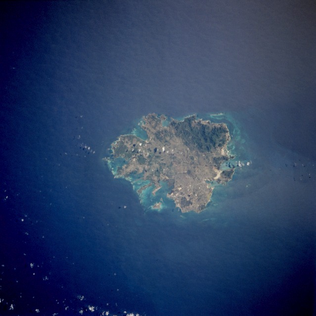
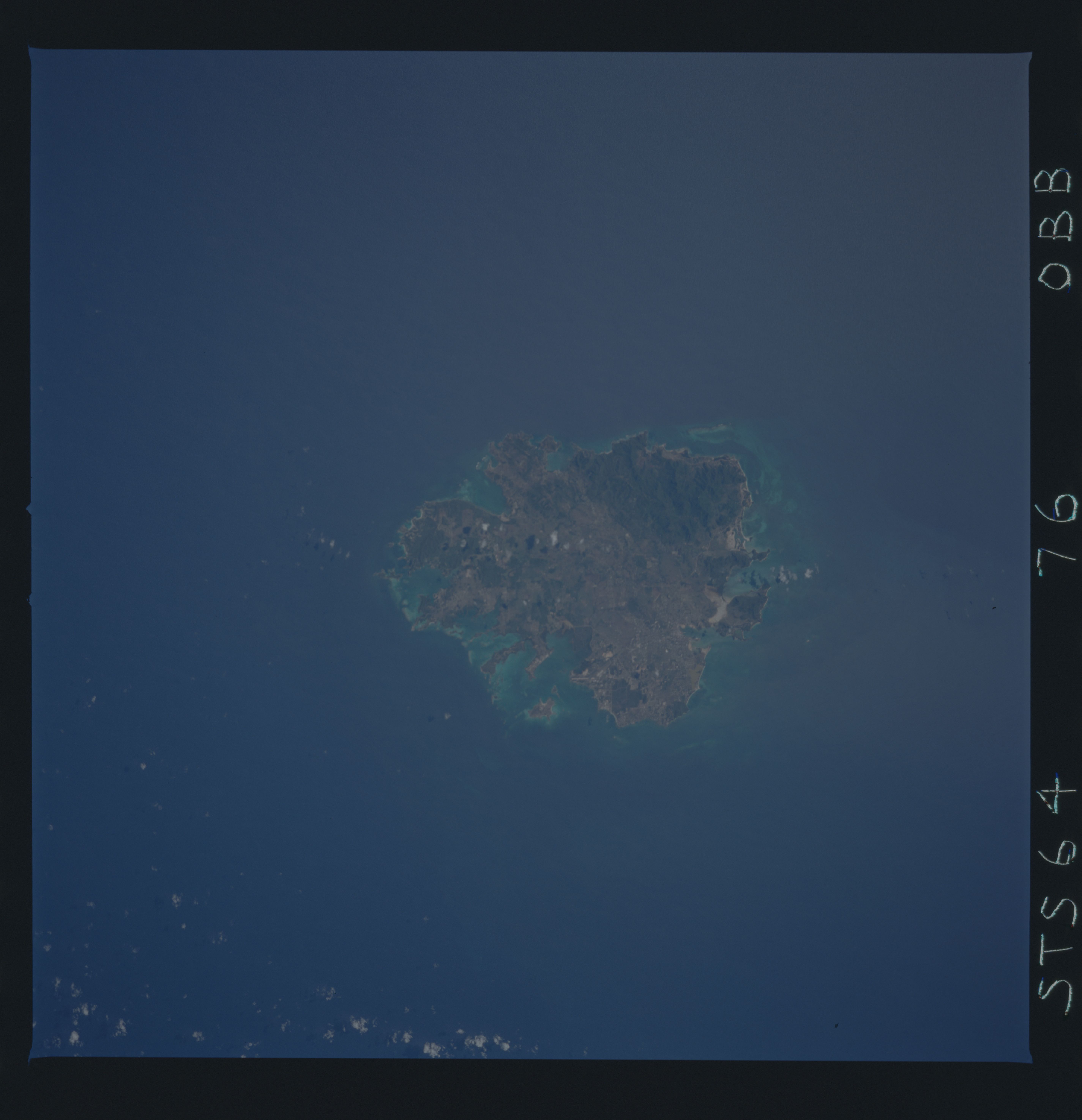
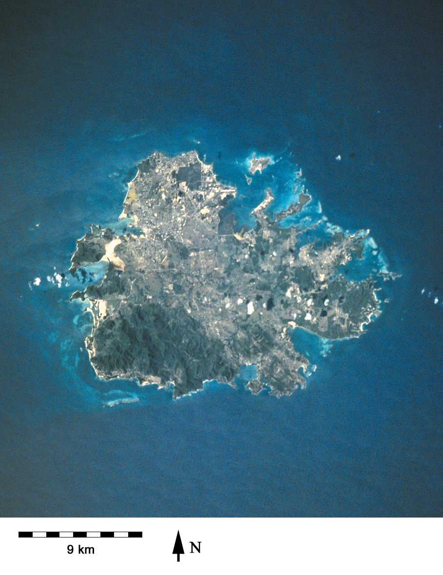
Image Caption: STS064-76-BB Antigua, Leeward Islands September 1994
Antigua, a low-lying, semiarid, limestone island of the Lesser Antilles, is part of a two-island independent state, Antigua and Barbuda. Antigua has severely eroded volcanic remnants along its forested southwestern quadrant, which has a maximum elevation of only 1319 feet (402 meters) above sea level. Although Antigua receives approximately 40 inches (100 centimeters) of precipitation annually, wide fluctuations in rainfall amounts occasionally create serious water shortages, especially for the agricultural industry. Some of the larger hotels transport water by barge from nearby islands when water supplies become critically low. At one time Antigua's economy was based largely on the sugarcane industry, but light manufacturing and tourism are now the leading contributors to the island's economy. St. John's, the country's capital, is located along the northwest coast, adjacent to one of the island's many natural harbors. More than half of the country's population of almost 80 000 live in the St. John's area. The island is approximately 16 miles (25 kilometers) east-west and 12 miles (19 kilometers) north-south.
Antigua, a low-lying, semiarid, limestone island of the Lesser Antilles, is part of a two-island independent state, Antigua and Barbuda. Antigua has severely eroded volcanic remnants along its forested southwestern quadrant, which has a maximum elevation of only 1319 feet (402 meters) above sea level. Although Antigua receives approximately 40 inches (100 centimeters) of precipitation annually, wide fluctuations in rainfall amounts occasionally create serious water shortages, especially for the agricultural industry. Some of the larger hotels transport water by barge from nearby islands when water supplies become critically low. At one time Antigua's economy was based largely on the sugarcane industry, but light manufacturing and tourism are now the leading contributors to the island's economy. St. John's, the country's capital, is located along the northwest coast, adjacent to one of the island's many natural harbors. More than half of the country's population of almost 80 000 live in the St. John's area. The island is approximately 16 miles (25 kilometers) east-west and 12 miles (19 kilometers) north-south.
