STS064-72-72
| NASA Photo ID | STS064-72-72 |
| Focal Length | 100mm |
| Date taken | 1994.09.11 |
| Time taken | 04:01:48 GMT |
Resolutions offered for this image:
3904 x 3840 pixels 639 x 629 pixels 5700 x 5900 pixels 500 x 518 pixels 640 x 480 pixels
3904 x 3840 pixels 639 x 629 pixels 5700 x 5900 pixels 500 x 518 pixels 640 x 480 pixels
Cloud masks available for this image:
Spacecraft nadir point: 35.8° S, 140.7° E
Photo center point: 35.5° S, 141.5° E
Photo center point by machine learning:
Photo center point: 35.5° S, 141.5° E
Photo center point by machine learning:
Nadir to Photo Center: East
Spacecraft Altitude: 140 nautical miles (259km)
Country or Geographic Name: | AUSTRALIA-V |
Features: | AGRICULTURE, BURN SCARS |
| Features Found Using Machine Learning: | |
Cloud Cover Percentage: | 5 (1-10)% |
Sun Elevation Angle: | 45° |
Sun Azimuth: | 328° |
Camera: | Hasselblad |
Focal Length: | 100mm |
Camera Tilt: | 20 degrees |
Format: | 5046: Kodak, natural color positive, Lumiere 100/5046, ASA 100, standard base |
Film Exposure: | Normal |
| Additional Information | |
| Width | Height | Annotated | Cropped | Purpose | Links |
|---|---|---|---|---|---|
| 3904 pixels | 3840 pixels | No | No | Earth From Space collection | Download Image |
| 639 pixels | 629 pixels | No | No | Earth From Space collection | Download Image |
| 5700 pixels | 5900 pixels | No | No | Download Image | |
| 500 pixels | 518 pixels | No | No | Download Image | |
| 640 pixels | 480 pixels | No | No | Download Image |
Download Packaged File
Download a Google Earth KML for this Image
View photo footprint information
Download a GeoTIFF for this photo
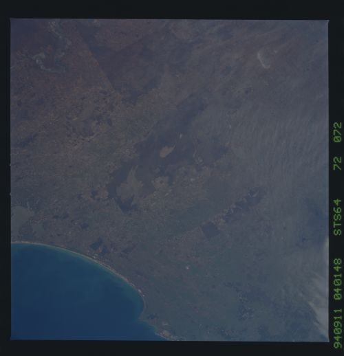
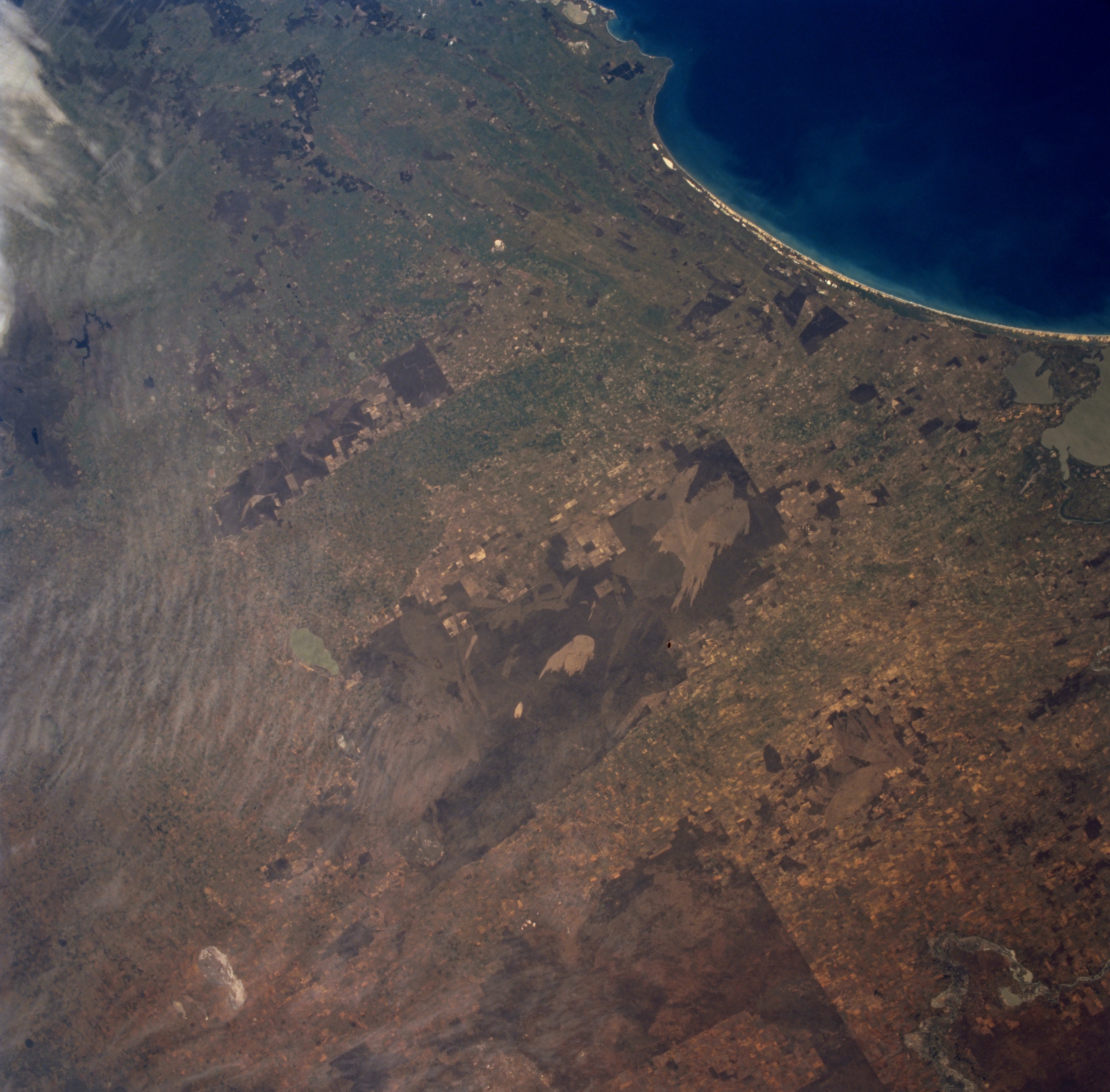
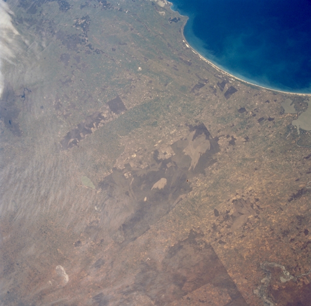
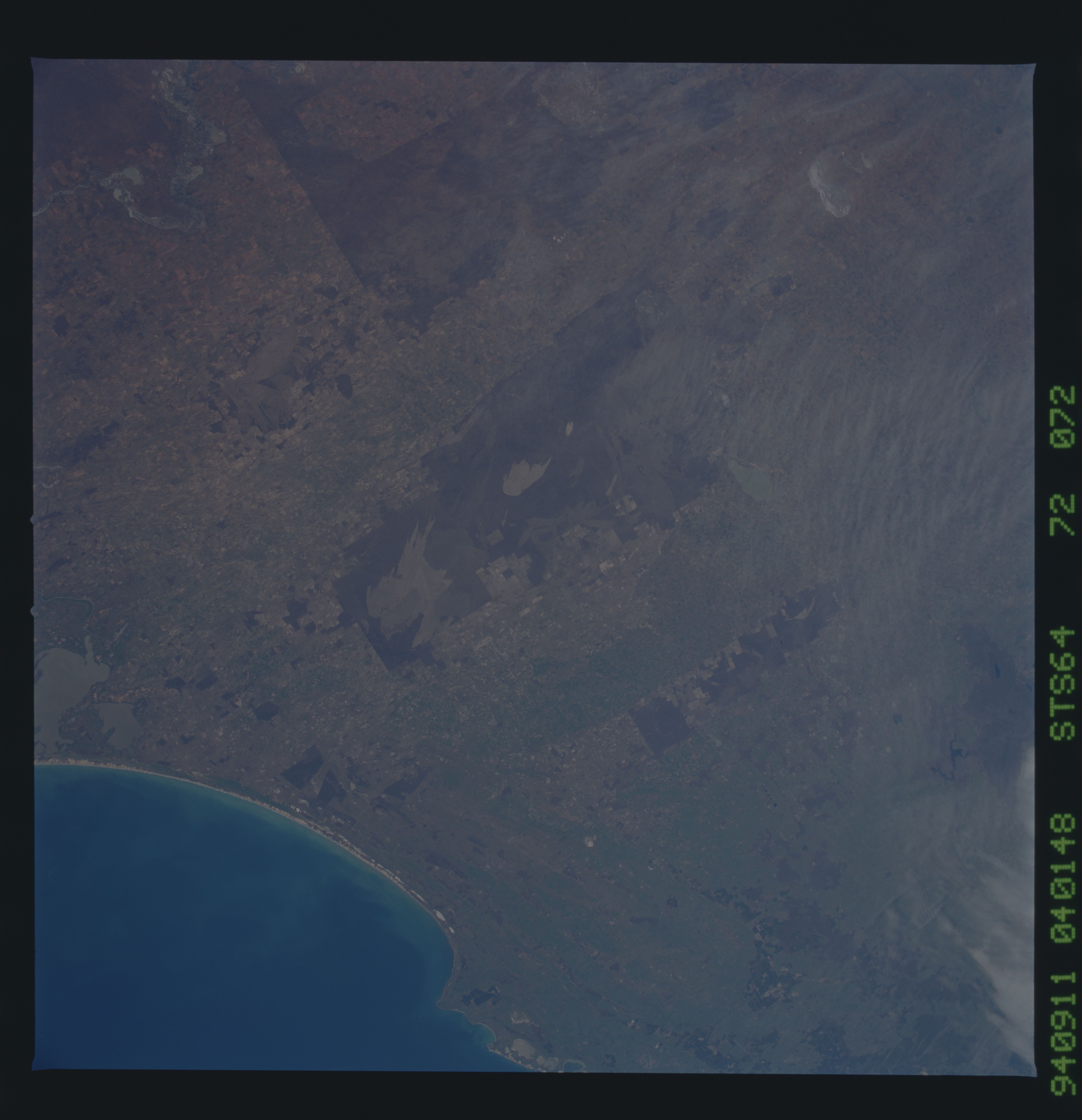
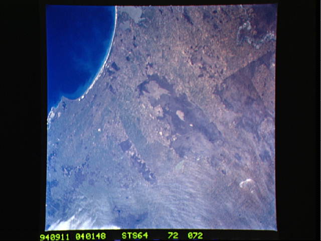
Image Caption: STS064-72-072 Burn Scar, South Australia, Australia September 1994
The curving shoreline of the Younghusband Peninsula in southeast South Australia is shown here in this southeast-looking small-scale view. The coastline extends from estuarine Lakes Albert and Alexandrina (middle right) to beyond Cape Jaffa (upper middle). The lagoon and dunes inside the Younghusband Peninsula, the Coorong, provide a natural habitat for wetland birds and wilderness areas with an array of coastal sand dunes. The larger dark areas show where more densely vegetated terrain is located on the gently rolling, sandy hills. The lighter-colored unique pattern within the darker area (slightly right of center) shows an extensive burn scar, probably caused by a random lighting strike and resultant range fire. Some clouds can be seen along the left upper margin of the picture. The distinctive pattern in the bottom right corner of the picture is part of the Murray River and its floodplain. The straight, linear boundaries that are visible throughout the region are created by the darker, undeveloped landscape (mainly very sandy soils) versus the lighter-colored agricultural lands.
The curving shoreline of the Younghusband Peninsula in southeast South Australia is shown here in this southeast-looking small-scale view. The coastline extends from estuarine Lakes Albert and Alexandrina (middle right) to beyond Cape Jaffa (upper middle). The lagoon and dunes inside the Younghusband Peninsula, the Coorong, provide a natural habitat for wetland birds and wilderness areas with an array of coastal sand dunes. The larger dark areas show where more densely vegetated terrain is located on the gently rolling, sandy hills. The lighter-colored unique pattern within the darker area (slightly right of center) shows an extensive burn scar, probably caused by a random lighting strike and resultant range fire. Some clouds can be seen along the left upper margin of the picture. The distinctive pattern in the bottom right corner of the picture is part of the Murray River and its floodplain. The straight, linear boundaries that are visible throughout the region are created by the darker, undeveloped landscape (mainly very sandy soils) versus the lighter-colored agricultural lands.
