STS064-205-50
| NASA Photo ID | STS064-205-50 |
| Focal Length | 250mm |
| Date taken | 1994.09.13 |
| Time taken | 23:44:19 GMT |
Resolutions offered for this image:
5167 x 5167 pixels 639 x 639 pixels 5700 x 5900 pixels 500 x 518 pixels 640 x 480 pixels
5167 x 5167 pixels 639 x 639 pixels 5700 x 5900 pixels 500 x 518 pixels 640 x 480 pixels

Cloud masks available for this image:
Spacecraft nadir point: 49.6° N, 93.9° W
Photo center point:
Photo center point by machine learning:
Photo center point:
Photo center point by machine learning:
Nadir to Photo Center:
Spacecraft Altitude: 139 nautical miles (257km)
Camera: | Hasselblad |
Focal Length: | 250mm |
Camera Tilt: | Low Oblique |
Format: | 5048: Kodak, natural color positive, Lumiere 100x/5048, ASA 100x, standard base |
Film Exposure: | Normal |
| Additional Information | |
| Width | Height | Annotated | Cropped | Purpose | Links |
|---|---|---|---|---|---|
| 5167 pixels | 5167 pixels | No | No | Earth From Space collection | Download Image |
| 639 pixels | 639 pixels | No | No | Earth From Space collection | Download Image |
| 5700 pixels | 5900 pixels | No | No | Download Image | |
| 500 pixels | 518 pixels | No | No | Download Image | |
| 640 pixels | 480 pixels | No | No | Download Image |
Download Packaged File
Download a Google Earth KML for this Image
View photo footprint information
Download a GeoTIFF for this photo
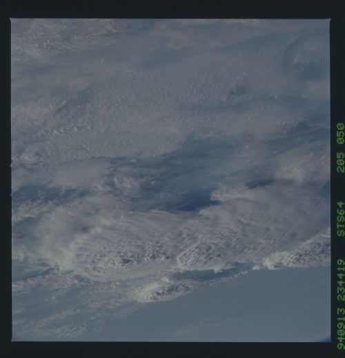
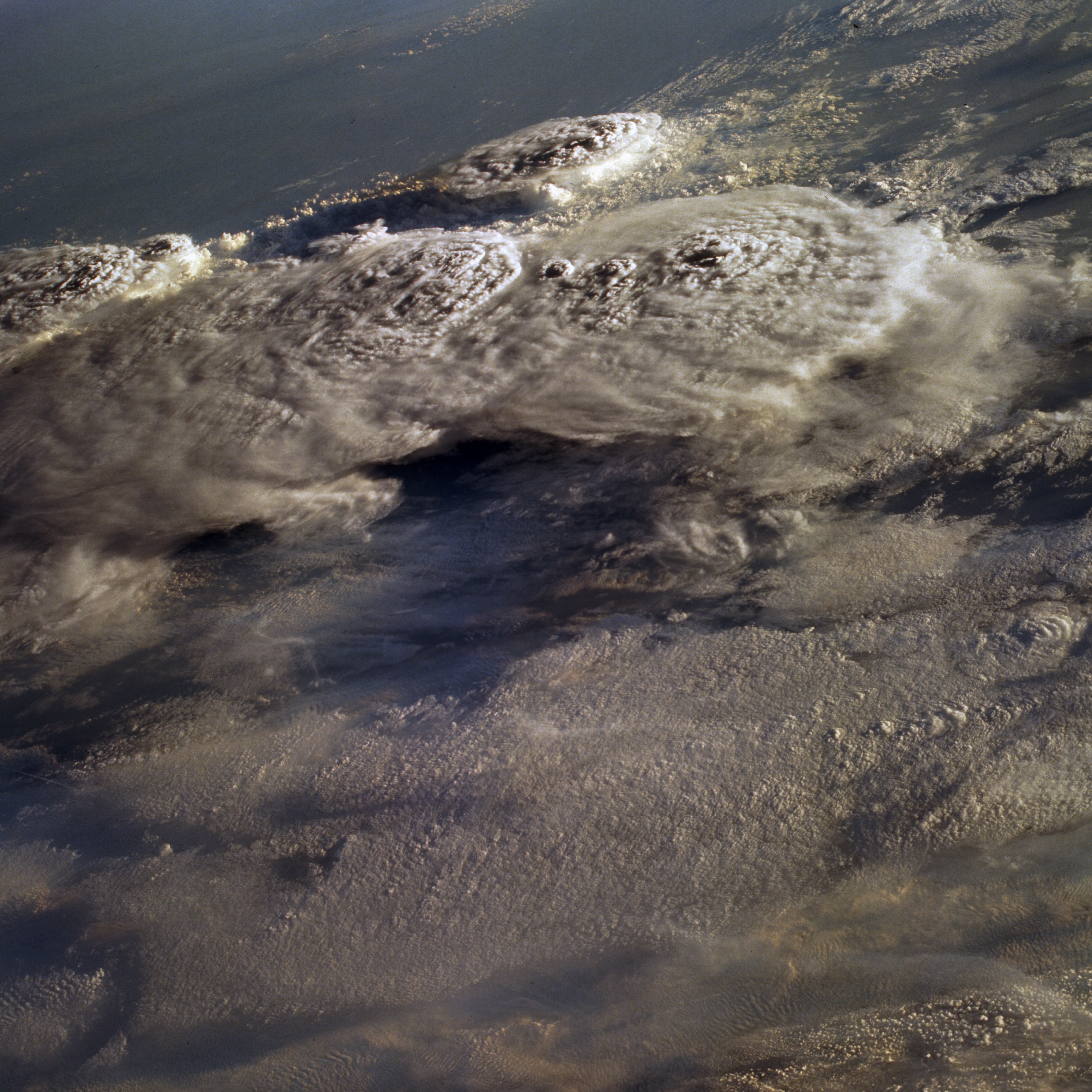
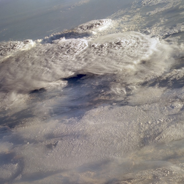
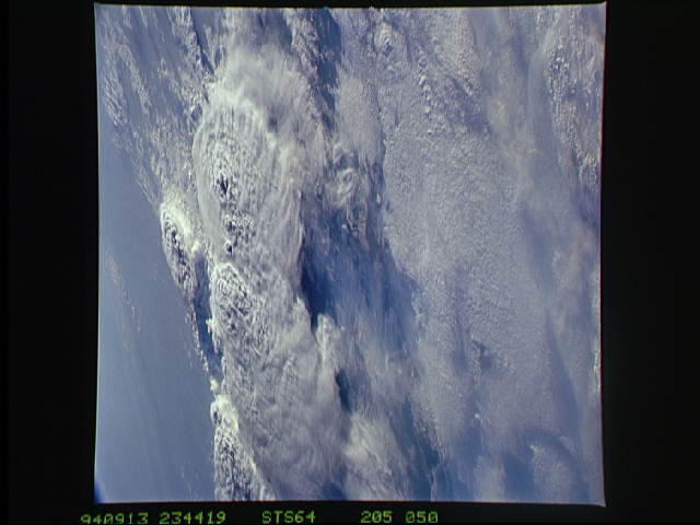
Image Caption: STS064-205-050 Supercell Thunderstorms, Canada September 1994
A cluster of large supercell thunderstorms, located near the border between Manitoba and Ontario, Canada, and Minnesota, United States can be seen in this low-oblique view. In North America, most supercell thunderstorms occur over the Great Plains of the United States and southern Canada, where moist, warm, tropical air from the Gulf of Mexico clashes with dryer, cooler, polar air from the Canadian Arctic. Such storms can produce violent downdrafts with locally strong and sometimes destructive winds. Storms of this magnitude can also produce hail and in many cases, tornadoes. A thunderstorm is an intense local storm associated with a tall, dense cumulonimbus cloud in which there are very strong updrafts of air. They occur when the atmosphere is unstable and moist warm air is abundant and becomes buoyant near the ground. The towering cumulonimbus thunderheads can rise through the stratosphere to altitudes of 12.5 miles (20 km); they penetrate the upper cirrus cloud layer in this view.
A cluster of large supercell thunderstorms, located near the border between Manitoba and Ontario, Canada, and Minnesota, United States can be seen in this low-oblique view. In North America, most supercell thunderstorms occur over the Great Plains of the United States and southern Canada, where moist, warm, tropical air from the Gulf of Mexico clashes with dryer, cooler, polar air from the Canadian Arctic. Such storms can produce violent downdrafts with locally strong and sometimes destructive winds. Storms of this magnitude can also produce hail and in many cases, tornadoes. A thunderstorm is an intense local storm associated with a tall, dense cumulonimbus cloud in which there are very strong updrafts of air. They occur when the atmosphere is unstable and moist warm air is abundant and becomes buoyant near the ground. The towering cumulonimbus thunderheads can rise through the stratosphere to altitudes of 12.5 miles (20 km); they penetrate the upper cirrus cloud layer in this view.
