STS064-112-92
| NASA Photo ID | STS064-112-92 |
| Focal Length | 100mm |
| Date taken | 1994.09.18 |
| Time taken | 22:56:27 GMT |
Resolutions offered for this image:
3904 x 3904 pixels 639 x 639 pixels 5700 x 5900 pixels 500 x 518 pixels 640 x 480 pixels 3904 x 3904 pixels 1024 x 768 pixels 540 x 405 pixels
3904 x 3904 pixels 639 x 639 pixels 5700 x 5900 pixels 500 x 518 pixels 640 x 480 pixels 3904 x 3904 pixels 1024 x 768 pixels 540 x 405 pixels


Cloud masks available for this image:
Spacecraft nadir point: 45.2° N, 119.3° W
Photo center point: 45.5° N, 122.0° W
Photo center point by machine learning:
Photo center point: 45.5° N, 122.0° W
Photo center point by machine learning:
Nadir to Photo Center: West
Spacecraft Altitude: 129 nautical miles (239km)
Country or Geographic Name: | USA-WASHINGTON |
Features: | MT. ADAMS, MOUNT ST. HELENS |
| Features Found Using Machine Learning: | |
Cloud Cover Percentage: | 0 (no clouds present) |
Sun Elevation Angle: | 31° |
Sun Azimuth: | 237° |
Camera: | Hasselblad |
Focal Length: | 100mm |
Camera Tilt: | 52 degrees |
Format: | VELVI: Fuji, natural color positive, Velvia 50, CS 135-36, ASA 32, standard base |
Film Exposure: | Normal |
| Additional Information | |
| Width | Height | Annotated | Cropped | Purpose | Links |
|---|---|---|---|---|---|
| 3904 pixels | 3904 pixels | No | No | Earth From Space collection | Download Image |
| 639 pixels | 639 pixels | No | No | Earth From Space collection | Download Image |
| 5700 pixels | 5900 pixels | No | No | Download Image | |
| 500 pixels | 518 pixels | No | No | Download Image | |
| 640 pixels | 480 pixels | No | No | Download Image | |
| 3904 pixels | 3904 pixels | Yes | Presentation | Download Image | |
| 1024 pixels | 768 pixels | Yes | Yes | Presentation | Download Image |
| 540 pixels | 405 pixels | Yes | Presentation | Download Image |
Download Packaged File
Download a Google Earth KML for this Image
View photo footprint information
Download a GeoTIFF for this photo
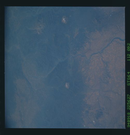
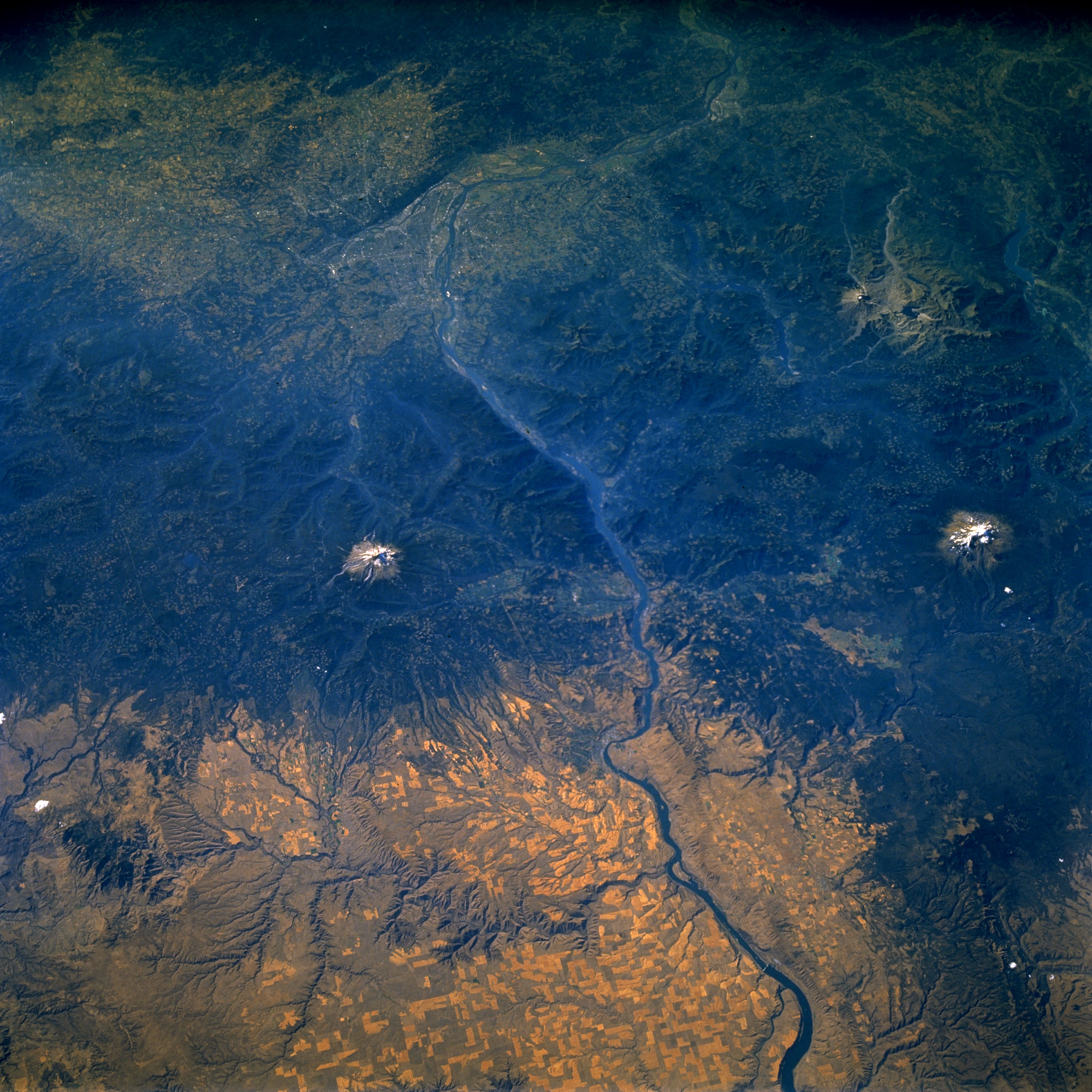
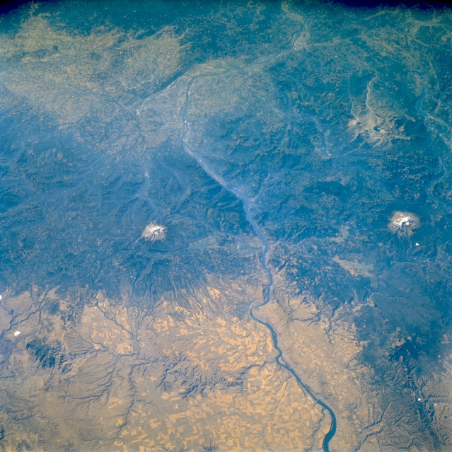
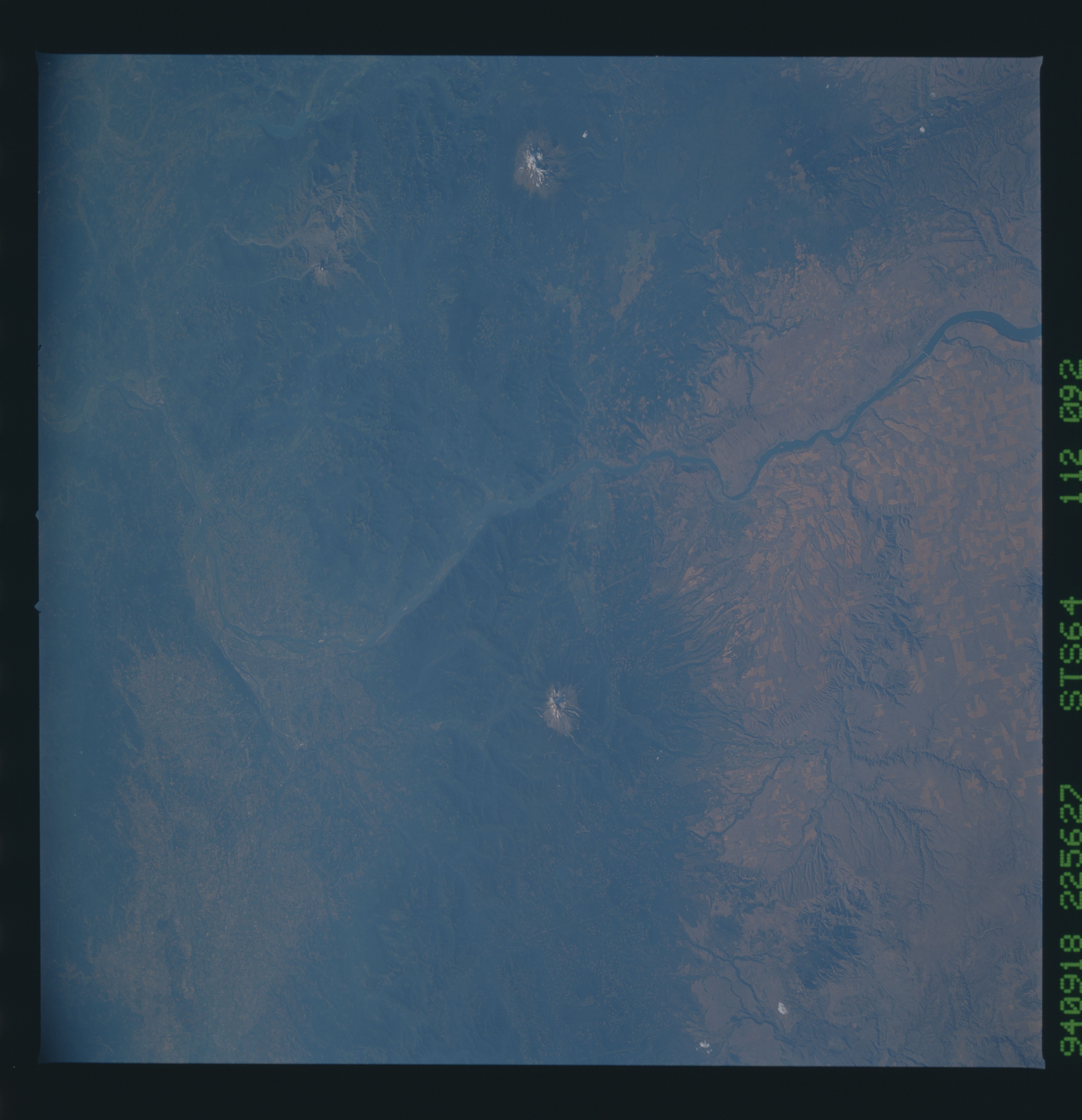
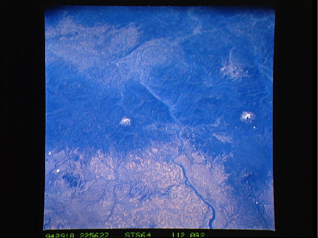
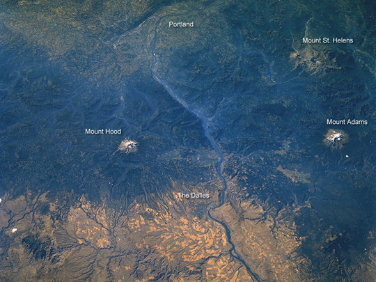
Image Caption: STS064-112-92 Columbia River Gorge, Washington, U.S.A. September 1994
Snow-capped, volcanic Mount Saint Helens and Mount Adams in Washington; Mount Hood in Oregon; and the beautiful Columbia River Gorge are featured in this west-northwest-looking, low-oblique photograph. The gorge resulted from the Columbia River eroding the rocks of the rising Cascade arch, which continues to rise as the river, now impeded by numerous dams within the gorge, attempts to maintain its course to the Pacific Ocean near Astoria, Oregon (not visible). At the western boundary of the gorge, the Columbia River passes the cities of Portland, Oregon, to the south and Vancouver, Washington, to the north (both barely discernible) before taking a more northerly course toward the cities of Longview and Kelso, Washington. Visible are the forested Cascade Range; field patterns in the Columbia Plateau; and the agriculturally rich lands of the Willamette Valley, south of Portland.
Snow-capped, volcanic Mount Saint Helens and Mount Adams in Washington; Mount Hood in Oregon; and the beautiful Columbia River Gorge are featured in this west-northwest-looking, low-oblique photograph. The gorge resulted from the Columbia River eroding the rocks of the rising Cascade arch, which continues to rise as the river, now impeded by numerous dams within the gorge, attempts to maintain its course to the Pacific Ocean near Astoria, Oregon (not visible). At the western boundary of the gorge, the Columbia River passes the cities of Portland, Oregon, to the south and Vancouver, Washington, to the north (both barely discernible) before taking a more northerly course toward the cities of Longview and Kelso, Washington. Visible are the forested Cascade Range; field patterns in the Columbia Plateau; and the agriculturally rich lands of the Willamette Valley, south of Portland.
