STS064-110-91
| NASA Photo ID | STS064-110-91 |
| Focal Length | 250mm |
| Date taken | 1994.09.15 |
| Time taken | 23:28:46 GMT |
Resolutions offered for this image:
3904 x 3904 pixels 639 x 639 pixels 5700 x 5900 pixels 500 x 518 pixels 640 x 480 pixels 1278 x 1293 pixels
3904 x 3904 pixels 639 x 639 pixels 5700 x 5900 pixels 500 x 518 pixels 640 x 480 pixels 1278 x 1293 pixels


Cloud masks available for this image:
Spacecraft nadir point: 39.6° N, 118.5° W
Photo center point: 40.0° N, 119.5° W
Photo center point by machine learning:
Photo center point: 40.0° N, 119.5° W
Photo center point by machine learning:
Nadir to Photo Center: West
Spacecraft Altitude: 131 nautical miles (243km)
Country or Geographic Name: | USA-NEVADA |
Features: | PYRAMID LAKE, MOUNTAINS |
| Features Found Using Machine Learning: | |
Cloud Cover Percentage: | 0 (no clouds present) |
Sun Elevation Angle: | 28° |
Sun Azimuth: | 248° |
Camera: | Hasselblad |
Focal Length: | 250mm |
Camera Tilt: | 26 degrees |
Format: | VELVI: Fuji, natural color positive, Velvia 50, CS 135-36, ASA 32, standard base |
Film Exposure: | Normal |
| Additional Information | |
| Width | Height | Annotated | Cropped | Purpose | Links |
|---|---|---|---|---|---|
| 3904 pixels | 3904 pixels | No | No | Earth From Space collection | Download Image |
| 639 pixels | 639 pixels | No | No | Earth From Space collection | Download Image |
| 5700 pixels | 5900 pixels | No | No | Download Image | |
| 500 pixels | 518 pixels | No | No | Download Image | |
| 640 pixels | 480 pixels | No | No | Download Image | |
| 1278 pixels | 1293 pixels | No | No | Download Image |
Download Packaged File
Download a Google Earth KML for this Image
View photo footprint information
Download a GeoTIFF for this photo
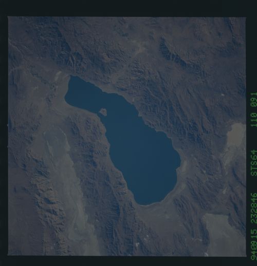
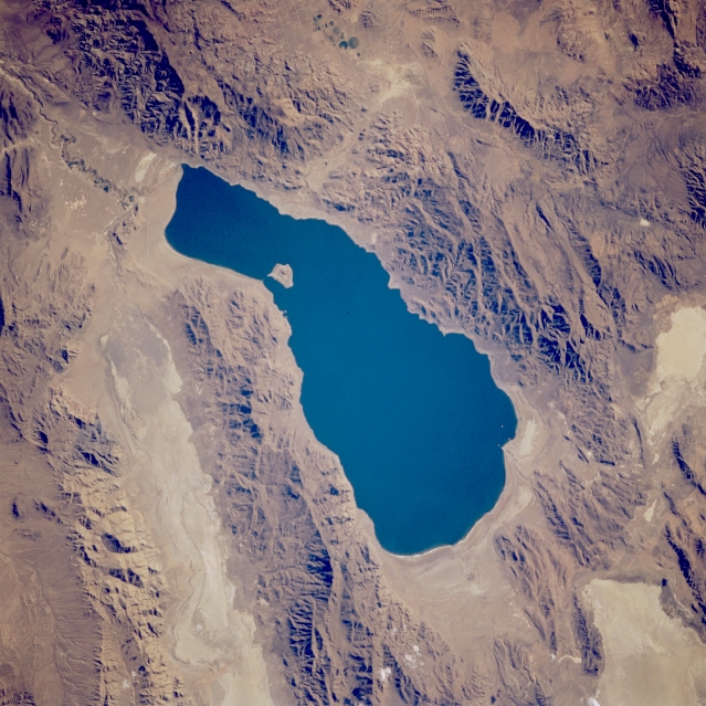
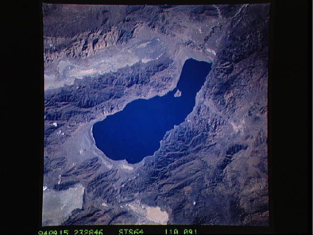
Image Caption: STS064-110-091 Pyramid Lake, Nevada, U.S.A. September 1994
Pyramid Lake, an elevated saline lake [3788 feet (1155 meters) above sea level] roughly 25 miles (40 kilometers) long, lies approximately 25 miles (40 kilometers) northeast of Reno, Nevada. Periodically, the intermittently flowing Truckee River and Canal enter the lake from the south to provide fresh water. The mountains east and west of the lake average 6000 feet (1830 meters) in elevation, with several peaks exceeding 8000 feet (2440 meters). Long, linear Winnemucca Lake (a dry lake) is visible along the eastern side of the photograph.
Pyramid Lake, an elevated saline lake [3788 feet (1155 meters) above sea level] roughly 25 miles (40 kilometers) long, lies approximately 25 miles (40 kilometers) northeast of Reno, Nevada. Periodically, the intermittently flowing Truckee River and Canal enter the lake from the south to provide fresh water. The mountains east and west of the lake average 6000 feet (1830 meters) in elevation, with several peaks exceeding 8000 feet (2440 meters). Long, linear Winnemucca Lake (a dry lake) is visible along the eastern side of the photograph.
