STS062-91-93
| NASA Photo ID | STS062-91-93 |
| Focal Length | 100mm |
| Date taken | 1994.03.06 |
| Time taken | 17:24:57 GMT |
Resolutions offered for this image:
3904 x 3904 pixels 639 x 639 pixels 5700 x 5900 pixels 500 x 518 pixels 640 x 480 pixels 1273 x 1276 pixels
3904 x 3904 pixels 639 x 639 pixels 5700 x 5900 pixels 500 x 518 pixels 640 x 480 pixels 1273 x 1276 pixels

Cloud masks available for this image:
Spacecraft nadir point: 38.1° N, 84.9° W
Photo center point: 38.0° N, 84.5° W
Photo center point by machine learning:
Photo center point: 38.0° N, 84.5° W
Photo center point by machine learning:
Nadir to Photo Center: East
Spacecraft Altitude: 161 nautical miles (298km)
Country or Geographic Name: | USA-KENTUCKY |
Features: | LEXINGTON AREA |
| Features Found Using Machine Learning: | |
Cloud Cover Percentage: | 0 (no clouds present) |
Sun Elevation Angle: | 46° |
Sun Azimuth: | 171° |
Camera: | Hasselblad |
Focal Length: | 100mm |
Camera Tilt: | 9 degrees |
Format: | 5046: Kodak, natural color positive, Lumiere 100/5046, ASA 100, standard base |
Film Exposure: | Normal |
| Additional Information | |
| Width | Height | Annotated | Cropped | Purpose | Links |
|---|---|---|---|---|---|
| 3904 pixels | 3904 pixels | No | No | Earth From Space collection | Download Image |
| 639 pixels | 639 pixels | No | No | Earth From Space collection | Download Image |
| 5700 pixels | 5900 pixels | No | No | Download Image | |
| 500 pixels | 518 pixels | No | No | Download Image | |
| 640 pixels | 480 pixels | No | No | Download Image | |
| 1273 pixels | 1276 pixels | No | No | Download Image |
Download Packaged File
Download a Google Earth KML for this Image
View photo footprint information
Download a GeoTIFF for this photo
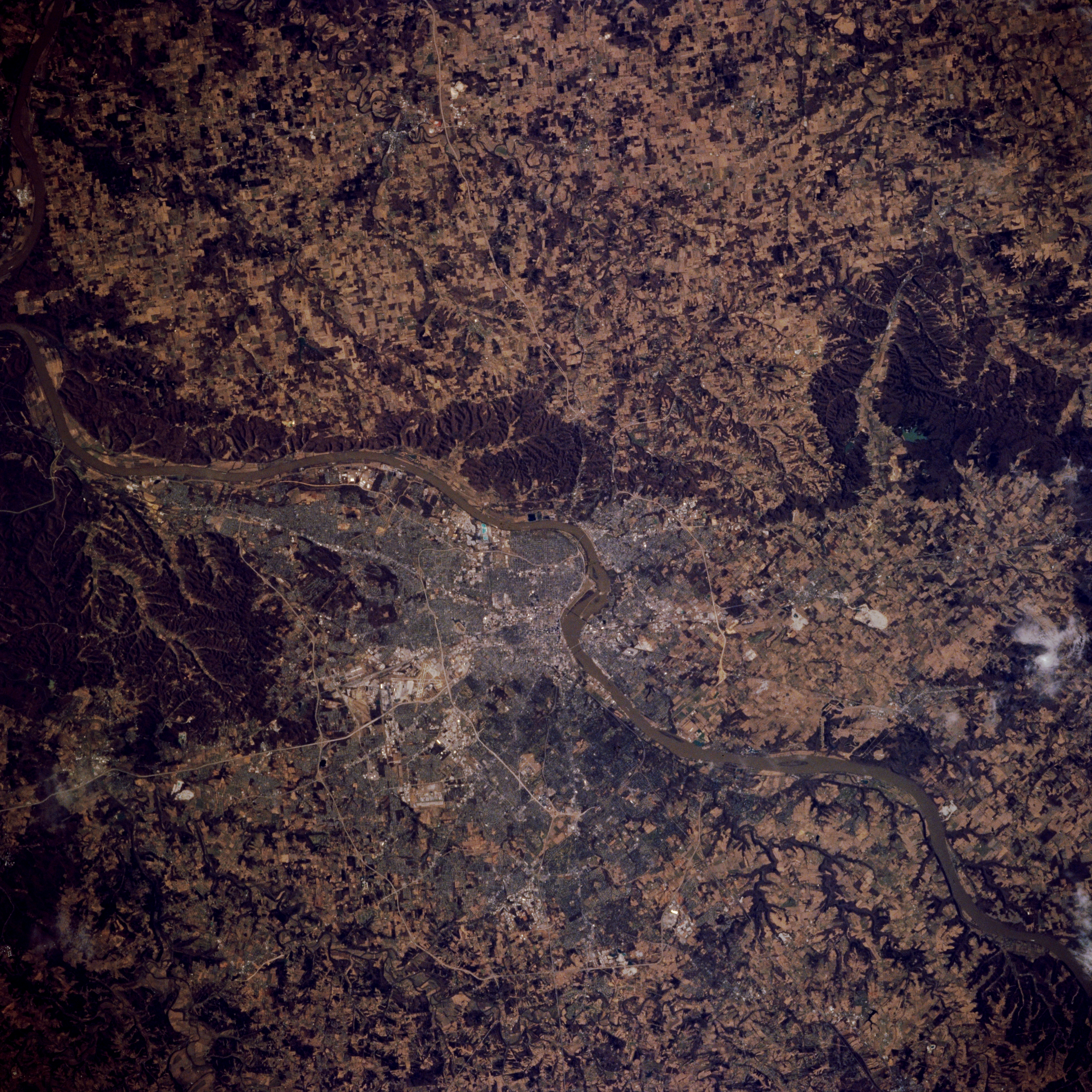
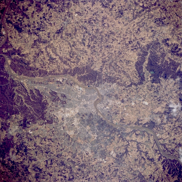
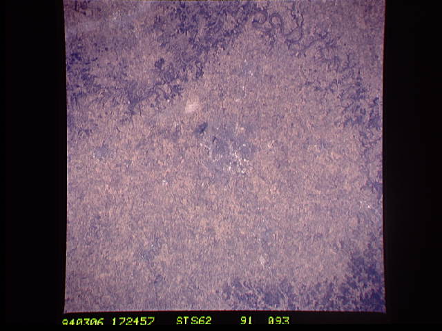
Image Caption: STS062-091-093 Louisville, Kentucky, U.S.A. March 1994
As part of the border between Indiana and Kentucky, the southwest-flowing Ohio River separates New Albany, Indiana (to the north), and Louisville, Kentucky (to the south). Two concentric beltways loop around the south side of Louisville--Interstate Highway 264, the inner belt, and Interstate Highway 265, the outer belt. Louisville developed as a major urban area as a result of Ohio River waterfalls. Goods shipped via the river had to be unloaded before reaching the falls and carried around the falls, thereby creating a need for workers and services. Today ships use locks to navigate the barrier. The dark features throughout the photograph are areas of hilly, eroded, wooded terrain.
As part of the border between Indiana and Kentucky, the southwest-flowing Ohio River separates New Albany, Indiana (to the north), and Louisville, Kentucky (to the south). Two concentric beltways loop around the south side of Louisville--Interstate Highway 264, the inner belt, and Interstate Highway 265, the outer belt. Louisville developed as a major urban area as a result of Ohio River waterfalls. Goods shipped via the river had to be unloaded before reaching the falls and carried around the falls, thereby creating a need for workers and services. Today ships use locks to navigate the barrier. The dark features throughout the photograph are areas of hilly, eroded, wooded terrain.
