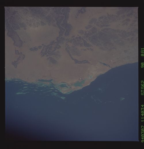
STS062-90-81
| NASA Photo ID | STS062-90-81 |
| Focal Length | 250mm |
| Date taken | 1994.03.07 |
| Time taken | 11:40:34 GMT |
Resolutions offered for this image:
5700 x 5900 pixels 500 x 518 pixels 640 x 480 pixels 2544 x 2574 pixels 2589 x 2574 pixels 909 x 1181 pixels 3999 x 3999 pixels 540 x 702 pixels
5700 x 5900 pixels 500 x 518 pixels 640 x 480 pixels 2544 x 2574 pixels 2589 x 2574 pixels 909 x 1181 pixels 3999 x 3999 pixels 540 x 702 pixels


Cloud masks available for this image:
Spacecraft nadir point: 21.3° N, 41.2° E
Photo center point: 21.5° N, 39.0° E
Photo center point by machine learning:
Photo center point: 21.5° N, 39.0° E
Photo center point by machine learning:
Nadir to Photo Center: West
Spacecraft Altitude: 163 nautical miles (302km)
Country or Geographic Name: | SAUDI ARABIA |
Features: | JIDDAH AREA |
| Features Found Using Machine Learning: | |
Cloud Cover Percentage: | 0 (no clouds present) |
Sun Elevation Angle: | 48° |
Sun Azimuth: | 235° |
Camera: | Hasselblad |
Focal Length: | 250mm |
Camera Tilt: | 39 degrees |
Format: | 5046: Kodak, natural color positive, Lumiere 100/5046, ASA 100, standard base |
Film Exposure: | Normal |
| Additional Information | |
| Width | Height | Annotated | Cropped | Purpose | Links |
|---|---|---|---|---|---|
| 5700 pixels | 5900 pixels | No | No | Download Image | |
| 500 pixels | 518 pixels | No | No | Download Image | |
| 640 pixels | 480 pixels | No | No | Download Image | |
| 2544 pixels | 2574 pixels | No | Yes | ReefBase 1 | Download Image |
| 2589 pixels | 2574 pixels | No | No | ReefBase 1 | Download Image |
| 909 pixels | 1181 pixels | Yes | Yes | Publisher Request | Download Image |
| 3999 pixels | 3999 pixels | No | No | Download Image | |
| 540 pixels | 702 pixels | Yes | Yes | Publisher Request | Download Image |
Download Packaged File
Download a Google Earth KML for this Image
View photo footprint information
Download a GeoTIFF for this photo
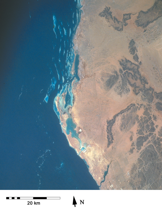
Image Caption: The Red Sea coastline running north from Jeddah. Although reefs have been badly disrupted as this city has grown, important fringing and patch reefs remain to north and south [STS062-90-81, 1994].
