STS062-90-41
| NASA Photo ID | STS062-90-41 |
| Focal Length | 250mm |
| Date taken | 1994.03.07 |
| Time taken | 09:54:59 GMT |
Resolutions offered for this image:
5276 x 5276 pixels 640 x 640 pixels 5700 x 5900 pixels 500 x 518 pixels 640 x 480 pixels
5276 x 5276 pixels 640 x 640 pixels 5700 x 5900 pixels 500 x 518 pixels 640 x 480 pixels
Cloud masks available for this image:
Spacecraft nadir point: 39.0° N, 0.3° W
Photo center point: 41.0° N, 0.5° E
Photo center point by machine learning:
Photo center point: 41.0° N, 0.5° E
Photo center point by machine learning:
Nadir to Photo Center: North
Spacecraft Altitude: 161 nautical miles (298km)
Country or Geographic Name: | SPAIN |
Features: | EBRO R. DELTA AREA |
| Features Found Using Machine Learning: | |
Cloud Cover Percentage: | 20 (11-25)% |
Sun Elevation Angle: | 36° |
Sun Azimuth: | 136° |
Camera: | Hasselblad |
Focal Length: | 250mm |
Camera Tilt: | 39 degrees |
Format: | 5046: Kodak, natural color positive, Lumiere 100/5046, ASA 100, standard base |
Film Exposure: | Normal |
| Additional Information | |
| Width | Height | Annotated | Cropped | Purpose | Links |
|---|---|---|---|---|---|
| 5276 pixels | 5276 pixels | No | No | Earth From Space collection | Download Image |
| 640 pixels | 640 pixels | No | No | Earth From Space collection | Download Image |
| 5700 pixels | 5900 pixels | No | No | Download Image | |
| 500 pixels | 518 pixels | No | No | Download Image | |
| 640 pixels | 480 pixels | No | No | Download Image |
Download Packaged File
Download a Google Earth KML for this Image
View photo footprint information
Download a GeoTIFF for this photo
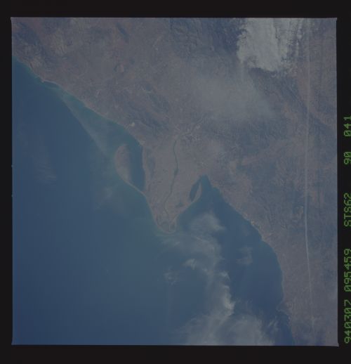
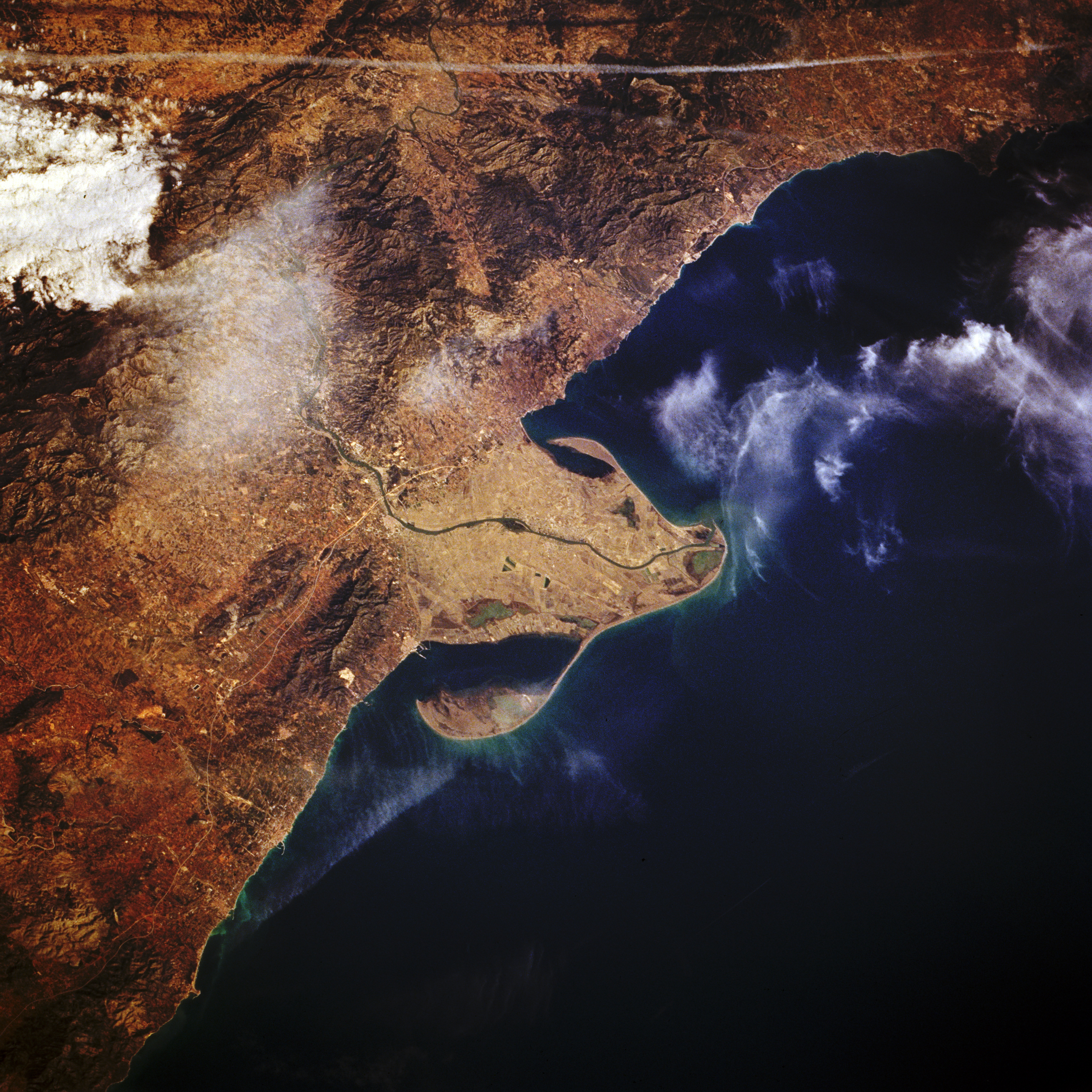
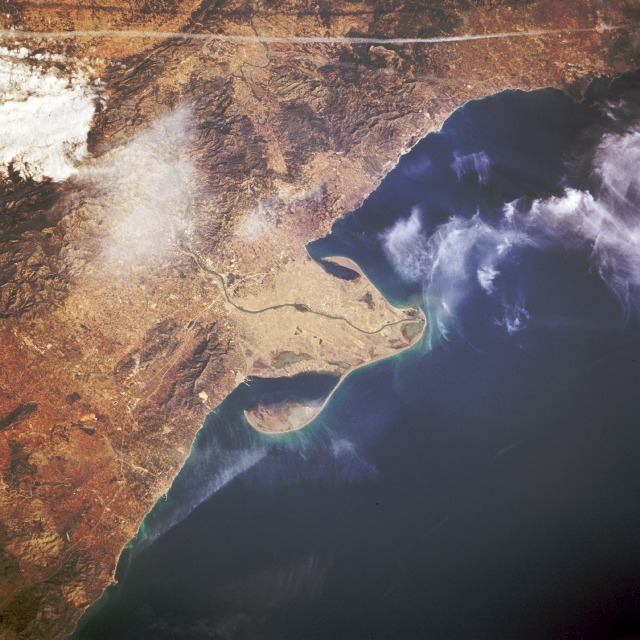
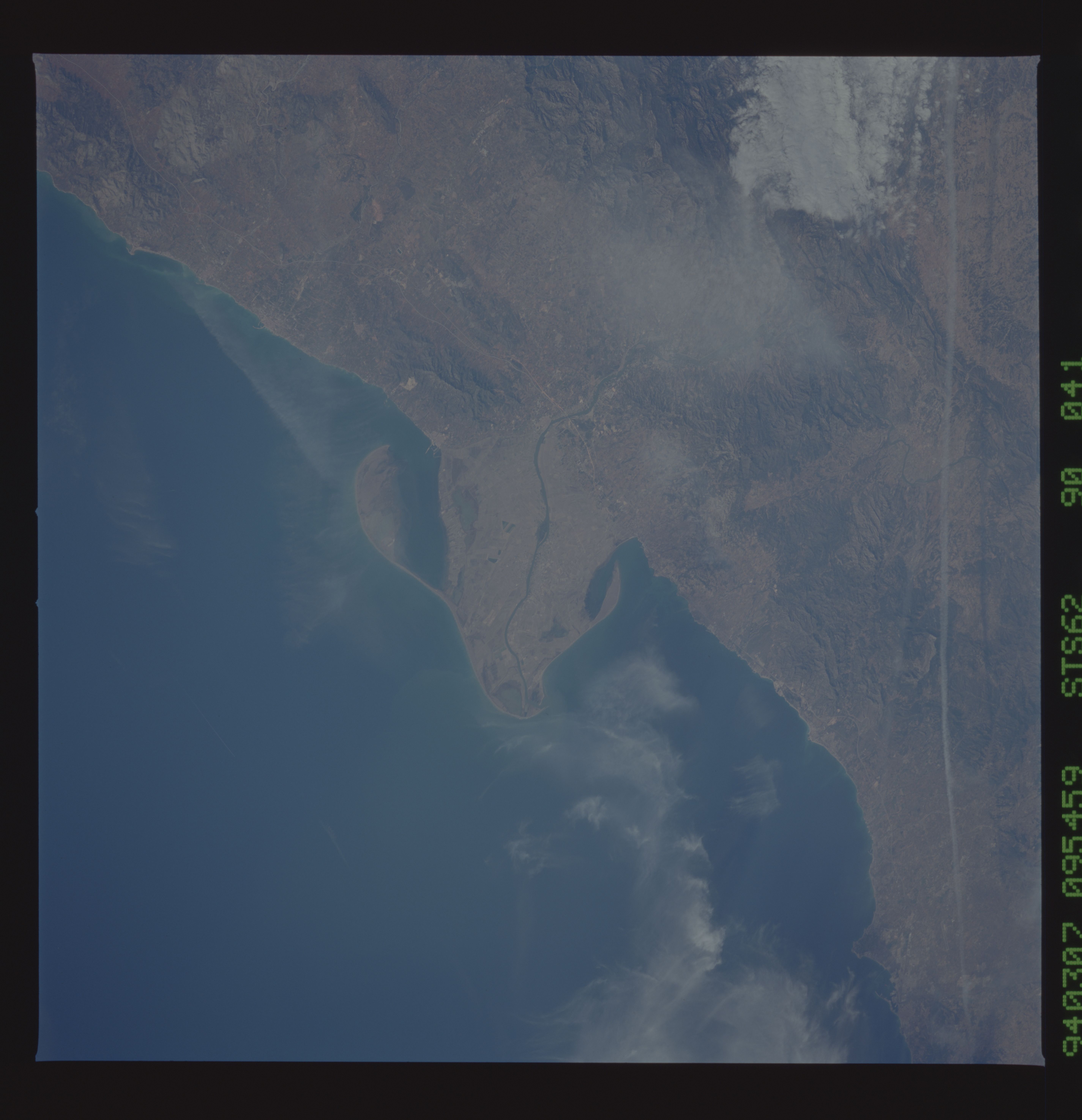
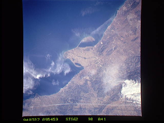
Image Caption: STS062-090-041 Ebro River Delta, Spain March 1994
This low-oblique, north-looking photograph shows the mouth of the Ebro River, the second longest river in Spain. The Ebro rises in the Cantabria Mountains of northern Spain and flows east-southeast between the Pyrenees Mountains in the north and the Iberian Mountains in the south before entering a wide delta and emptying into the Mediterranean Sea. The river cuts through the coastal ranges in a series of gorges so that seagoing vessels cannot go upstream above the city of Tortosa, 22 miles (35 kilometers) from the river's mouth. The Ebro River has a drainage basin of over 33 600 square miles (87 024 square kilometers). Irrigation has been practiced along the Ebro's most important valleys since the time of Moorish occupancy of the area. Today more than 35 major dams help increase irrigated land area to more than 919 715 acres (372 210 hectares). An aircraft contrail traverses west-east near the edge of the photograph.
This low-oblique, north-looking photograph shows the mouth of the Ebro River, the second longest river in Spain. The Ebro rises in the Cantabria Mountains of northern Spain and flows east-southeast between the Pyrenees Mountains in the north and the Iberian Mountains in the south before entering a wide delta and emptying into the Mediterranean Sea. The river cuts through the coastal ranges in a series of gorges so that seagoing vessels cannot go upstream above the city of Tortosa, 22 miles (35 kilometers) from the river's mouth. The Ebro River has a drainage basin of over 33 600 square miles (87 024 square kilometers). Irrigation has been practiced along the Ebro's most important valleys since the time of Moorish occupancy of the area. Today more than 35 major dams help increase irrigated land area to more than 919 715 acres (372 210 hectares). An aircraft contrail traverses west-east near the edge of the photograph.
