STS062-89-38

| NASA Photo ID | STS062-89-38 |
| Focal Length | 250mm |
| Date taken | 1994.03.06 |
| Time taken | 19:01:28 GMT |
Resolutions offered for this image:
3904 x 3904 pixels 639 x 639 pixels 5700 x 5900 pixels 500 x 518 pixels 640 x 480 pixels
3904 x 3904 pixels 639 x 639 pixels 5700 x 5900 pixels 500 x 518 pixels 640 x 480 pixels


Cloud masks available for this image:
Spacecraft nadir point: 30.5° N, 81.5° W
Photo center point: 30.5° N, 81.5° W
Photo center point by machine learning:
Photo center point: 30.5° N, 81.5° W
Photo center point by machine learning:
Nadir to Photo Center:
Spacecraft Altitude: 162 nautical miles (300km)
Country or Geographic Name: | USA-FLORIDA |
Features: | JACKSONVILLE |
| Features Found Using Machine Learning: | |
Cloud Cover Percentage: | 0 (no clouds present) |
Sun Elevation Angle: | 49° |
Sun Azimuth: | 213° |
Camera: | Hasselblad |
Focal Length: | 250mm |
Camera Tilt: | 0 degrees |
Format: | 5046: Kodak, natural color positive, Lumiere 100/5046, ASA 100, standard base |
Film Exposure: | Normal |
| Additional Information | |
| Width | Height | Annotated | Cropped | Purpose | Links |
|---|---|---|---|---|---|
| 3904 pixels | 3904 pixels | No | No | Earth From Space collection | Download Image |
| 639 pixels | 639 pixels | No | No | Earth From Space collection | Download Image |
| 5700 pixels | 5900 pixels | No | No | Download Image | |
| 500 pixels | 518 pixels | No | No | Download Image | |
| 640 pixels | 480 pixels | No | No | Download Image |
Download Packaged File
Download a Google Earth KML for this Image
View photo footprint information
Download a GeoTIFF for this photo
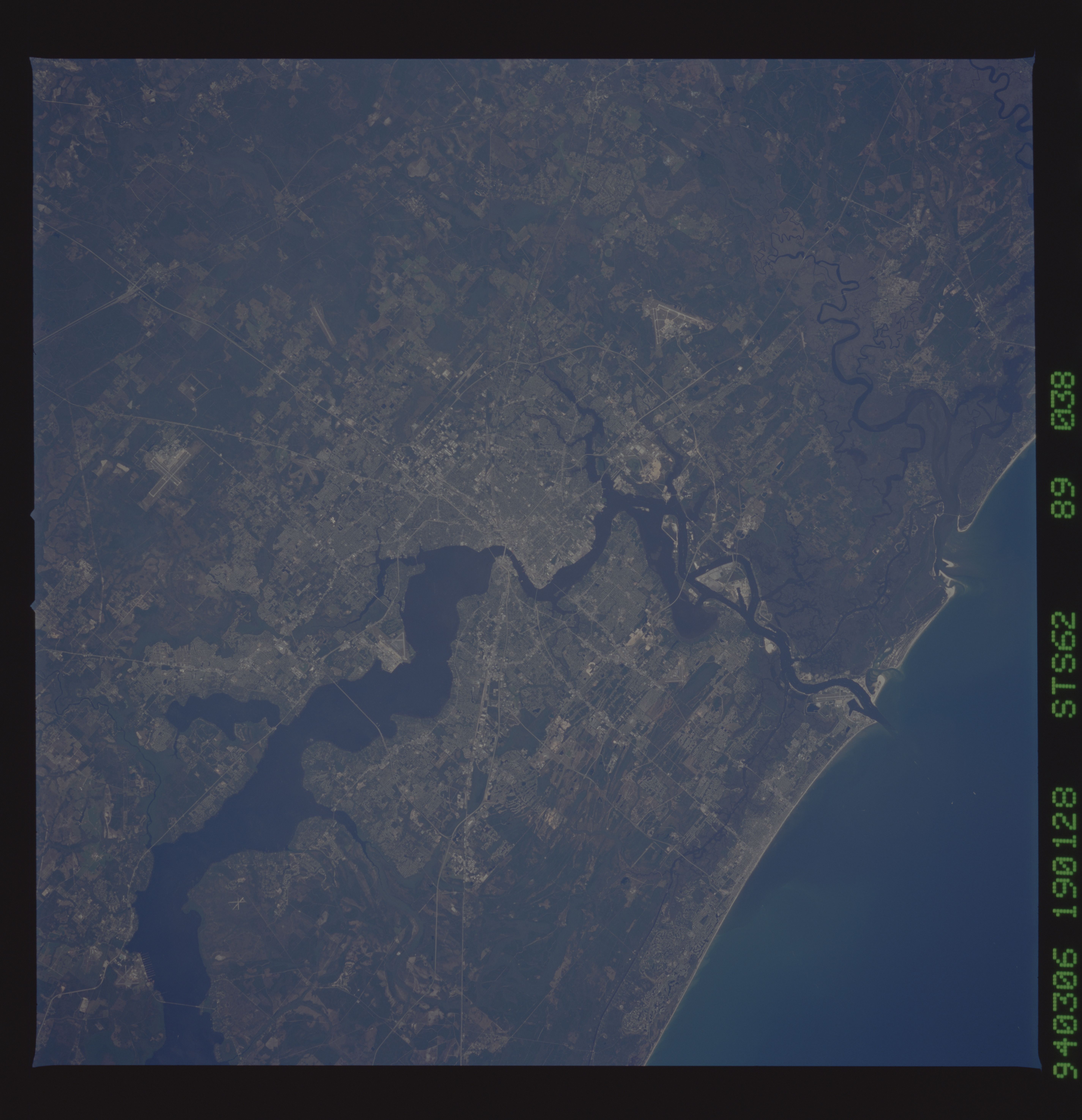
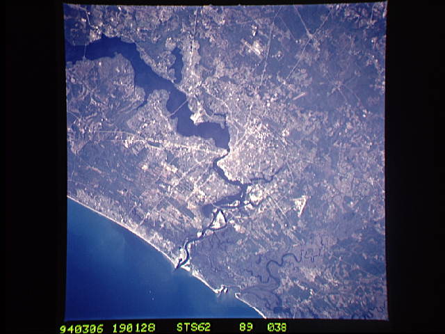
Image Caption: STS062-089-038 Jacksonville, Florida, U.S.A. March 1994
Much of the early history and development of Jacksonville, northeast Florida's largest city, was tied to dark Saint Johns River that cuts through this expanding urban area. South of downtown, before the river narrows and changes direction, the river exceeds 5 miles (8 kilometers) in width. North of the city, meandering Saint Marys River and its broad floodplain form the border between northeast Florida and southeast Georgia before it empties into the Atlantic Ocean. Discernible are several highways (Interstate Highways 95, 295, and 10 and U.S. Highway 1) and three major airports--Jacksonville International Airport north of the city, Cecil Field Naval Air Station southwest of the city, and Jacksonville Naval Air Station south of the city along the west bank of the Saint Johns River. The darker landscape throughout the photograph shows concentrations of natural stands of vegetation, which, in many instances are poorly drained swamplands.
Much of the early history and development of Jacksonville, northeast Florida's largest city, was tied to dark Saint Johns River that cuts through this expanding urban area. South of downtown, before the river narrows and changes direction, the river exceeds 5 miles (8 kilometers) in width. North of the city, meandering Saint Marys River and its broad floodplain form the border between northeast Florida and southeast Georgia before it empties into the Atlantic Ocean. Discernible are several highways (Interstate Highways 95, 295, and 10 and U.S. Highway 1) and three major airports--Jacksonville International Airport north of the city, Cecil Field Naval Air Station southwest of the city, and Jacksonville Naval Air Station south of the city along the west bank of the Saint Johns River. The darker landscape throughout the photograph shows concentrations of natural stands of vegetation, which, in many instances are poorly drained swamplands.
