STS062-89-1
| NASA Photo ID | STS062-89-1 |
| Focal Length | 250mm |
| Date taken | 1994.03.06 |
| Time taken | 17:27:14 GMT |
Resolutions offered for this image:
3904 x 3904 pixels 639 x 639 pixels 5700 x 5900 pixels 500 x 518 pixels 640 x 480 pixels
3904 x 3904 pixels 639 x 639 pixels 5700 x 5900 pixels 500 x 518 pixels 640 x 480 pixels
Cloud masks available for this image:
Spacecraft nadir point: 36.0° N, 74.4° W
Photo center point: 37.0° N, 76.5° W
Photo center point by machine learning:
Photo center point: 37.0° N, 76.5° W
Photo center point by machine learning:
Nadir to Photo Center: West
Spacecraft Altitude: 162 nautical miles (300km)
Country or Geographic Name: | USA-VIRGINIA |
Features: | NORFOLK, CHESAPEAKE BAY |
| Features Found Using Machine Learning: | |
Cloud Cover Percentage: | 0 (no clouds present) |
Sun Elevation Angle: | 48° |
Sun Azimuth: | 187° |
Camera: | Hasselblad |
Focal Length: | 250mm |
Camera Tilt: | 41 degrees |
Format: | 5046: Kodak, natural color positive, Lumiere 100/5046, ASA 100, standard base |
Film Exposure: | Normal |
| Additional Information | |
| Width | Height | Annotated | Cropped | Purpose | Links |
|---|---|---|---|---|---|
| 3904 pixels | 3904 pixels | No | No | Earth From Space collection | Download Image |
| 639 pixels | 639 pixels | No | No | Earth From Space collection | Download Image |
| 5700 pixels | 5900 pixels | No | No | Download Image | |
| 500 pixels | 518 pixels | No | No | Download Image | |
| 640 pixels | 480 pixels | No | No | Download Image |
Download Packaged File
Download a Google Earth KML for this Image
View photo footprint information
Download a GeoTIFF for this photo
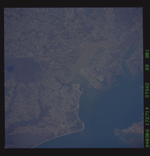
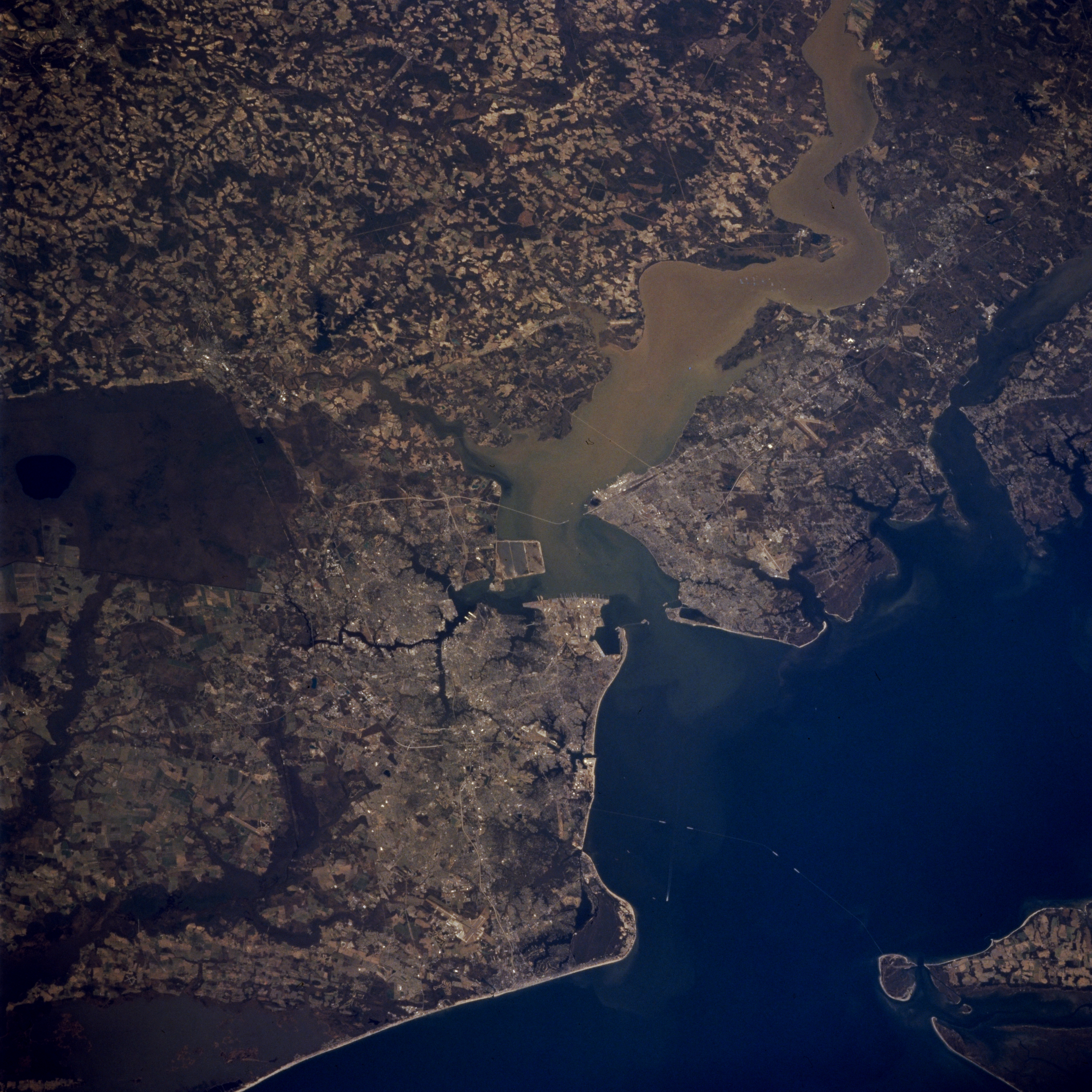
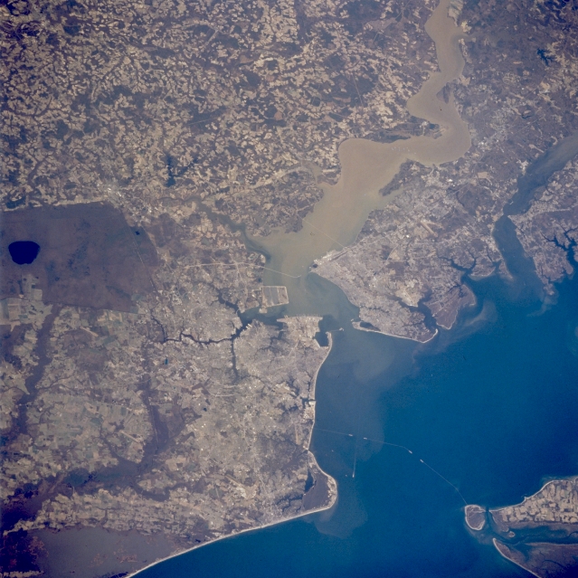
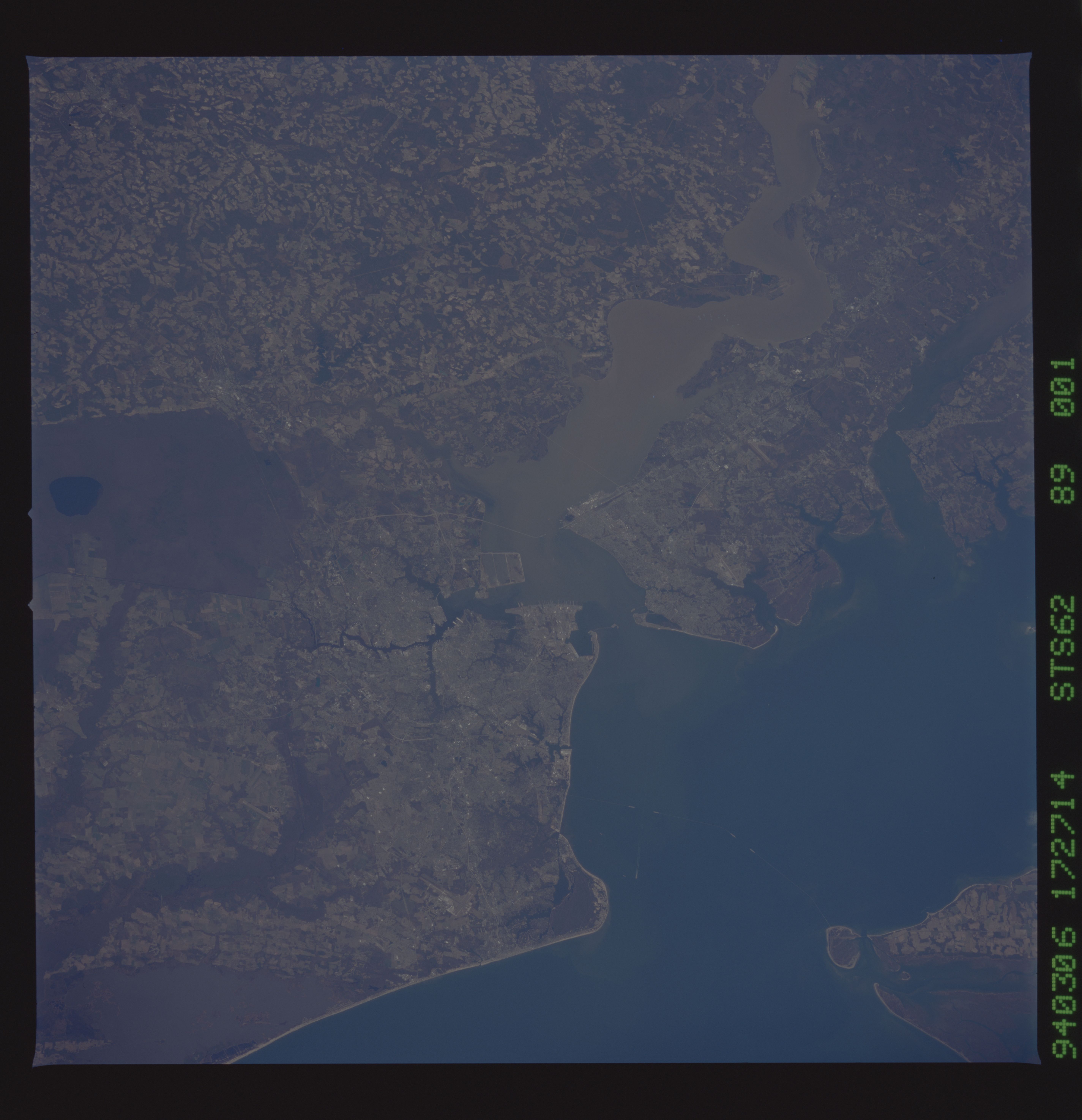
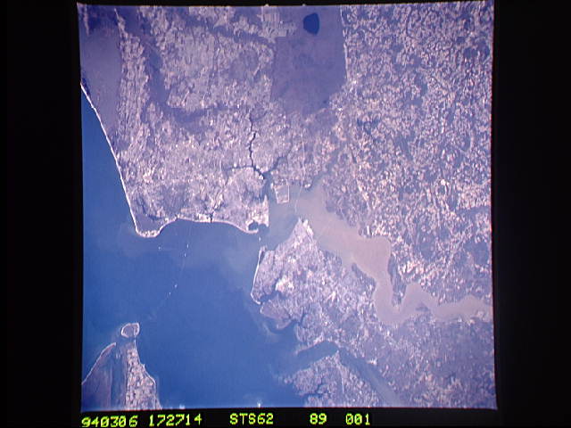
Image Caption: STS062-089-001 JAMES RIVER; NORFOLK, VIRGINIA MARCH, 1994
This west-looking view shows the brown, turbid James River entering Hampton Roads, near the mouth of the Chesapeake Bay (lower right). Hampton Roads is one of the best natural harbors in the U.S. and has been a major anchorage point since colonial times. In March of 1862, Hampton Roads was the site of the Civil War Battle between the Ironclad Monitor and Merrimack. The James River is still navigable for large ships to Richmond, Virginia, 100 miles (160 km) upstream. Norfolk, Virginia is the urban region developed along the southern shore of the James where it enters the Chesapeake Bay. North of Hampton Roads are the smaller cities of Newport News and Hampton. Near the right side of the image is the historic city of Williamsburg, located between the James and York Rivers
Other key features in this region include the Dismal Swamp, the dark region at center left. Though much larger in the past, the swamp has been drained and now covers a little more than 600 sq. miles (1554 sq. km). The southern tip of the Delmarva Peninsula is visible near the lower right corner. The linear feature crossing the mouth of the Chesapeake Bay is the Chesapeake Bay Bridge and Tunnel that connects the Delmarva Peninsula (lower right) with the city of Norfolk on the mainland.
