STS062-86-196
| NASA Photo ID | STS062-86-196 |
| Focal Length | 250mm |
| Date taken | 1994.03.12 |
| Time taken | 07:42:36 GMT |
Cloud masks available for this image:
Spacecraft nadir point: 19.0° N, 67.6° E
Photo center point:
Photo center point by machine learning:
Photo center point:
Photo center point by machine learning:
Nadir to Photo Center:
Spacecraft Altitude: 163 nautical miles (302km)
Camera: | Hasselblad |
Focal Length: | 250mm |
Camera Tilt: | Low Oblique |
Format: | 5046: Kodak, natural color positive, Lumiere 100/5046, ASA 100, standard base |
Film Exposure: | Normal |
| Additional Information | |
| Width | Height | Annotated | Cropped | Purpose | Links |
|---|---|---|---|---|---|
| 5700 pixels | 5900 pixels | No | No | Download Image | |
| 500 pixels | 518 pixels | No | No | Download Image | |
| 640 pixels | 480 pixels | No | No | Download Image |
Download Packaged File
Download a Google Earth KML for this Image
View photo footprint information
Download a GeoTIFF for this photo
Image Caption: STS062-87-153 Saint Lawrence River
The Saint Lawrence River can be seen just below the tail of the Space
Shuttle in this northwest looking panoramic view. From Lake Ontario to
the Atlantic Ocean, the Saint Lawrence River flows some 750 km. Just
above the Saint Lawrence and to the left of the shuttle tail is the
circular, 100 km wide Manicouagan impact crater. To the right center
of the view is the Gulf of Saint Lawrence. The view along the coast
includes Cape Cod on the lower left to the Bay of Fundy, and Nova
Scotia to the lower right. W147
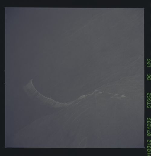
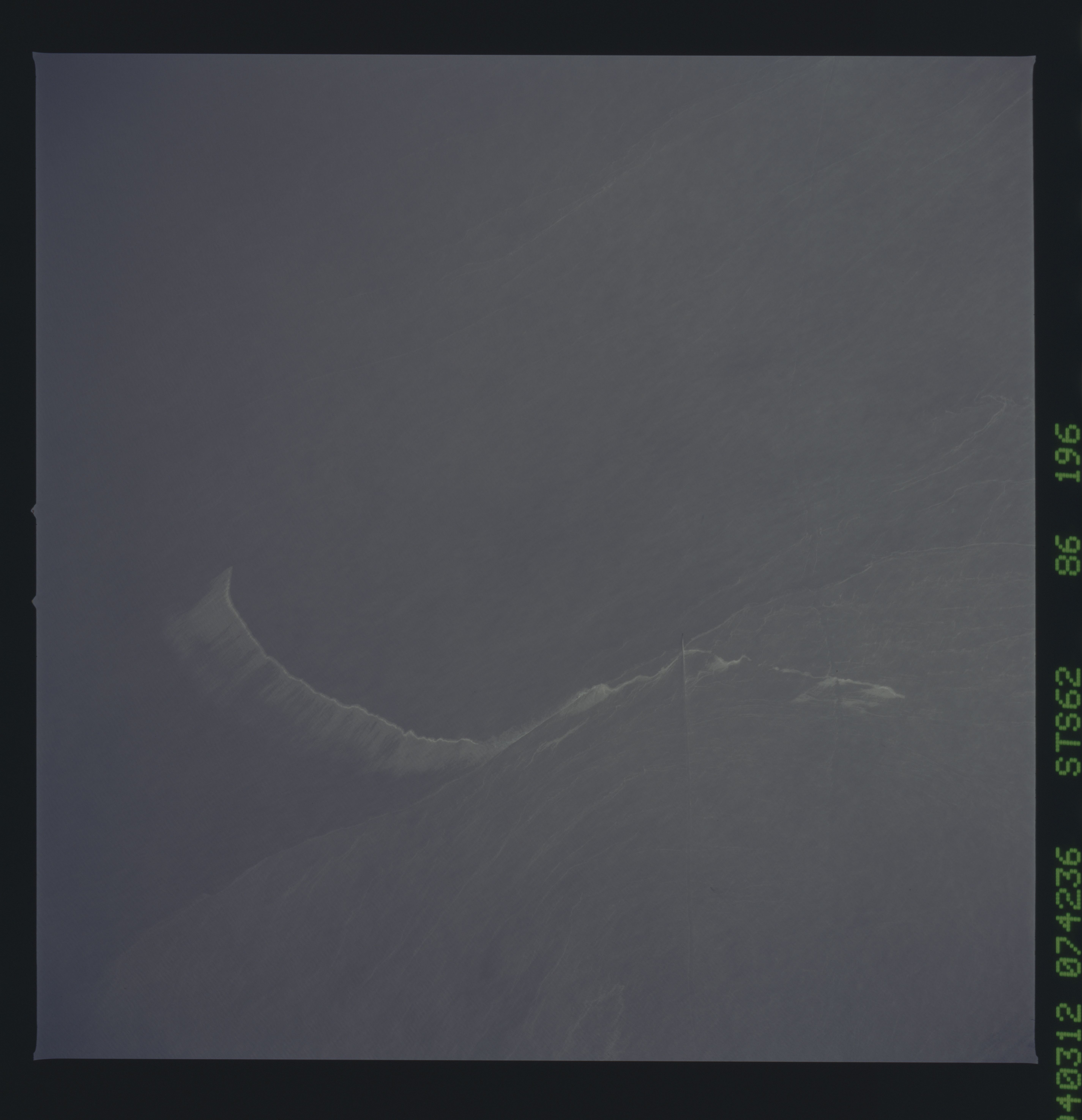
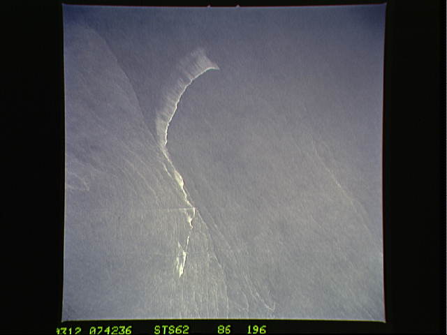
The photo depicts many of the types of ocean features seen when illuminated by sunglint. These features include a shear line, bilge dump, currents, and ship wakes. Winds, currents and oils effect the smoothness of the surface of the water. The oils smooth the water which reflect the sun more than the rougher surrounding water. This is seen in the bright curved line which is a bilge dump of oily water from a ship. The oils then start to take the form of the currents and in this case are also being blown by the surface winds. The shear line is approximately 240 miles west of Bombay, India. This shear line appears to be a result of two water masses, moving at slightly different speeds, having converged. Ship wakes, such as those in the photo, which cross a shear line, often give us an indication of the relative strength of a shear.
The Saint Lawrence River can be seen just below the tail of the Space
Shuttle in this northwest looking panoramic view. From Lake Ontario to
the Atlantic Ocean, the Saint Lawrence River flows some 750 km. Just
above the Saint Lawrence and to the left of the shuttle tail is the
circular, 100 km wide Manicouagan impact crater. To the right center
of the view is the Gulf of Saint Lawrence. The view along the coast
includes Cape Cod on the lower left to the Bay of Fundy, and Nova
Scotia to the lower right. W147
The photo depicts many of the types of ocean features seen when illuminated by sunglint. These features include a shear line, bilge dump, currents, and ship wakes. Winds, currents and oils effect the smoothness of the surface of the water. The oils smooth the water which reflect the sun more than the rougher surrounding water. This is seen in the bright curved line which is a bilge dump of oily water from a ship. The oils then start to take the form of the currents and in this case are also being blown by the surface winds. The shear line is approximately 240 miles west of Bombay, India. This shear line appears to be a result of two water masses, moving at slightly different speeds, having converged. Ship wakes, such as those in the photo, which cross a shear line, often give us an indication of the relative strength of a shear.
