STS062-86-106
| NASA Photo ID | STS062-86-106 |
| Focal Length | 250mm |
| Date taken | 1994.03.11 |
| Time taken | 16:30:06 GMT |
Resolutions offered for this image:
3904 x 3904 pixels 639 x 639 pixels 5700 x 5900 pixels 500 x 518 pixels 640 x 480 pixels
3904 x 3904 pixels 639 x 639 pixels 5700 x 5900 pixels 500 x 518 pixels 640 x 480 pixels
Cloud masks available for this image:
Spacecraft nadir point: 34.9° N, 93.3° W
Photo center point: 33.5° N, 91.0° W
Photo center point by machine learning:
Photo center point: 33.5° N, 91.0° W
Photo center point by machine learning:
Nadir to Photo Center: Southeast
Spacecraft Altitude: 161 nautical miles (298km)
Country or Geographic Name: | USA-MISSISSIPPI |
Features: | ARKANSAS & MISSISSIPPI R |
| Features Found Using Machine Learning: | |
Cloud Cover Percentage: | 0 (no clouds present) |
Sun Elevation Angle: | 43° |
Sun Azimuth: | 139° |
Camera: | Hasselblad |
Focal Length: | 250mm |
Camera Tilt: | 45 degrees |
Format: | 5046: Kodak, natural color positive, Lumiere 100/5046, ASA 100, standard base |
Film Exposure: | Normal |
| Additional Information | |
| Width | Height | Annotated | Cropped | Purpose | Links |
|---|---|---|---|---|---|
| 3904 pixels | 3904 pixels | No | No | Earth From Space collection | Download Image |
| 639 pixels | 639 pixels | No | No | Earth From Space collection | Download Image |
| 5700 pixels | 5900 pixels | No | No | Download Image | |
| 500 pixels | 518 pixels | No | No | Download Image | |
| 640 pixels | 480 pixels | No | No | Download Image |
Download Packaged File
Download a Google Earth KML for this Image
View photo footprint information
Download a GeoTIFF for this photo
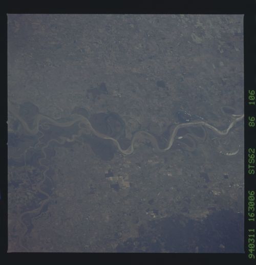
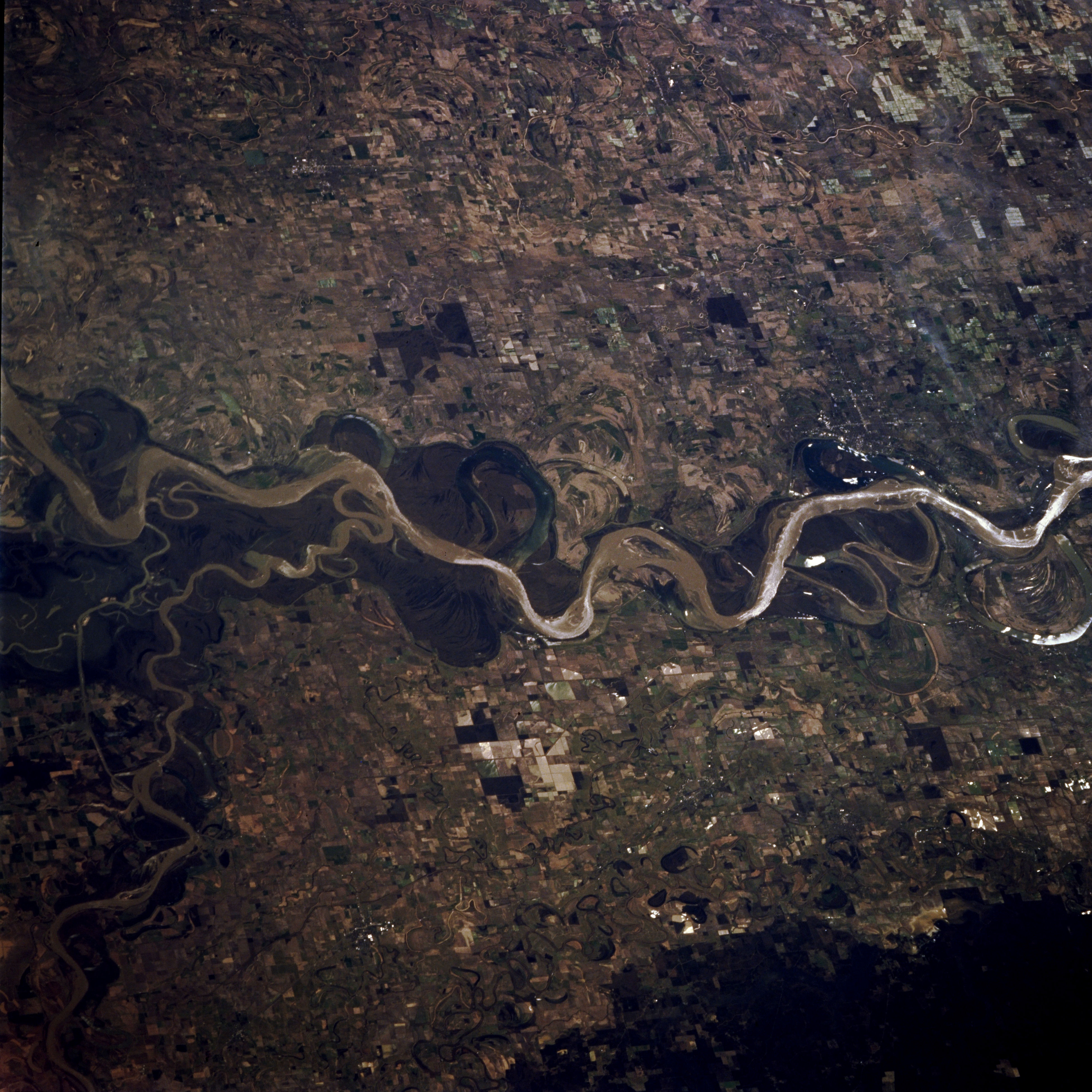
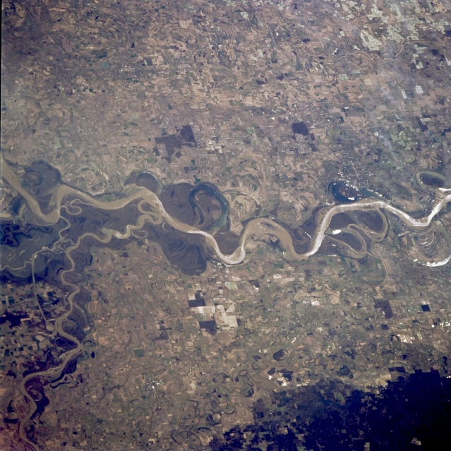
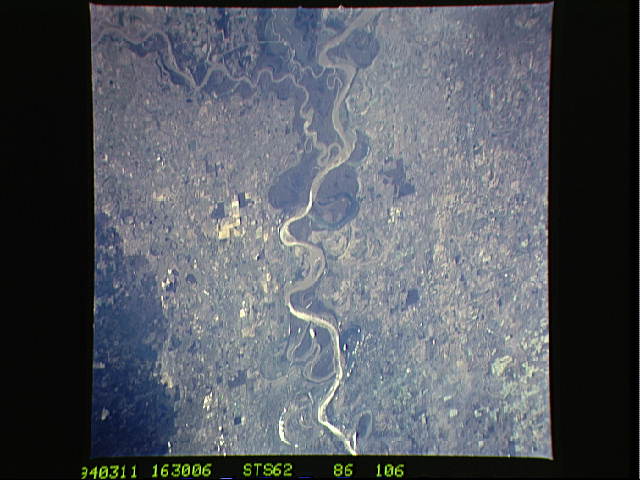
Image Caption: STS062-086-106 Mississippi River Floodplain, Arkansas, U.S.A. March 1994
The serpentine main channel of the Mississippi River is visible in its broad east-west floodplain in which the multitude of field patterns evidences fertile soils. Apparent are several scars where the former main course of the river created oxbow lakes. The smaller, meandering Arkansas River flows into the Mississippi River. The darker landscape along the rivers are swampy, heavily vegetated woodlands; the darker area (bottom right) is elevated, forested terrain.
The serpentine main channel of the Mississippi River is visible in its broad east-west floodplain in which the multitude of field patterns evidences fertile soils. Apparent are several scars where the former main course of the river created oxbow lakes. The smaller, meandering Arkansas River flows into the Mississippi River. The darker landscape along the rivers are swampy, heavily vegetated woodlands; the darker area (bottom right) is elevated, forested terrain.
