STS062-84-28
| NASA Photo ID | STS062-84-28 |
| Focal Length | 250mm |
| Date taken | 1994.03.16 |
| Time taken | 16:35:13 GMT |
Resolutions offered for this image:
794 x 798 pixels 5700 x 5900 pixels 500 x 518 pixels 640 x 480 pixels
794 x 798 pixels 5700 x 5900 pixels 500 x 518 pixels 640 x 480 pixels

Cloud masks available for this image:
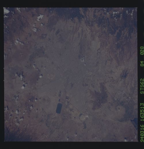
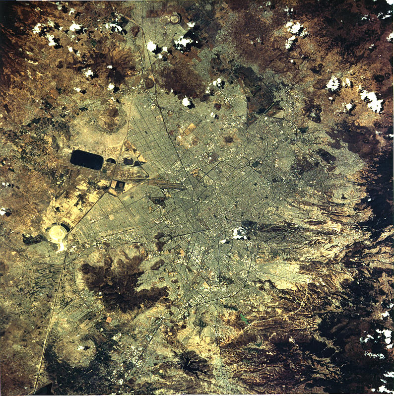
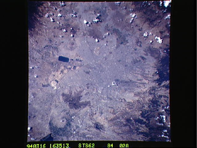
Spacecraft nadir point: 18.6° N, 98.5° W
Photo center point: 19.5° N, 99.0° W
Photo center point by machine learning:
Photo center point: 19.5° N, 99.0° W
Photo center point by machine learning:
Nadir to Photo Center: Northwest
Spacecraft Altitude: 116 nautical miles (215km)
Country or Geographic Name: | MEXICO |
Features: | MEXICO CITY, MTS., VOL. |
| Features Found Using Machine Learning: | |
Cloud Cover Percentage: | 5 (1-10)% |
Sun Elevation Angle: | 53° |
Sun Azimuth: | 119° |
Camera: | Hasselblad |
Focal Length: | 250mm |
Camera Tilt: | 28 degrees |
Format: | 5046: Kodak, natural color positive, Lumiere 100/5046, ASA 100, standard base |
Film Exposure: | Normal |
| Additional Information | |
| Width | Height | Annotated | Cropped | Purpose | Links |
|---|---|---|---|---|---|
| 794 pixels | 798 pixels | No | No | Cities collection | Download Image |
| 5700 pixels | 5900 pixels | No | No | Download Image | |
| 500 pixels | 518 pixels | No | No | Download Image | |
| 640 pixels | 480 pixels | No | No | Download Image |
Download Packaged File
Download a Google Earth KML for this Image
View photo footprint information
Download a GeoTIFF for this photo
Image Caption: This image is the clearest photo of Mexico City, Mexico taken from U.S. Manned Spacecraft. North is to the upper right. Mexico City sits in a basin surrounded by large volcanoes. The restricted atmospheric circulation in the basin, coupled with the inevitable air emissions produced by a city of 20 million people has created a critical air pollution problem for the city. In most photographs of the region, Mexico City is obscured by haze. The clarity of the photograph allows many key cultural features to be identified, including all of the major boulevards, the horse track (western part of the city), the university (south of the city), and the museum areas. Large, man-made ponds east of the city also stand out.
