STS062-83-9
| NASA Photo ID | STS062-83-9 |
| Focal Length | 250mm |
| Date taken | 1994.03.05 |
| Time taken | 15:41:11 GMT |
Resolutions offered for this image:
3904 x 3904 pixels 639 x 639 pixels 5700 x 5900 pixels 500 x 518 pixels 640 x 480 pixels
3904 x 3904 pixels 639 x 639 pixels 5700 x 5900 pixels 500 x 518 pixels 640 x 480 pixels
Cloud masks available for this image:
Spacecraft nadir point: 37.7° N, 85.1° W
Photo center point: 37.0° N, 88.0° W
Photo center point by machine learning:
Photo center point: 37.0° N, 88.0° W
Photo center point by machine learning:
Nadir to Photo Center: West
Spacecraft Altitude: 161 nautical miles (298km)
Country or Geographic Name: | USA-KENTUCKY |
Features: | L. BARKLEY & KENTUCKY L. |
| Features Found Using Machine Learning: | |
Cloud Cover Percentage: | 0 (no clouds present) |
Sun Elevation Angle: | 37° |
Sun Azimuth: | 138° |
Camera: | Hasselblad |
Focal Length: | 250mm |
Camera Tilt: | 48 degrees |
Format: | 5046: Kodak, natural color positive, Lumiere 100/5046, ASA 100, standard base |
Film Exposure: | Normal |
| Additional Information | |
| Width | Height | Annotated | Cropped | Purpose | Links |
|---|---|---|---|---|---|
| 3904 pixels | 3904 pixels | No | No | Earth From Space collection | Download Image |
| 639 pixels | 639 pixels | No | No | Earth From Space collection | Download Image |
| 5700 pixels | 5900 pixels | No | No | Download Image | |
| 500 pixels | 518 pixels | No | No | Download Image | |
| 640 pixels | 480 pixels | No | No | Download Image |
Download Packaged File
Download a Google Earth KML for this Image
View photo footprint information
Download a GeoTIFF for this photo
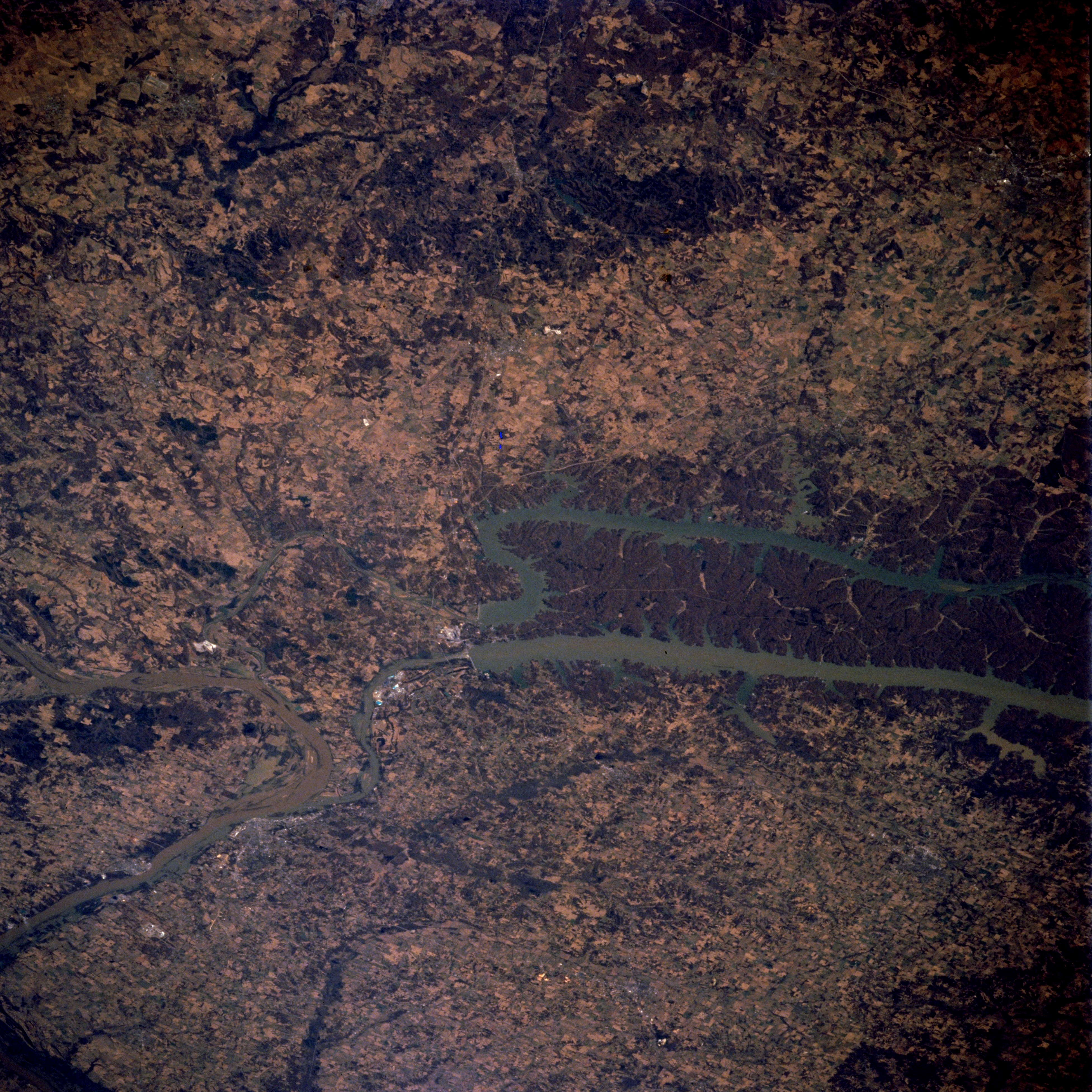
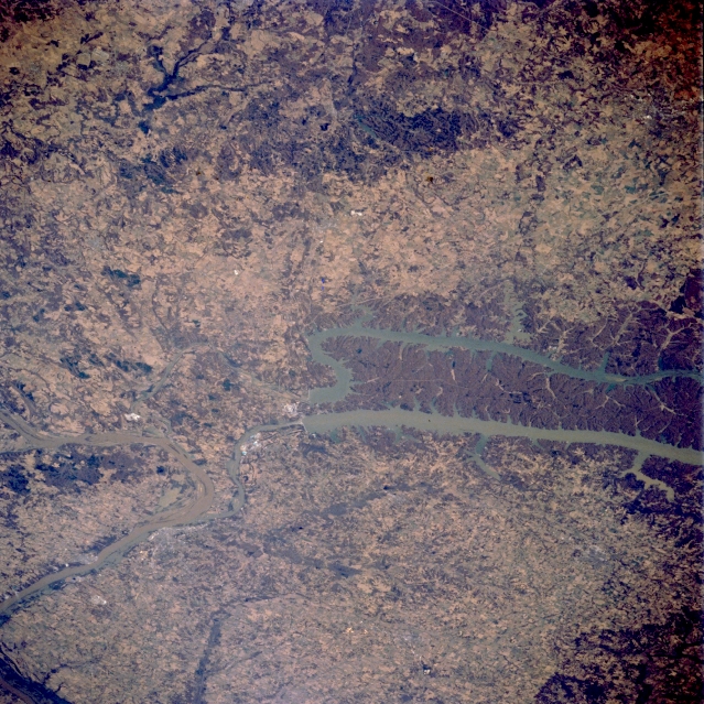
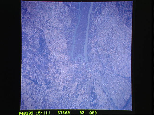
Image Caption: STS062-083-009 Kentucky Lake and Lake Barkley, Kentucky, U.S.A. March 1994
The northern ends of two long reservoirs, Kentucky Lake and Lake Barkley, are visible in this northwest-looking, low-oblique photograph of western Kentucky. Westernmost Kentucky Lake is fed by the Tennessee River; Lake Barkley is part of the Cumberland River drainage basin. Each lake has a dam and channel that allow water to flow into the Ohio River, which makes a U-turn at this location. The heavily wooded peninsula between the lakes is called locally "the land between the lakes." Both lakes are under the aegis of the Tennessee Valley Authority, which was created to provide hydroelectric power, improve navigation of the rivers, and reduce flooding on the Tennessee and Cumberland Rivers and some of their tributaries. Most of the region east of the lakes is hilly; west of the lakes the landscape becomes a plain.
The northern ends of two long reservoirs, Kentucky Lake and Lake Barkley, are visible in this northwest-looking, low-oblique photograph of western Kentucky. Westernmost Kentucky Lake is fed by the Tennessee River; Lake Barkley is part of the Cumberland River drainage basin. Each lake has a dam and channel that allow water to flow into the Ohio River, which makes a U-turn at this location. The heavily wooded peninsula between the lakes is called locally "the land between the lakes." Both lakes are under the aegis of the Tennessee Valley Authority, which was created to provide hydroelectric power, improve navigation of the rivers, and reduce flooding on the Tennessee and Cumberland Rivers and some of their tributaries. Most of the region east of the lakes is hilly; west of the lakes the landscape becomes a plain.
