STS062-82-104
| NASA Photo ID | STS062-82-104 |
| Focal Length | 250mm |
| Date taken | 1994.03.10 |
| Time taken | 17:56:16 GMT |
Resolutions offered for this image:
3904 x 3904 pixels 639 x 639 pixels 5700 x 5900 pixels 500 x 518 pixels 640 x 480 pixels
3904 x 3904 pixels 639 x 639 pixels 5700 x 5900 pixels 500 x 518 pixels 640 x 480 pixels
Cloud masks available for this image:
Spacecraft nadir point: 31.7° N, 98.3° W
Photo center point: 29.5° N, 95.5° W
Photo center point by machine learning:
Photo center point: 29.5° N, 95.5° W
Photo center point by machine learning:
Nadir to Photo Center: Southeast
Spacecraft Altitude: 161 nautical miles (298km)
Country or Geographic Name: | USA-TEXAS |
Features: | HOUSTON-GALVESTON AREA |
| Features Found Using Machine Learning: | |
Cloud Cover Percentage: | 0 (no clouds present) |
Sun Elevation Angle: | 53° |
Sun Azimuth: | 160° |
Camera: | Hasselblad |
Focal Length: | 250mm |
Camera Tilt: | 53 degrees |
Format: | 5046: Kodak, natural color positive, Lumiere 100/5046, ASA 100, standard base |
Film Exposure: | Normal |
| Additional Information | |
| Width | Height | Annotated | Cropped | Purpose | Links |
|---|---|---|---|---|---|
| 3904 pixels | 3904 pixels | No | No | Earth From Space collection | Download Image |
| 639 pixels | 639 pixels | No | No | Earth From Space collection | Download Image |
| 5700 pixels | 5900 pixels | No | No | Download Image | |
| 500 pixels | 518 pixels | No | No | Download Image | |
| 640 pixels | 480 pixels | No | No | Download Image |
Download Packaged File
Download a Google Earth KML for this Image
View photo footprint information
Download a GeoTIFF for this photo
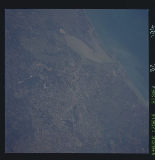
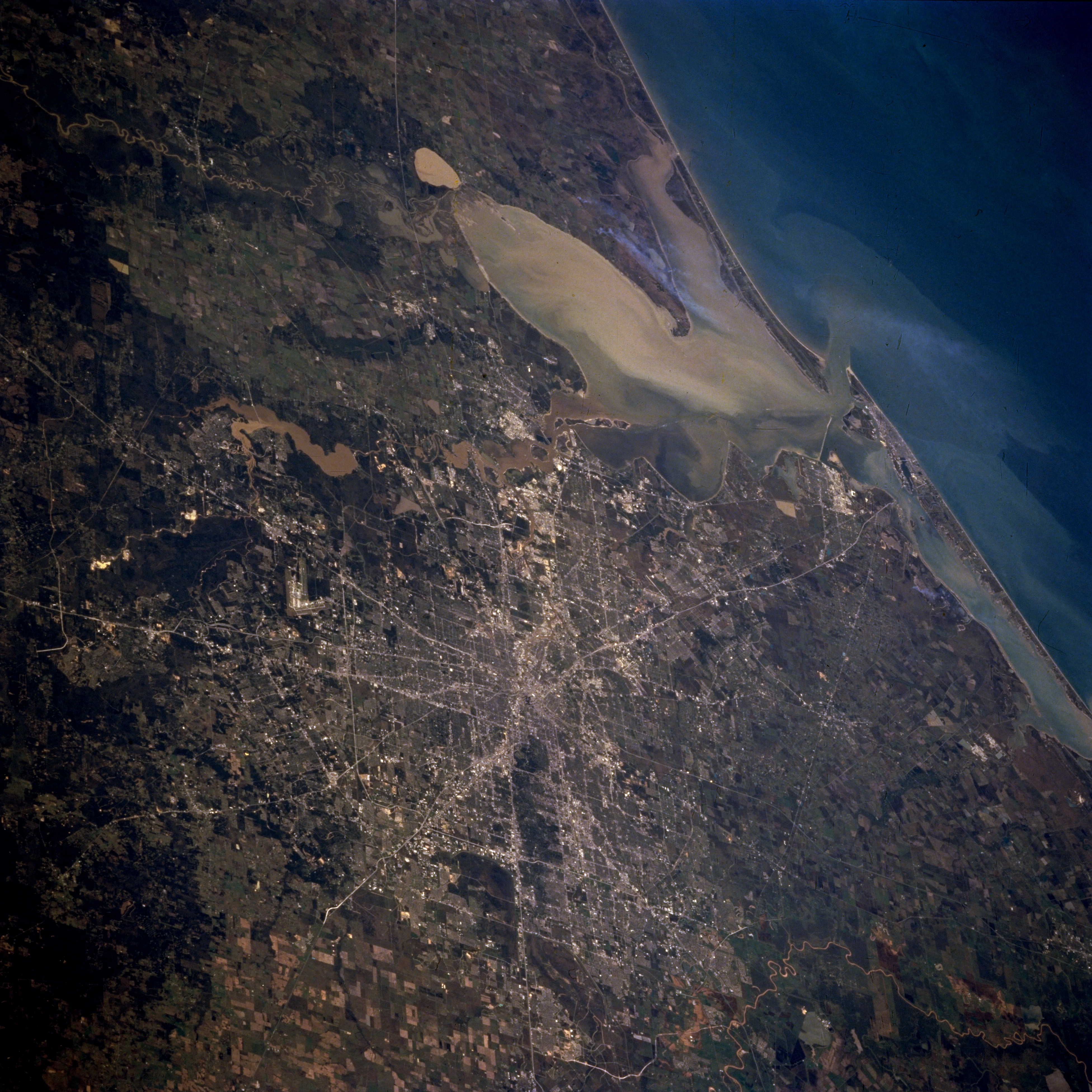
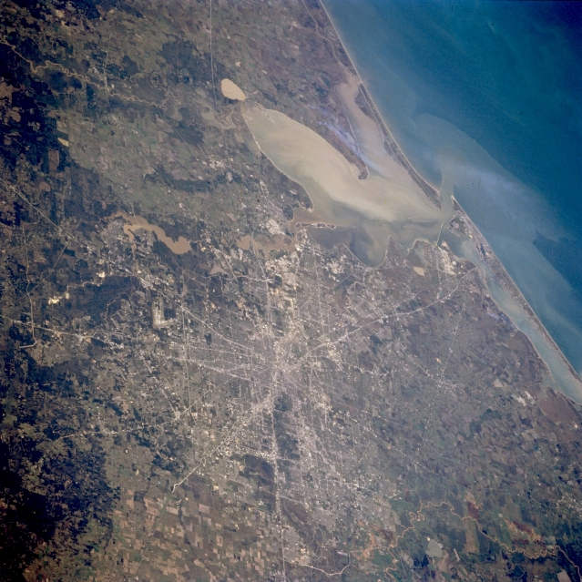
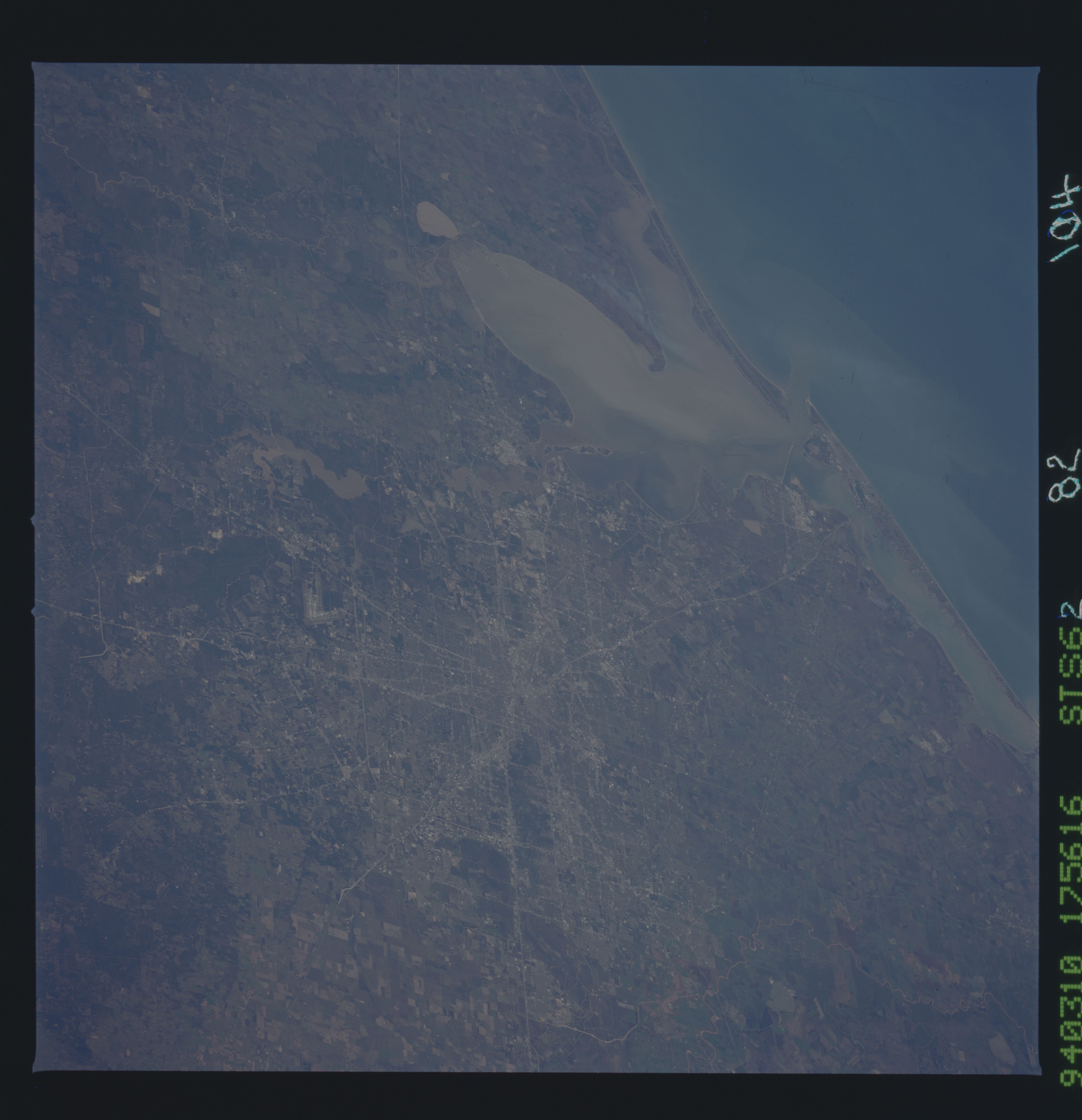
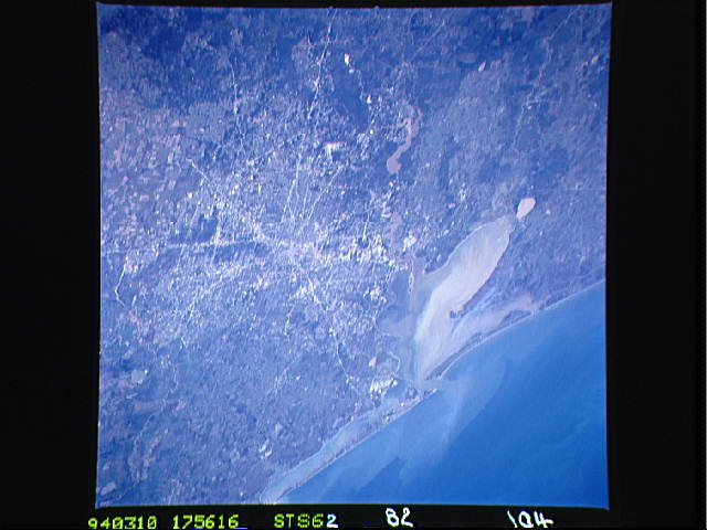
Image Caption: STS062-082-104 Houston, Texas, U.S.A. March 1994
This southeast-looking photograph depicts the flat coastal plain surrounding rapidly developing Houston. Major highway systems converging near downtown, Galveston Bay, and the Gulf of Mexico provide worldwide land and water connections. An extensive sediment plume in Galveston Bay has a small extension of the plume bleeding into the Gulf of Mexico. Visible are large cultivated fields west of Houston, mainly north of Interstate Highway 10; dark, forested lands, primarily pine forests, to the north; and muddy Lake Houston, a reservoir on the San Jacinto River, to the northeast.
This southeast-looking photograph depicts the flat coastal plain surrounding rapidly developing Houston. Major highway systems converging near downtown, Galveston Bay, and the Gulf of Mexico provide worldwide land and water connections. An extensive sediment plume in Galveston Bay has a small extension of the plume bleeding into the Gulf of Mexico. Visible are large cultivated fields west of Houston, mainly north of Interstate Highway 10; dark, forested lands, primarily pine forests, to the north; and muddy Lake Houston, a reservoir on the San Jacinto River, to the northeast.
