STS062-81-5
| NASA Photo ID | STS062-81-5 |
| Focal Length | 250mm |
| Date taken | 1994.03.04 |
| Time taken | 17:07:23 GMT |
Resolutions offered for this image:
3904 x 3875 pixels 639 x 635 pixels 5700 x 5900 pixels 500 x 518 pixels 640 x 480 pixels
3904 x 3875 pixels 639 x 635 pixels 5700 x 5900 pixels 500 x 518 pixels 640 x 480 pixels
Cloud masks available for this image:
Spacecraft nadir point: 39.0° N, 87.7° W
Photo center point: 38.5° N, 88.0° W
Photo center point by machine learning:
Photo center point: 38.5° N, 88.0° W
Photo center point by machine learning:
Nadir to Photo Center: Southwest
Spacecraft Altitude: 161 nautical miles (298km)
Country or Geographic Name: | USA-INDIANA |
Features: | MT. CARMEL, WABASH RIVER |
| Features Found Using Machine Learning: | |
Cloud Cover Percentage: | 0 (no clouds present) |
Sun Elevation Angle: | 43° |
Sun Azimuth: | 161° |
Camera: | Hasselblad |
Focal Length: | 250mm |
Camera Tilt: | 12 degrees |
Format: | 5046: Kodak, natural color positive, Lumiere 100/5046, ASA 100, standard base |
Film Exposure: | Normal |
| Additional Information | |
| Width | Height | Annotated | Cropped | Purpose | Links |
|---|---|---|---|---|---|
| 3904 pixels | 3875 pixels | No | No | Earth From Space collection | Download Image |
| 639 pixels | 635 pixels | No | No | Earth From Space collection | Download Image |
| 5700 pixels | 5900 pixels | No | No | Download Image | |
| 500 pixels | 518 pixels | No | No | Download Image | |
| 640 pixels | 480 pixels | No | No | Download Image |
Download Packaged File
Download a Google Earth KML for this Image
View photo footprint information
Download a GeoTIFF for this photo
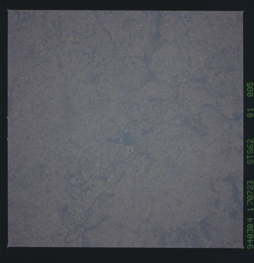
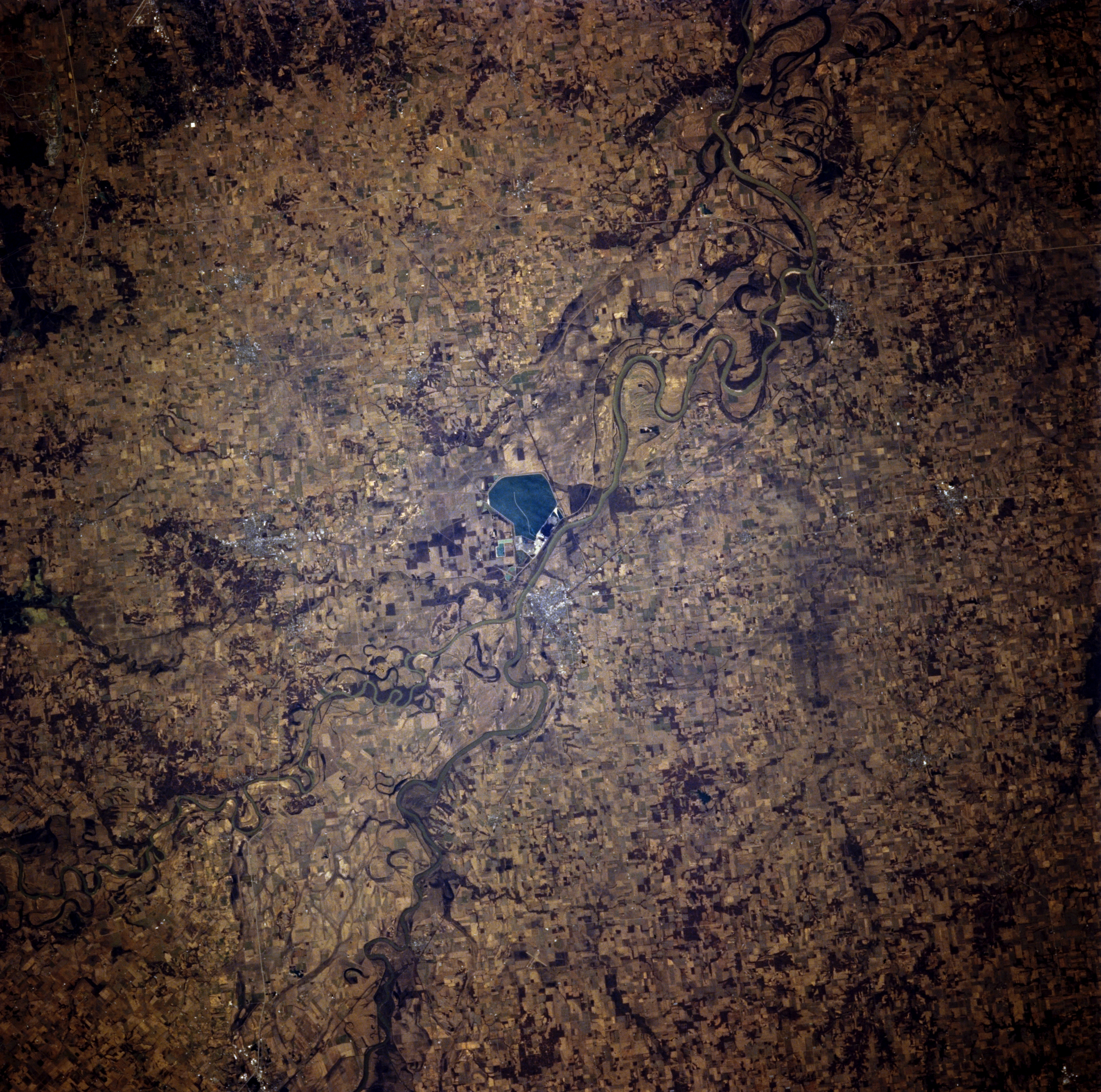
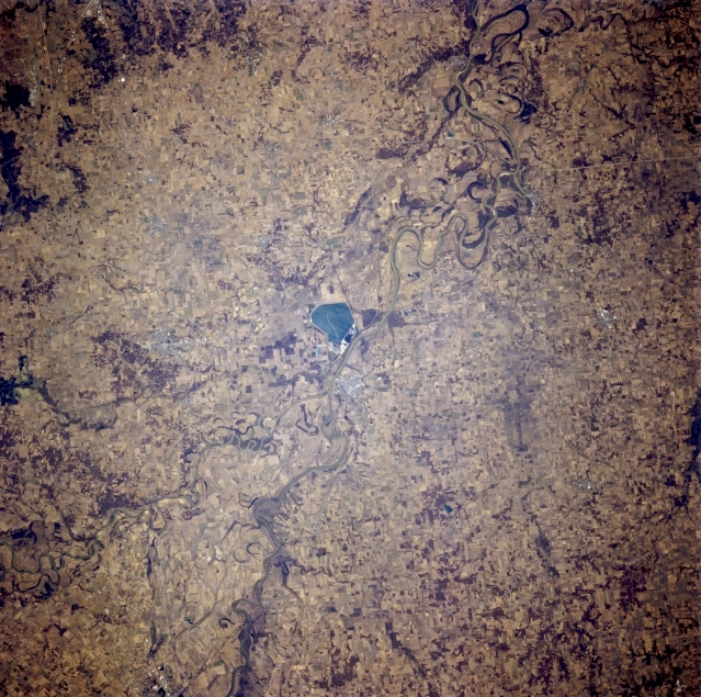
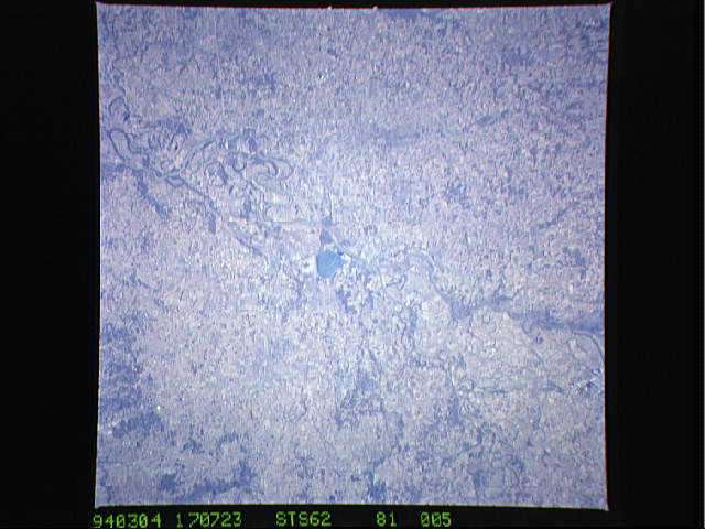
Image Caption: STS062-081-005 White River and Wabash River, Indiana, U.S.A. March 1994
Discernible in this near-vertical photograph are the White River and the Wabash River (left bottom center), which separates Illinois and Indiana. One of the Wabash's major tributaries, the White River, joins the Wabash north of a large pond visible near the center of the photograph. The fertile land on either side of the Wabash River is good for growing corn and soybeans and for raising livestock.
Discernible in this near-vertical photograph are the White River and the Wabash River (left bottom center), which separates Illinois and Indiana. One of the Wabash's major tributaries, the White River, joins the Wabash north of a large pond visible near the center of the photograph. The fertile land on either side of the Wabash River is good for growing corn and soybeans and for raising livestock.
