STS062-154-39
| NASA Photo ID | STS062-154-39 |
| Focal Length | 250mm |
| Date taken | 1994.03.16 |
| Time taken | 06:35:56 GMT |
Cloud masks available for this image:
Spacecraft nadir point: 34.9° S, 138.0° E
Photo center point: 35.0° S, 139.0° E
Photo center point by machine learning:
Photo center point: 35.0° S, 139.0° E
Photo center point by machine learning:
Nadir to Photo Center: East
Spacecraft Altitude: 140 nautical miles (259km)
Country or Geographic Name: | AUSTRALIA-SA |
Features: | L. ALEXANDRINA, MURRAY R |
| Features Found Using Machine Learning: | |
Cloud Cover Percentage: | 5 (1-10)% |
Sun Elevation Angle: | 30° |
Sun Azimuth: | 290° |
Camera: | Linhof |
Focal Length: | 250mm |
Camera Tilt: | 23 degrees |
Format: | 5048: Kodak, natural color positive, Lumiere 100x/5048, ASA 100x, standard base |
Film Exposure: | Normal |
| Additional Information | |
| Width | Height | Annotated | Cropped | Purpose | Links |
|---|---|---|---|---|---|
| 5056 pixels | 3968 pixels | No | No | Earth From Space collection | Download Image |
| 640 pixels | 502 pixels | No | No | Earth From Space collection | Download Image |
| 640 pixels | 480 pixels | No | No | ISD 1 | Download Image |
Download Packaged File
Download a Google Earth KML for this Image
View photo footprint information
Download a GeoTIFF for this photo
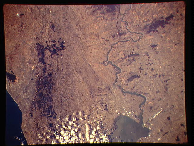
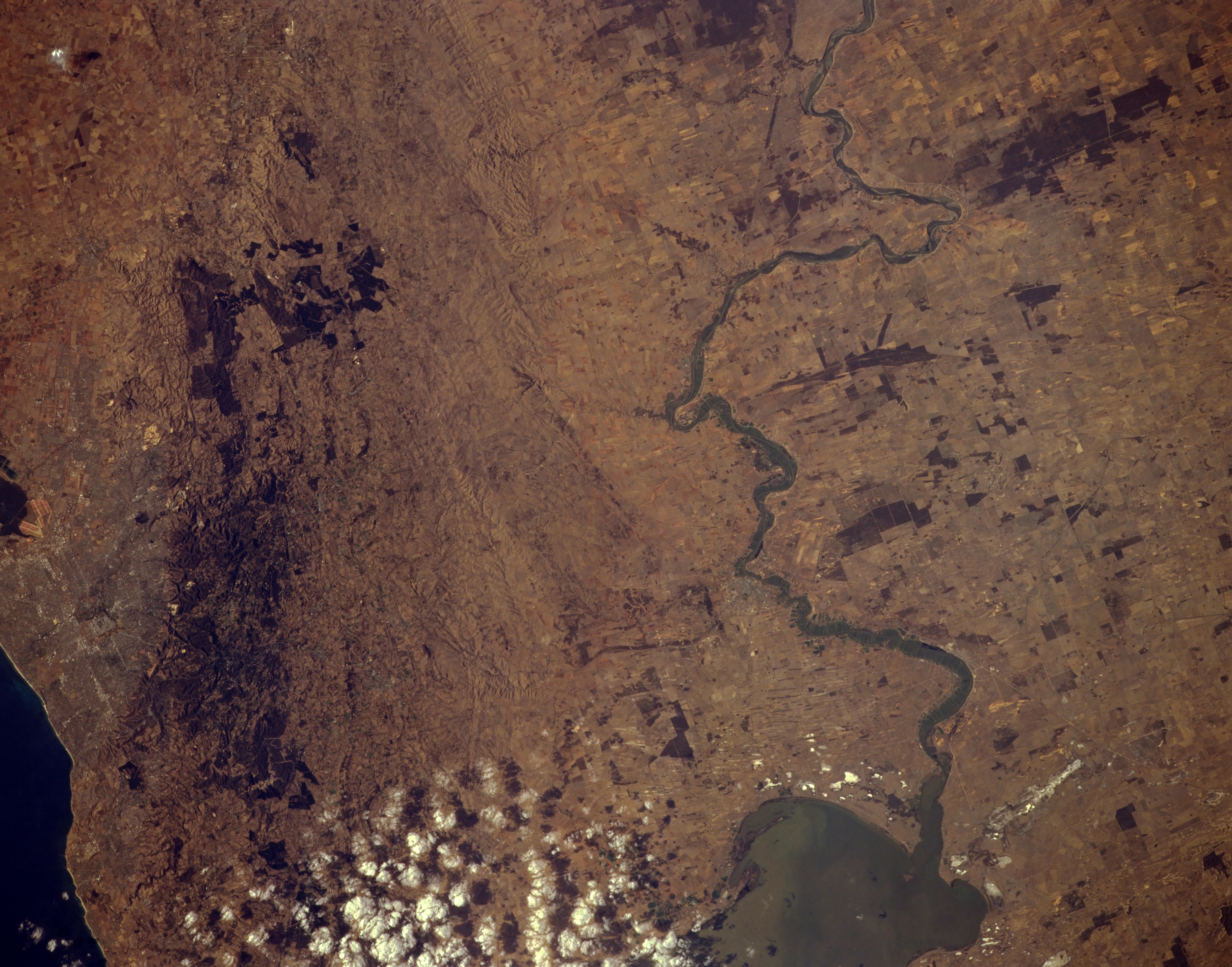
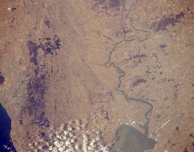
Image Caption: STS062-154-039 Murray River Basin, South Australia, Australia March 1994
The photograph shows three distinct geographic regions that are part of southeast South Australia. From east to west (right to left) these regions are the Murray River Basin (eastern half of the image); the faulted and fractured Mt. Lofty Range; and part of the largest city in South Australia, Adelaide (barely discernible). Sometimes called Australia's Mississippi River, the lower extent of the Murray River is visible as it snakes its way across an agricultural landscape. The Murray River eventually flows into estuarine Lake Alexandrina (near bottom center). The square block of varying shades of brown represent large tracts of land indicative of an important agricultural region. The agriculture includes dairying, vegetable gardening, fruit crops, and wool production. The darker areas (lower left) towards the western side of the Mt. Lofty Range are forest. The very dark areas (upper left) appear to be large cultivated tracts of land, perhaps vineyards. This region has a Mediterranean climate and is noted for its superior wines.
The photograph shows three distinct geographic regions that are part of southeast South Australia. From east to west (right to left) these regions are the Murray River Basin (eastern half of the image); the faulted and fractured Mt. Lofty Range; and part of the largest city in South Australia, Adelaide (barely discernible). Sometimes called Australia's Mississippi River, the lower extent of the Murray River is visible as it snakes its way across an agricultural landscape. The Murray River eventually flows into estuarine Lake Alexandrina (near bottom center). The square block of varying shades of brown represent large tracts of land indicative of an important agricultural region. The agriculture includes dairying, vegetable gardening, fruit crops, and wool production. The darker areas (lower left) towards the western side of the Mt. Lofty Range are forest. The very dark areas (upper left) appear to be large cultivated tracts of land, perhaps vineyards. This region has a Mediterranean climate and is noted for its superior wines.
