STS062-153-203
| NASA Photo ID | STS062-153-203 |
| Focal Length | 250mm |
| Date taken | 1994.03.17 |
| Time taken | 13:12:08 GMT |


Cloud masks available for this image:
Spacecraft nadir point: 34.6° N, 88.0° W
Photo center point: 33.5° N, 87.5° W
Photo center point by machine learning:
Photo center point: 33.5° N, 87.5° W
Photo center point by machine learning:
Nadir to Photo Center: South
Spacecraft Altitude: 106 nautical miles (196km)
Country or Geographic Name: | USA-ALABAMA |
Features: | BIRMINGHAM, APPALACHIAN R |
| Features Found Using Machine Learning: | |
Cloud Cover Percentage: | 5 (1-10)% |
Sun Elevation Angle: | 14° |
Sun Azimuth: | 101° |
Camera: | Linhof |
Focal Length: | 250mm |
Camera Tilt: | 34 degrees |
Format: | 5048: Kodak, natural color positive, Lumiere 100x/5048, ASA 100x, standard base |
Film Exposure: | Normal |
| Additional Information | |
| Width | Height | Annotated | Cropped | Purpose | Links |
|---|---|---|---|---|---|
| 4096 pixels | 5184 pixels | No | No | Earth From Space collection | Download Image |
| 505 pixels | 640 pixels | No | No | Earth From Space collection | Download Image |
| 640 pixels | 480 pixels | No | No | ISD 1 | Download Image |
Download Packaged File
Download a Google Earth KML for this Image
View photo footprint information
Download a GeoTIFF for this photo
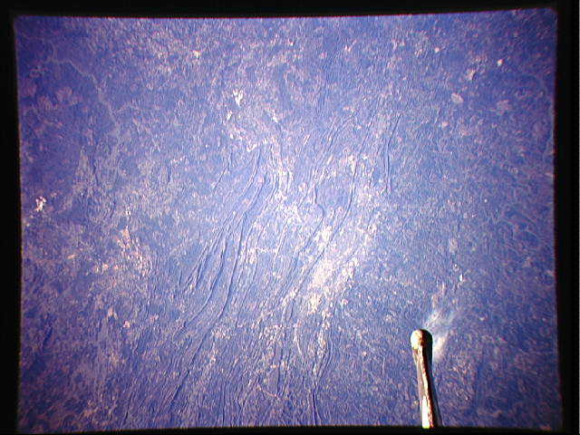
Image Caption: STS062-153-203 Birmingham, Alabama, U.S.A. March 1994
The growth pattern of Birmingham, the "Pittsburgh of the South," is determined by the northeast-southwest alignment of low mountains in north-central Alabama. The shadowed, northwest-facing slopes of several taller ridges help accentuate the topographic relief of the photograph. The street patterns of Birmingham are not discernible; however, the general northeast-southwest development within the valley is apparent--Bessemer, a smaller, steel-producing city southwest of Birmingham, was the major source of economic development for the region during the mid-1900s. Proximity to nearby coal fields and large iron ore deposits helped to develop the region. Reflective Birmingham International Airport is barely discernible northeast of Birmingham. The tip of the Space Shuttle tail is apparent in the lower left corner of the photograph.
The growth pattern of Birmingham, the "Pittsburgh of the South," is determined by the northeast-southwest alignment of low mountains in north-central Alabama. The shadowed, northwest-facing slopes of several taller ridges help accentuate the topographic relief of the photograph. The street patterns of Birmingham are not discernible; however, the general northeast-southwest development within the valley is apparent--Bessemer, a smaller, steel-producing city southwest of Birmingham, was the major source of economic development for the region during the mid-1900s. Proximity to nearby coal fields and large iron ore deposits helped to develop the region. Reflective Birmingham International Airport is barely discernible northeast of Birmingham. The tip of the Space Shuttle tail is apparent in the lower left corner of the photograph.
