STS062-153-137
| NASA Photo ID | STS062-153-137 |
| Focal Length | 90mm |
| Date taken | 1994.03.__ |
| Time taken | GMT |
Cloud masks available for this image:
Spacecraft nadir point:
Photo center point: 31.5° N, 88.0° W
Photo center point by machine learning:
Photo center point: 31.5° N, 88.0° W
Photo center point by machine learning:
Nadir to Photo Center:
Spacecraft Altitude: nautical miles (0km)
Country or Geographic Name: | USA-ALABAMA |
Features: | ALABAMA & TOMBIGBEE RIV. |
| Features Found Using Machine Learning: | |
Cloud Cover Percentage: | 0 (no clouds present) |
Sun Elevation Angle: | ° |
Sun Azimuth: | ° |
Camera: | Linhof |
Focal Length: | 90mm |
Camera Tilt: | Low Oblique |
Format: | 5046: Kodak, natural color positive, Lumiere 100/5046, ASA 100, standard base |
Film Exposure: | Normal |
| Additional Information | |
| Width | Height | Annotated | Cropped | Purpose | Links |
|---|---|---|---|---|---|
| 5184 pixels | 4096 pixels | No | No | Earth From Space collection | Download Image |
| 640 pixels | 505 pixels | No | No | Earth From Space collection | Download Image |
| 640 pixels | 480 pixels | No | No | ISD 1 | Download Image |
Download Packaged File
Download a Google Earth KML for this Image
View photo footprint information
Download a GeoTIFF for this photo
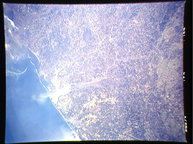
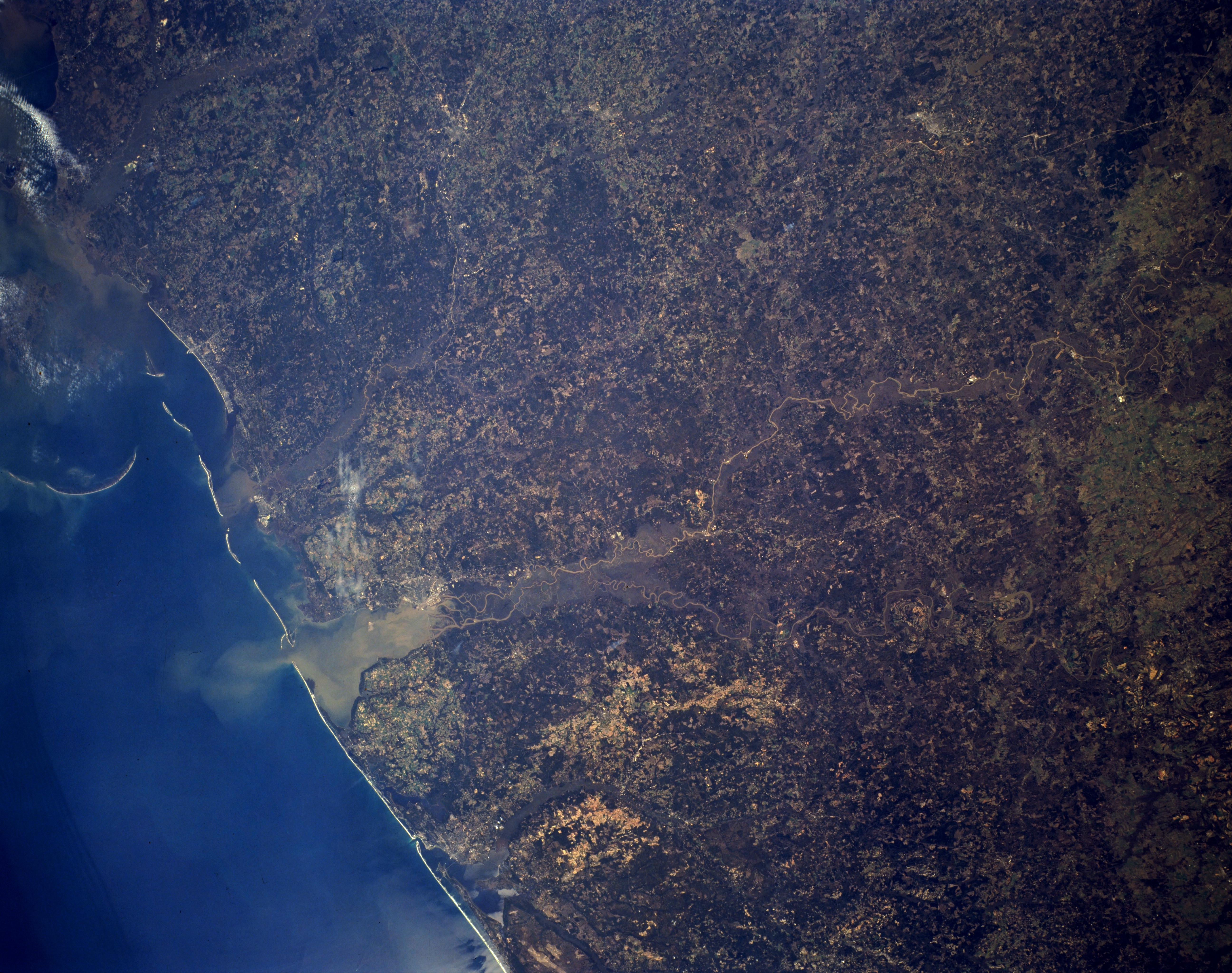
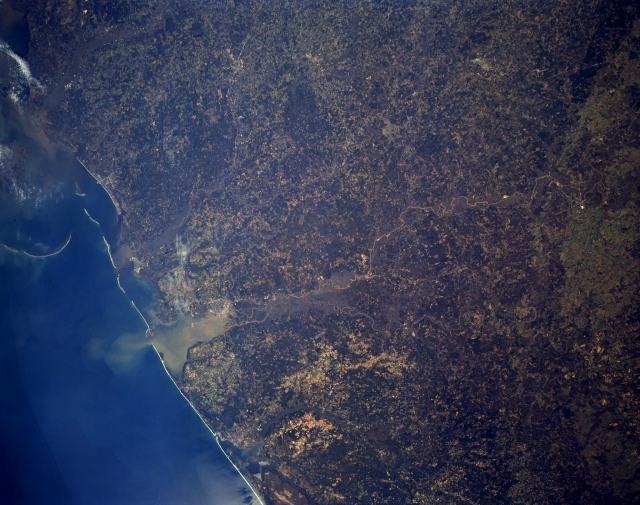
Image Caption: STS062-153-137 Mobile Bay, Alabama, U.S.A. March 1994
Featured in this synoptic, northwest-looking photograph are sediment-laden Mobile Bay; the coastlines of southern Mississippi and Alabama extending from the Pearl River floodplain in the west (upper left) to just west of Pensacola, Florida, in the east (bottom center); and the highly reflective, sandy beaches of the barrier islands that help protect the Intracoastal Waterway. Mobile is barely discernible northwest of Mobile Bay, north of which is an extensive delta and floodplain created by the convergence of two rivers--light, meandering Tombigbee and the southwest-flowing Alabama. Apparent are dark, forested lands interspersed with lighter agricultural areas. The Talladega National Forest is visible north-northeast of Mobile (right edge of photograph).
Featured in this synoptic, northwest-looking photograph are sediment-laden Mobile Bay; the coastlines of southern Mississippi and Alabama extending from the Pearl River floodplain in the west (upper left) to just west of Pensacola, Florida, in the east (bottom center); and the highly reflective, sandy beaches of the barrier islands that help protect the Intracoastal Waterway. Mobile is barely discernible northwest of Mobile Bay, north of which is an extensive delta and floodplain created by the convergence of two rivers--light, meandering Tombigbee and the southwest-flowing Alabama. Apparent are dark, forested lands interspersed with lighter agricultural areas. The Talladega National Forest is visible north-northeast of Mobile (right edge of photograph).
