STS062-114-15

| NASA Photo ID | STS062-114-15 |
| Focal Length | 40mm |
| Date taken | 1994.03.13 |
| Time taken | 08:08:07 GMT |
Resolutions offered for this image:
3872 x 3872 pixels 639 x 639 pixels 5700 x 5900 pixels 500 x 518 pixels 640 x 480 pixels
3872 x 3872 pixels 639 x 639 pixels 5700 x 5900 pixels 500 x 518 pixels 640 x 480 pixels
Cloud masks available for this image:
Spacecraft nadir point: 26.8° S, 116.8° E
Photo center point: 24.0° S, 114.0° E
Photo center point by machine learning:
Photo center point: 24.0° S, 114.0° E
Photo center point by machine learning:
Nadir to Photo Center: Northwest
Spacecraft Altitude: 164 nautical miles (304km)
Country or Geographic Name: | AUSTRALIA-WA |
Features: | LAKE MCLEOD, GASCOYNE R. |
| Features Found Using Machine Learning: | |
Cloud Cover Percentage: | 5 (1-10)% |
Sun Elevation Angle: | 31° |
Sun Azimuth: | 284° |
Camera: | Hasselblad |
Focal Length: | 40mm |
Camera Tilt: | Low Oblique |
Format: | VELVI: Fuji, natural color positive, Velvia 50, CS 135-36, ASA 32, standard base |
Film Exposure: | Normal |
| Additional Information | |
| Width | Height | Annotated | Cropped | Purpose | Links |
|---|---|---|---|---|---|
| 3872 pixels | 3872 pixels | No | No | Earth From Space collection | Download Image |
| 639 pixels | 639 pixels | No | No | Earth From Space collection | Download Image |
| 5700 pixels | 5900 pixels | No | No | Download Image | |
| 500 pixels | 518 pixels | No | No | Download Image | |
| 640 pixels | 480 pixels | No | No | Download Image |
Download Packaged File
Download a Google Earth KML for this Image
View photo footprint information
Download a GeoTIFF for this photo
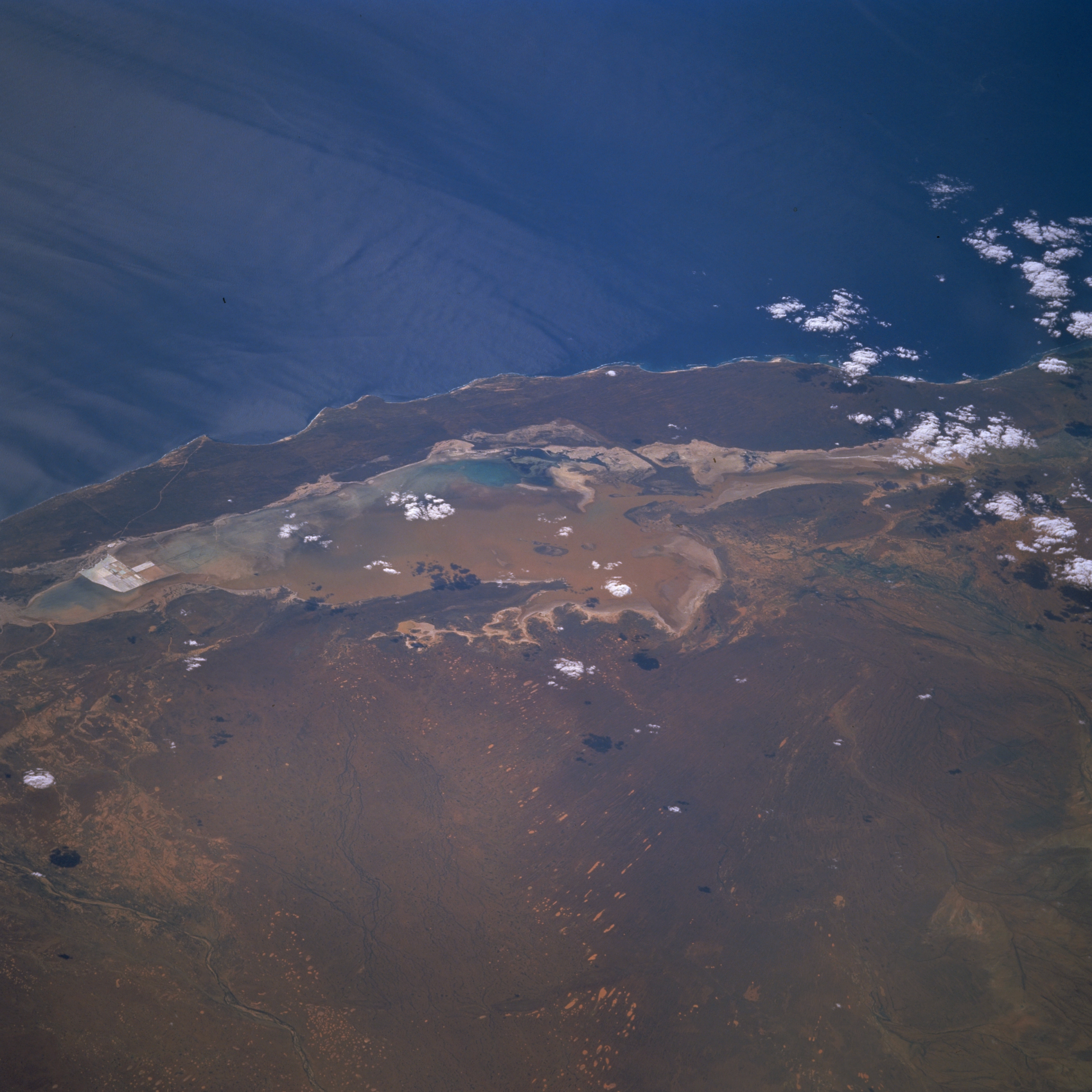
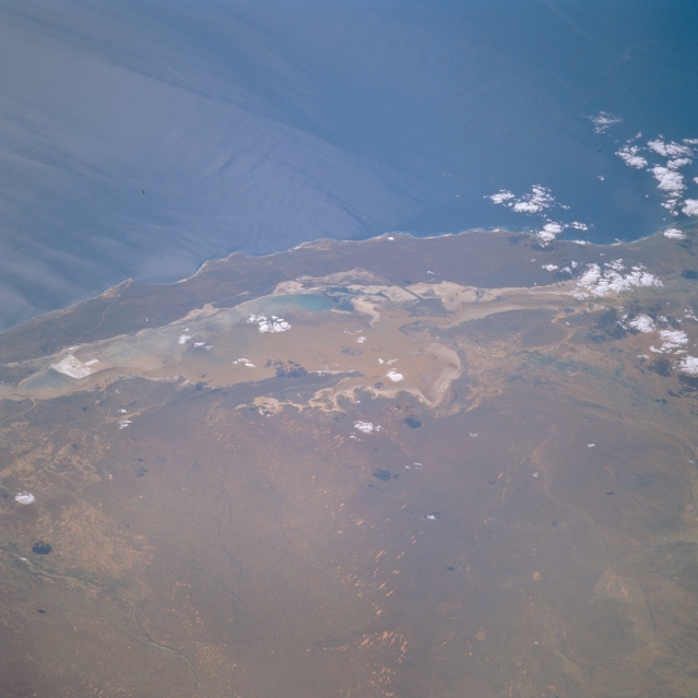
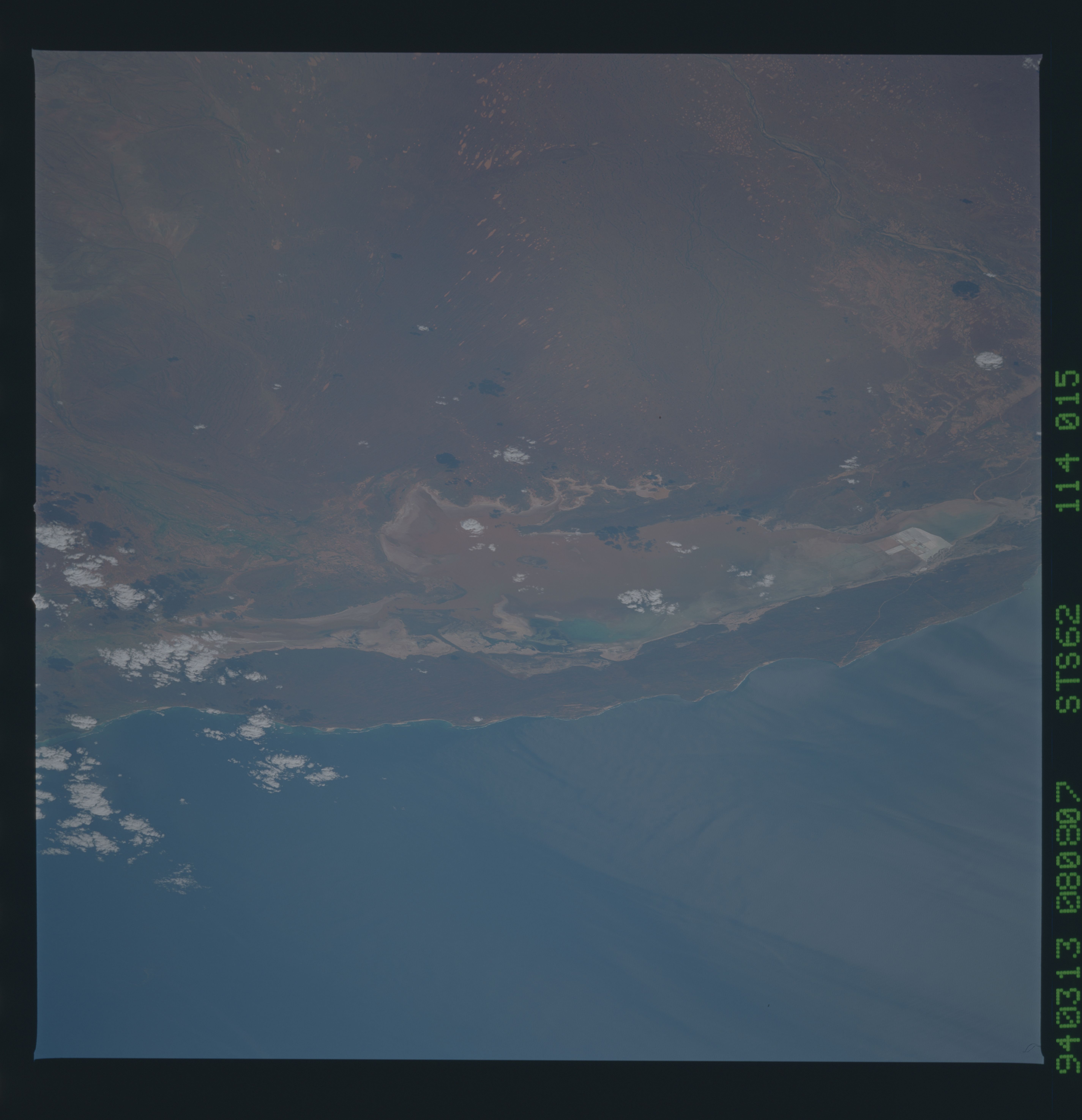
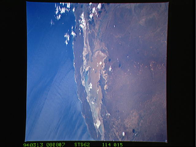
Image Caption: STS062-114-015 Lake Macleod, Western Australia, Australia March 1994
The 370 000 acre (150 000 hectare) bed of Lake Macleod is usually dry, but this image shows brownish-looking shallow water in the central and eastern sections of the lake. The primary water source for Lake Macleod is seawater that passes underground and up into sinkholes on the west side of the lake (turquoise blue areas). Water in the sinkholes is permanent, occasionally flows over land to collect at the south end, and is used for commerical salt production (squared white areas in the center left). Under rare conditions, flows from rivers such as the Lyndon River (greenish band in the center right) or high local precipitation can flood the dry lakebed. Compare this low oblique, west-looking view to STS035-076-040, which is a near vertical look at Lake Macleod during typical dry conditions.
The 370 000 acre (150 000 hectare) bed of Lake Macleod is usually dry, but this image shows brownish-looking shallow water in the central and eastern sections of the lake. The primary water source for Lake Macleod is seawater that passes underground and up into sinkholes on the west side of the lake (turquoise blue areas). Water in the sinkholes is permanent, occasionally flows over land to collect at the south end, and is used for commerical salt production (squared white areas in the center left). Under rare conditions, flows from rivers such as the Lyndon River (greenish band in the center right) or high local precipitation can flood the dry lakebed. Compare this low oblique, west-looking view to STS035-076-040, which is a near vertical look at Lake Macleod during typical dry conditions.
